HOT Prepares to Map Lifeline Infrastructure in Surabaya
Posted by Biondi Sanda Sima • Sept. 30, 2016

Humanitarian OpenStreetMap Team (HOT) Indonesia continued in taking up its role for the InAWARE (All-hazard Warnings, Analysis, and Risk Evaluation) program. InAWARE is a platform that integrates information, modeling, and mapping technologies to provide situational awareness and decision support in a user-friendly and highly visualized web application.
HOT is tasked to develop data collection and validation methodology that can be used for the program and be replicated for future mapping initiatives for disaster early-warning and decision making. A follow-up meeting was organized in DMInnovation Office in Jakarta, hosting our key partners, Pacific Disaster Center (PDC) and Peta Bencana—Massachusetts Institute of Technology (MIT).
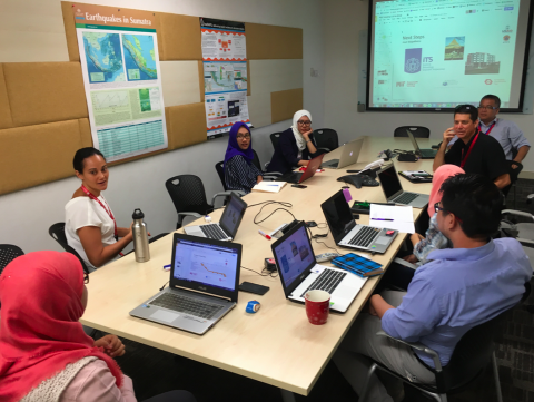
HOT is setting up a new office setup in Surabaya as a working space for conducting team trainings, importing existing data sets into OpenStreetMap, remote mapping of building footprints and road networks, data collection coordination and processing, data validation and overall logistical management.
Surabaya is home to over 2.7 million people spread across 32 subdistricts and 154 villages. It is one of the most densely populated urban cities in Indonesia. Completing the lifeline infrastructure data in this area is contingent to developing an effective disaster response system that will help avoid potentially life-threatening situations in the event of disaster.

A mapathon event will also be co-organized by HOT and Sepuluh Nopember Institut of Technology (ITS) to assist with remote mapping in the lead up to collecting data on the ground to capture detailed lifeline infrastructure information in Surabaya. This data will include communication infrastructure, transportation, water supply systems, electrical power systems, fuel storage, public institutions, health facilities, emergency services and government establishments.
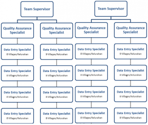
HOT is now in its active phase of building their team by recruiting four Quality Assurance (QA) specialists who will be responsible for managing and reviewing the collected data. The QA specialists will also be working closely and be directed by HOT’s mapping supervisors, Dewi Sulistioningrum and Wulansari Khairunisa to ensure the quality of the data. Each QA specialist will manage four Data Entry (DE) specialists, making up a strong ground mapping force of 20 individuals.
As part of the program’s objectives, HOT is committed to continue working closely with BPBD (Regional Disaster Management Agency) in importing existing data into OpenStreetMap and train local BPBD staff to further use, develop and update all relevant spatial data and information critical for effective disaster management. To make this initiative sustainable beyond the initial timeframe, HOT would also strive to enable local talent and develop professional skills by cooperating with universities and existing communities. Upon completion, the pilot program in Surabaya will be followed by a subsequent phase of enhancing infrastructure data in Jakarta.
Share
