![]() Campaigns sized by edits
Campaigns sized by edits
Argentina
Argentina has 2 HOT projects
Read more about each project below or learn more about getting involved.
Get in touch with HOT or reach out to the local community.
Contact HOT
info@hotosm.org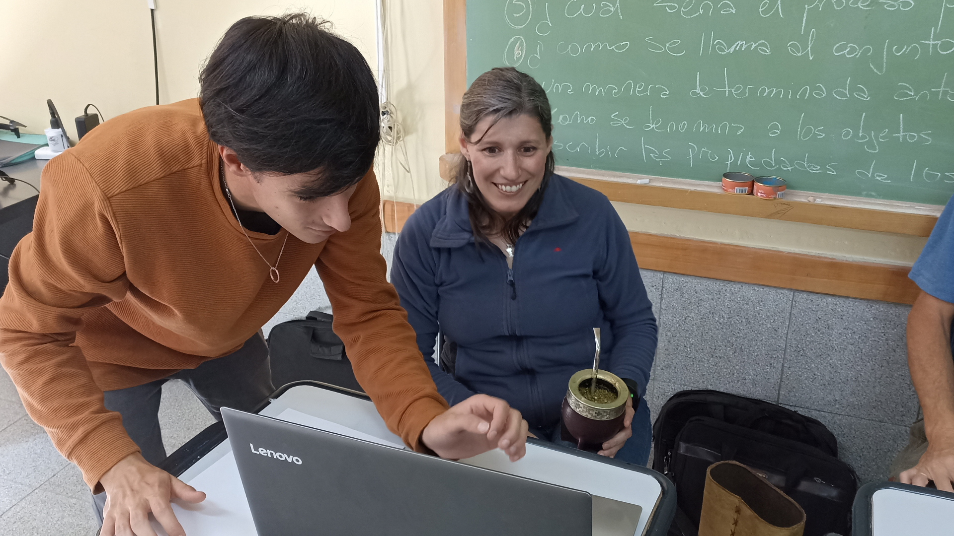
Recent news from Argentina (View all news)
Mapeo Humanitario en Bahía Blanca: Colaboración ante la Emergencia
Respuesta rápida y efectiva tras las inundaciones en Bahía Blanca, Argentina. el LAC Hub activó a la comunidad de mapeo humanitario para generar datos clave para la atención y recuperación.
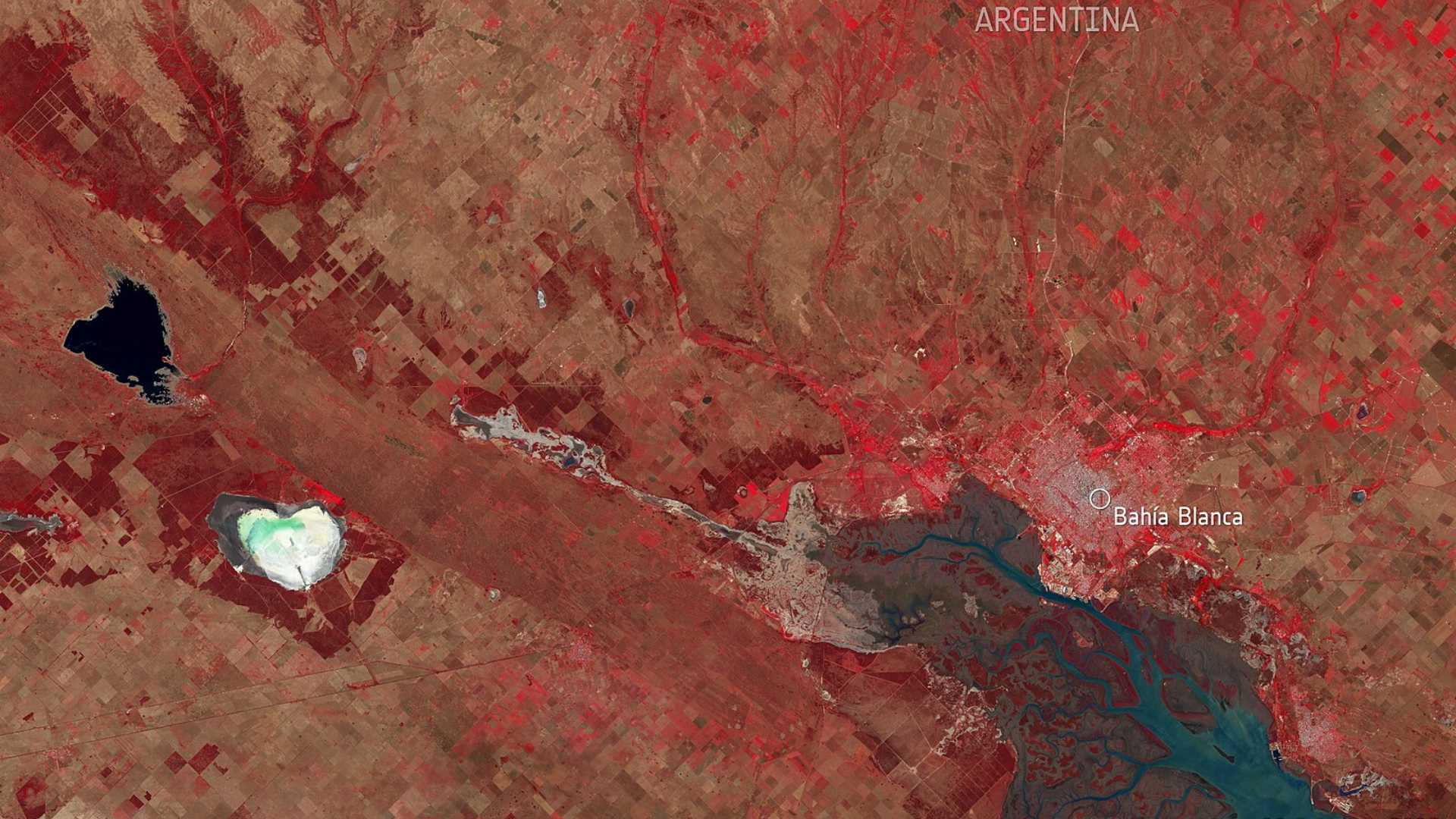
Humanitarian Mapping in Bahía Blanca: Collaboration in Response to the Emergency
Swift and effective response after the floods in Bahía Blanca, Argentina. The LAC Hub mobilized the humanitarian mapping community to generate key data for response and recovery efforts.
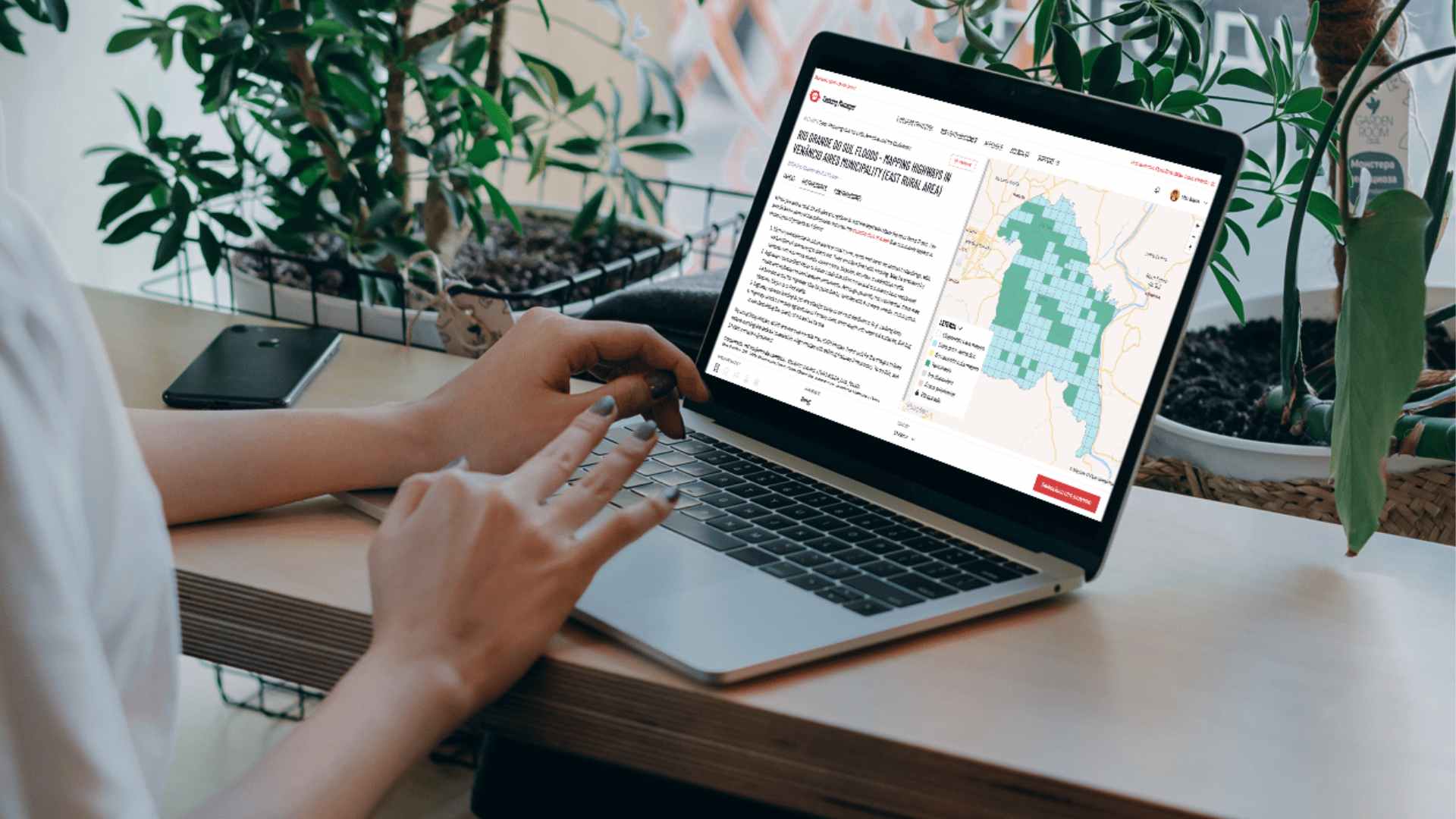
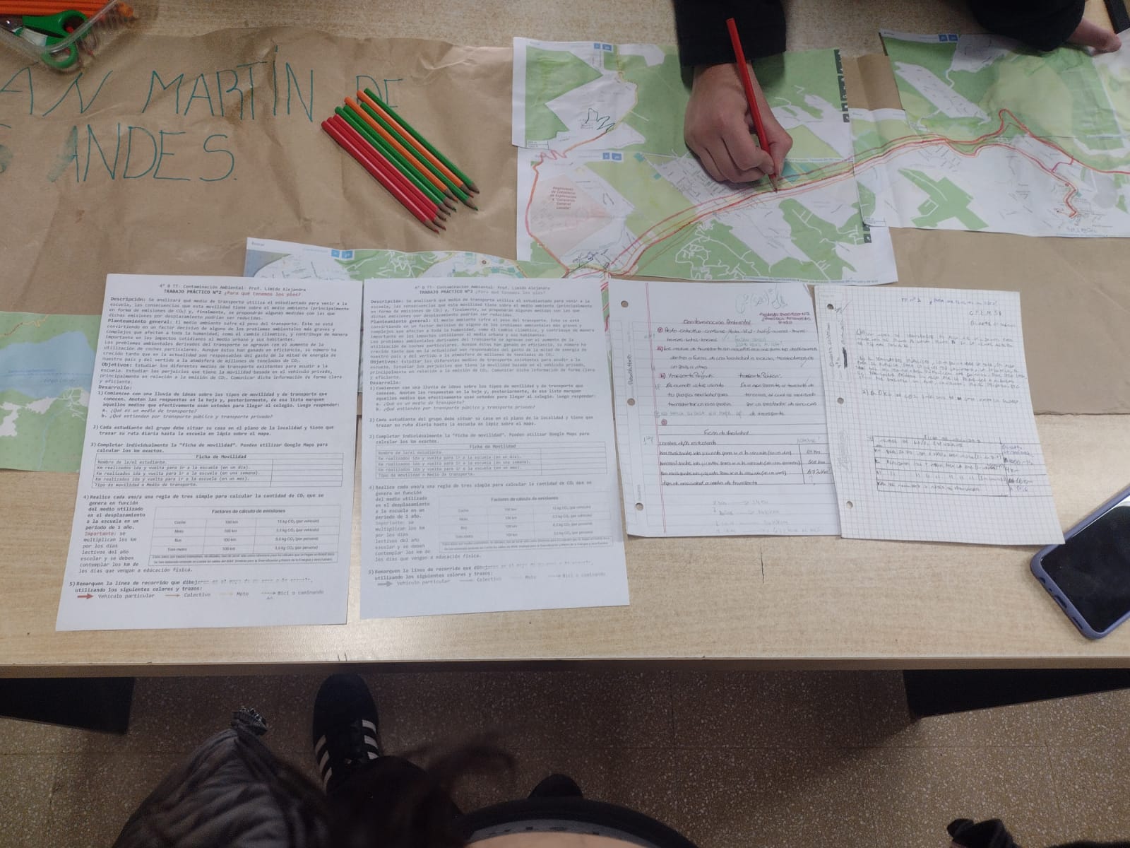
Huellas de Carbono: Acción y Conciencia ante las Emisiones de CO2 con Mapeo Abierto
Estudiantes de la asignatura de “Orientación y Ecología” del CPEM-57 en San Martín de los Andes, Argentina emplean herramientas de mapeo abierto para medir las consecuencias ambientales que tienen los medios de transportes utilizados y así proponer medidas con las cuales las emisiones de CO2 podrían ser reducidas en la localidad.
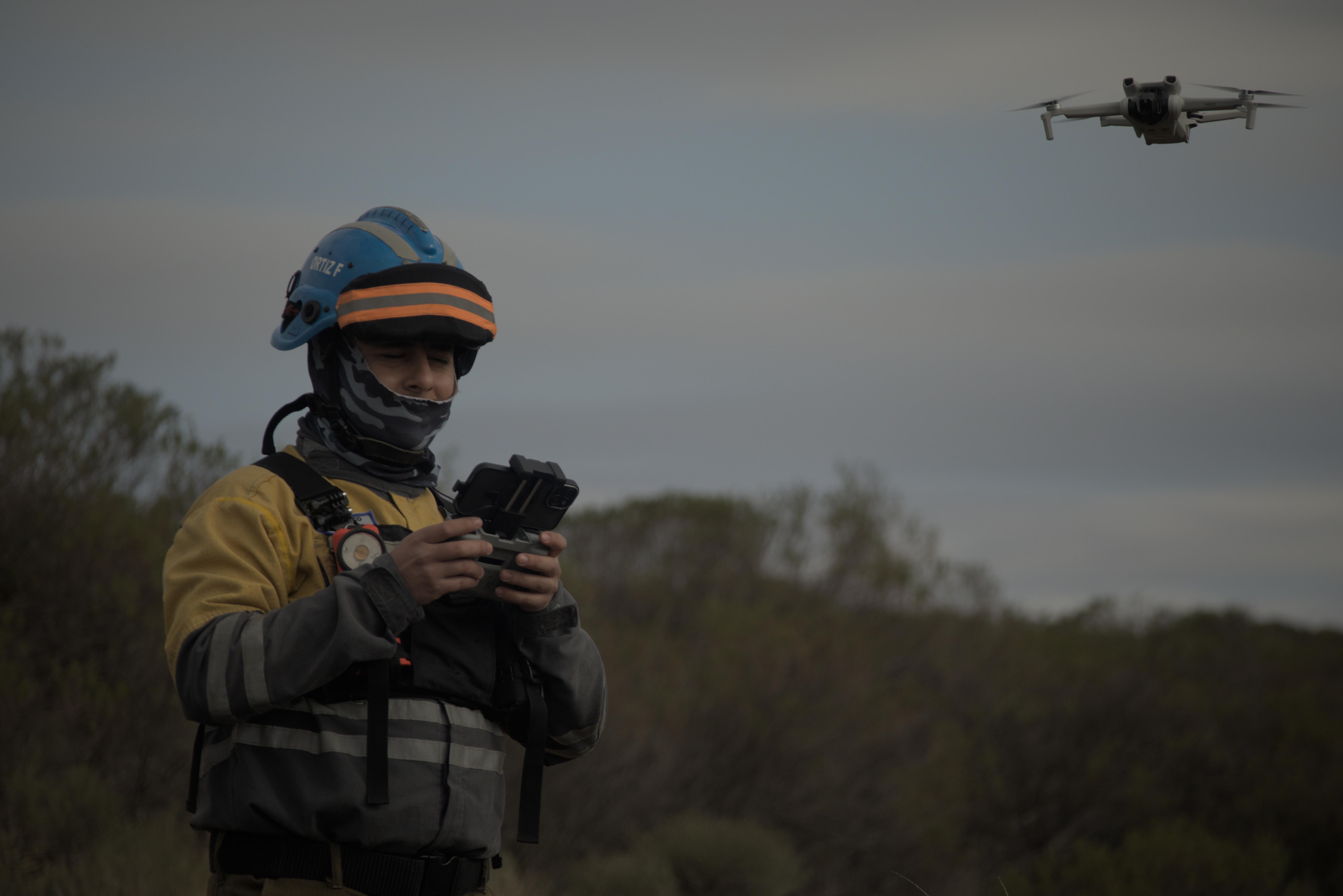
On the Front Line of Climate Change: End-to-End Open Mapping Tech for Wildfires
Climate change has led to an increase in wildfire season length, wildfire frequency, and burned areas around the world. The wildfire season has lengthened in many areas due to factors including warmer springs, longer summer dry seasons, and drier soils and vegetation. Given this context, people from the Alpa Corral region in Córdoba, Argentina, who want to protect our native forests and towns, met from July 26 to 28 to see how the Humanitarian OpenStreetMap Team’s End-to-End Open Mapping Tech can help people prepare themselves to face disasters together.
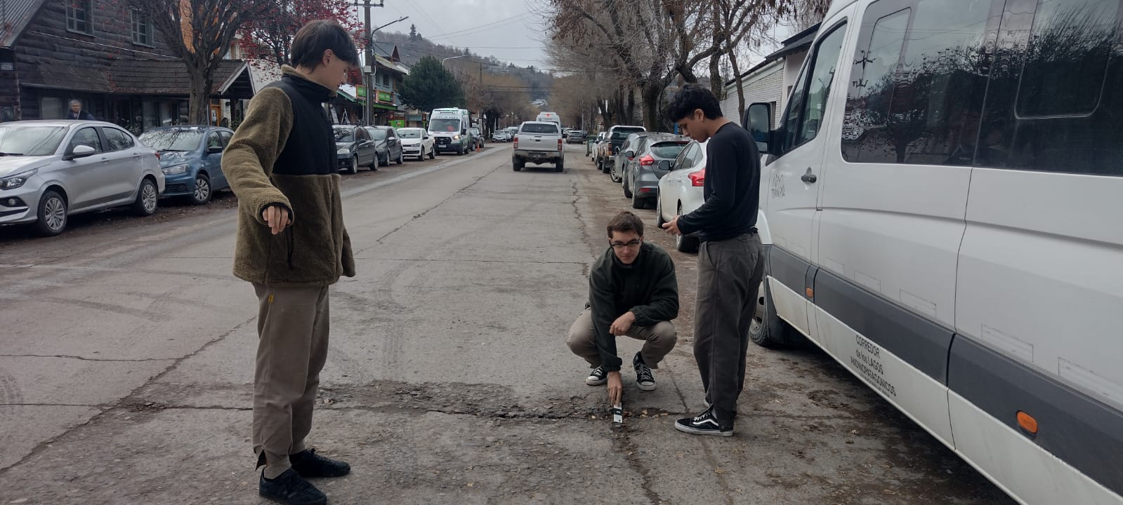
El Proyecto Bache: Mapeando una Problemática Ciudadana en San Martín de Los Andes
Estudiantes y docentes de la secundaria del CPEM-13 en San Martín de los Andes, Argentina, emplean herramientas de mapeo abierto para abordar problemas viales mediante el programa Open Mapping for All, facilitando la identificación de problemas y la búsqueda de soluciones.
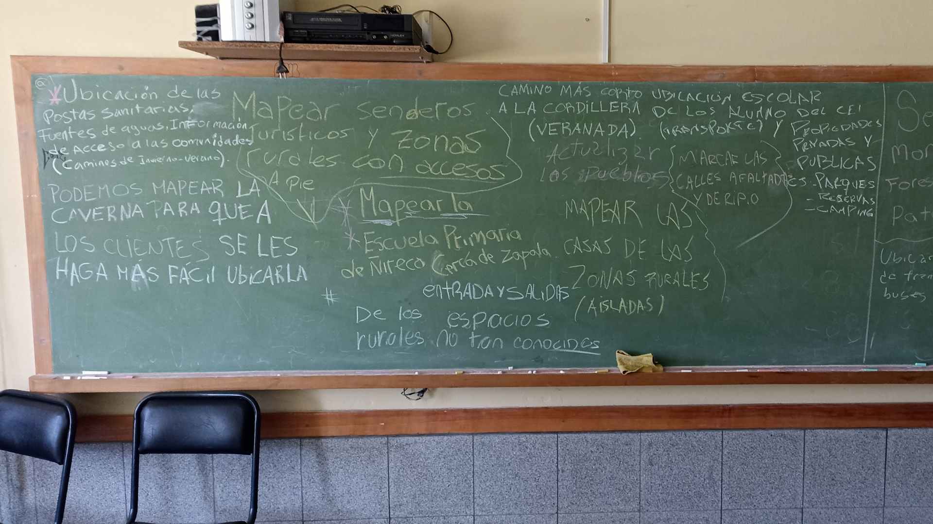
Open Mapping Experiences at the Rural Secondary School "San Ignacio"
Through the Open Mapping for All program, teachers and students at an educational institution in Argentine Patagonia use Open Mapping tools to document, recognize, and improve school physical infrastructure while connecting with their environment and cultural values.