News — 25 February, 2025
Strengthening Disaster Preparedness in Belize Through Youth-Led Open Mapping and Open Data Collection
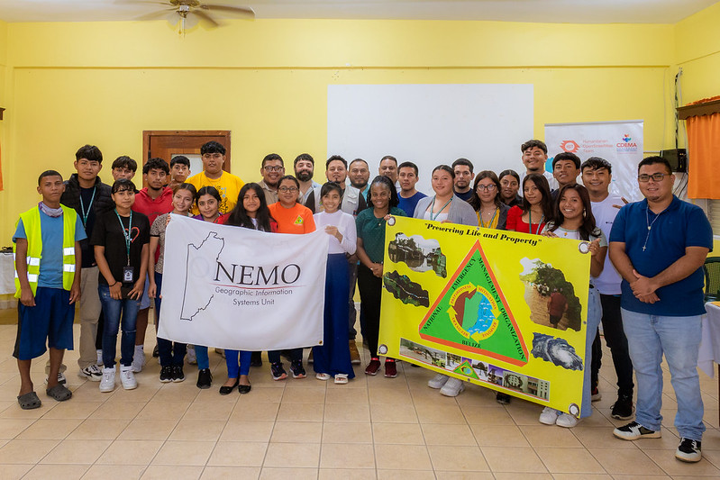
A cohort of 30 young volunteers in Belize was trained in open data collection and mapping tools to enhance disaster preparedness. The Emergency Resources Mapping pilot, led by HOT in partnership with CDEMA and NEMO, focused on identifying key emergency resources such as hazardous areas and communication towers. The initiative strengthens local capacity for disaster risk reduction and anticipatory action. This successful pilot sets the stage for scaling up open mapping efforts across the Caribbean.
The Emergency Resources Mapping pilot project was successfully completed with a training of over 30 students in open mapping and open-data collection tools and techniques. The first part of the pilot included mapping of features that are critical to Disaster Risk Reduction (DRR) and Management (DRM).
The Emergency Resources Mapping project was conducted primarily in partnership with the Caribbean Disaster Emergency Management Agency (CDEMA), which coordinates disaster management across the Caribbean and includes 19 participating states. In 2023, HOT signed an MOU with CDEMA, strengthening a mutually beneficial relationship that enhances disaster resilience through open data.
“This project is incredibly important for Belize,” noted Fabrizio Scrollini, HOT’s Regional Director for the Latin American and Caribbean Hub. “By involving young people in disaster preparedness and response, we can improve coordination and enhance NEMO’s services.”
As HOT continues expanding its presence in the Caribbean, it recognizes that regional and local partnerships—such as those with CDEMA, NEMO, and other organizations—are critical for strengthening education on DRR and DRM. This project aims to train relevant stakeholders on open data and mapping for anticipatory action and emergency response. The primary outcome is a comprehensive map/database of emergency resources within the implementing countries, which will be shared with stakeholders to enhance disaster preparedness while identifying gaps and needs.
Implementing the Pilot in Belize
The pilot country, Belize, was selected upon recommendation from CDEMA. The Belize National Emergency Management Organization (NEMO), which also signed an MoU with HOT, identified Belize City, Belmopan City, San Ignacio, and Santa Elena as key locations for implementation.
Following the successful pilot with local implementation partner EliteCSoft, HOT and NEMO recognized the importance of expanding the work beyond initial locations while promoting sustainability through volunteer training. As a result, the pilot was extended to Corozal, placing greater emphasis on volunteer engagement and capacity building.
“Corozal town was chosen for this project because of its geographical significance,” explained Vasni, a participant from the workshop. “Having updated data on flood-prone areas in Corozal is crucial. This information will enable NEMO coordinators to assist residents in low-lying areas more effectively, improving disaster response and mitigation efforts.”
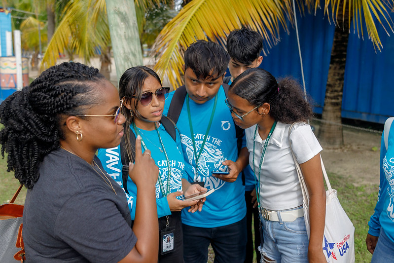
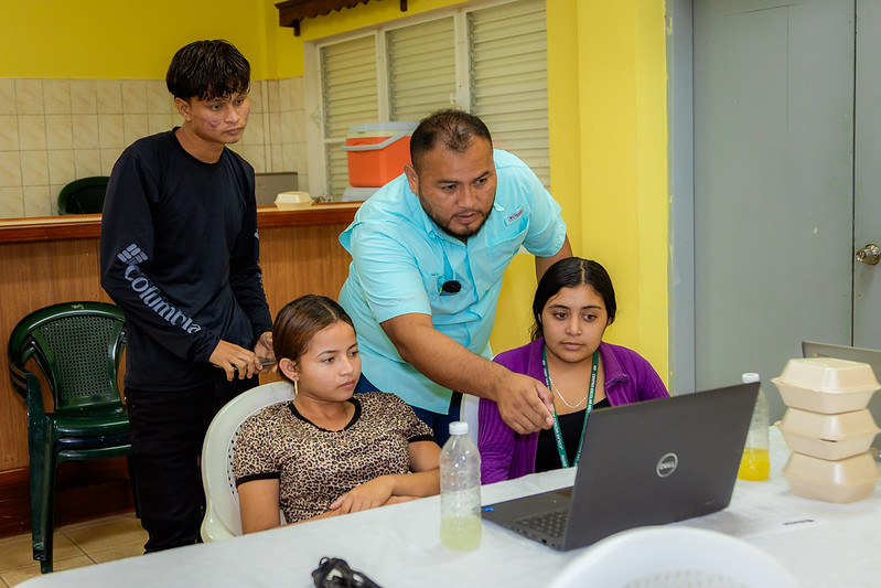
Hands-On Training for Young Volunteers
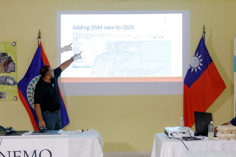
During this phase, HOT’s co-executive director, Fabrizio Scrollini, and LAC Hub Disaster Services Specialist, Arnelle Isaac, joined Belize NEMO for a two-day workshop and training on the methodology used for emergency resource mapping.
A cadre of 30 young volunteers was trained in open-source data collection and mapping tools—skills they can apply both in their careers and as emergency response volunteers in their districts.
One of the participants, Jessie, Galen University Student, reflected on the training’s impact: “This GIS training has given me a new perspective. When you’re out in the field, you see things at ground level. But through GIS mapping, you gain a bird’s-eye view, allowing for better visualization and strategic response planning.”
Mapping Critical Resources for Disaster Preparedness
As a result of this two-day exercise, Corozal now has a comprehensive database containing the locations and attributes of key emergency resources such as hazardous areas, flood-prone zones, and communication towers.
“Mapping is completely new to me, but through this training, I’ve gained valuable skills that will be useful in my future career,” added Elias Arias, Centro Escolar Mexico Junior College student.
The importance of this mapping effort extends beyond local preparedness. Jason Twan, from the Taiwan International Cooperation and Development Fund, emphasized the critical role of data in disaster prevention: “We support this project because data is essential for disaster prevention. Understanding where people live and identifying key infrastructure is crucial for early warning systems. By integrating this information, we can issue more accurate alerts. Our long-term goal is to expand the early warning system across the entire country, ensuring nationwide coverage and improved disaster preparedness.”
Understanding the Local Context & Future Engagement
Beyond training, the HOT team also visited several communities that are highly susceptible to flooding. These interactions with NEMO’s central and district staff provided a deeper understanding of the unique disaster management challenges faced in Belize.
“Having precise, real-time data allows us to model different disaster scenarios and assess the potential impact on flood-prone areas, safe zones, and evacuation routes in Corozal,” emphasized Ronnie Hernández, Corozal District NEMO Coordinator. “This project introduces GIS capabilities to Corozal for the first time, integrating OpenStreetMap data into disaster response planning.”
This experience further cemented HOT’s commitment to supporting NEMO Belize in future projects. Discussions are already underway with additional partners to scale up the initiative.
Looking Ahead
Overall, the Emergency Resources Mapping Project pilot has been a resounding success. HOT looks forward to continuing this critical work across the Caribbean region, ensuring that open data and open mapping play a central role in disaster risk reduction and emergency preparedness.
More importantly, this initiative empowers young people to take an active role in emergency response. They don’t just learn how to map—they engage with authorities, develop disaster response skills, and gain exposure to OpenStreetMap, potentially shaping their future careers.
HOT aims to continue working with CDEMA and the broader Caribbean region to expand capacity-building efforts, improve map quality, and provide agencies with better data analysis tools.
Caribbean countries are shifting their approach—not only focusing on disaster response but also on recovery efforts and economic development. Geospatial data and new tools—such as our Drone Tasking Manager and Field Mapping Tasking Manager—can support agencies beyond emergency management, helping them make data-driven decisions for long-term development.
The Caribbean remains an innovative hub, and HOT looks forward to collaborating with professionals and young people to further enhance these tools and advance disaster preparedness across the region.