News — 12 March, 2025
Strengthening Communities in Mangrove Conservation: Drone Technology and Local Collaboration
Discover how collaboration between local communities and the use of lightweight drones are revolutionizing mangrove conservation in Mexico, strengthening territorial management, and promoting community resilience.
Since 2022, the Humanitarian OpenStreetMap Team (HOT) has worked on projects and emergency responses in Latin America and the Caribbean, focusing on coastal zone issues. One of the most notable projects is Open Cities in Tulum, where support was provided to the municipal government in generating open cartography to address local challenges and facilitate territorial planning. Another key experience was the comprehensive response to the emergency caused by Hurricane Otis in Guerrero.
Based on these experiences, the LAC Hub of HOT has systematically investigated coastal issues in Mexico, identifying challenges such as sargassum accumulation, mangrove vulnerability, and the importance of reefs in environmental management. Thanks to funding from the Wikimedia Foundation, planned actions have been carried out alongside local actors committed to defending their natural and urban environment.
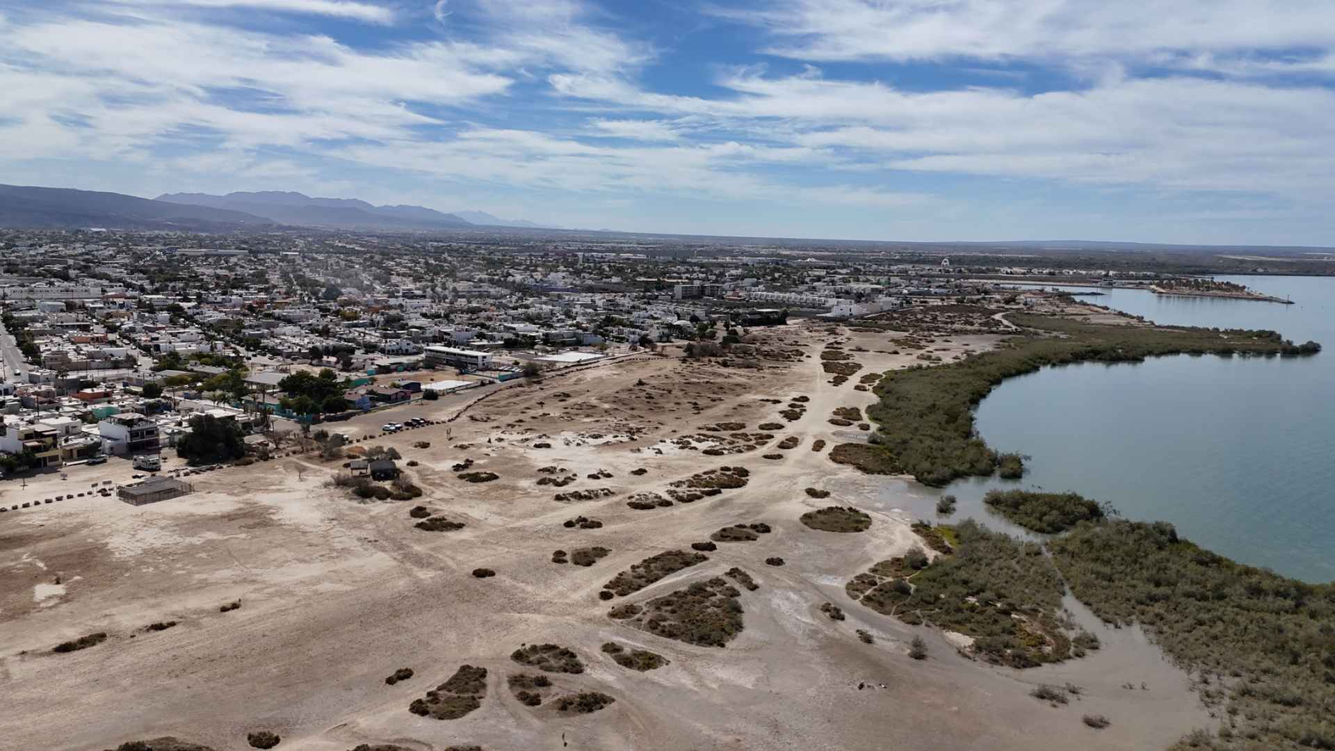
The Degradation of Mangroves and the Importance of Local Allies
Photos: RollitoDeGuayaba / Wikimedia Commons CC-BY-4.0
Mangroves are key ecosystems in coastal protection, biodiversity, and carbon sequestration. However, they face threats such as rising sea levels, pollution, and unregulated urban expansion. In Mexico, the loss of mangroves impacts food security, storm resilience, and the economic stability of fishing and tourism communities. The lack of updated data on their health and evolution hinders their protection and restoration, leaving communities with few tools to address these challenges.
To close this information gap and strengthen environmental governance, this initiative promotes the use of open technologies and participatory methodologies to create aerial imagery and data autonomously, allowing for sustainable monitoring and management of mangroves.
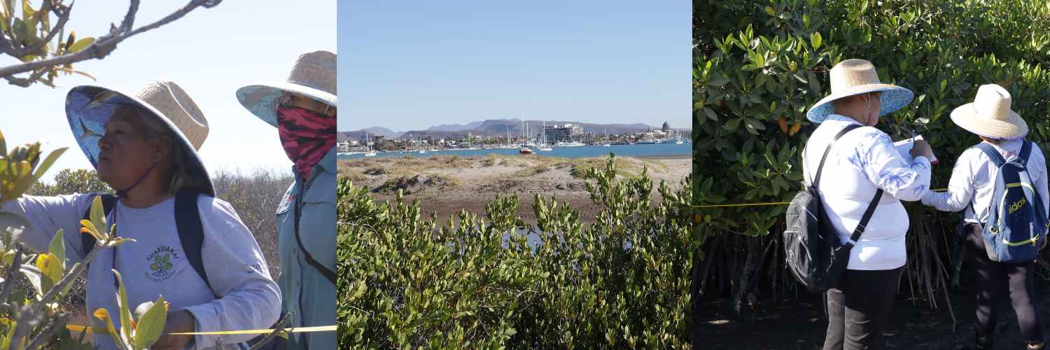
The preservation of this ecosystem would not be possible without the participation of local organizations actively working in conservation and territorial defense. Guardianas del Conchalito and BSCicletos are key allies in this process. Guardianas del Conchalito has led mangrove protection efforts since 2016 with a community and gender perspective, promoting female leadership and economic autonomy through marine conservation. BCSicletos, on the other hand, has worked in territorial defense and urban sustainability in La Paz since 2010, linking environmental activism with mobility and public space use.
Daniela Bareño, a member of Guardianas del Conchalito, shares: “The mangrove is a vital ecosystem that acts as the city’s lung, a natural barrier against hurricanes, and an efficient carbon sink, absorbing up to five times more CO₂ than other forests. To strengthen its restoration, the use of drones and technical training will allow us to monitor its condition, identify affected areas, and improve our conservation strategies, as well as train young people in mangrove mapping and protection.”
The collaboration between these groups enables sustainable actions with real community impact in La Paz. Through their territorial knowledge, local networks, and prior work, these organizations ensure that mangrove monitoring and conservation strategies are appropriate for the local context and have continuity and impact beyond the initial project implementation.
Carlos Mancilla, Executive Director of BCSicletos, shares the importance of this workshop for the organization and how they will use it to support the Guardianas del Conchalito and other social territorial struggles:
“La Paz has a unique urban dynamic that must be protected to ensure its sustainability. At BCSicletos, this training is key, so through our Urban Co-Laboratory, we develop analytical tools and generate valuable information for the community. With a focus on community mapping, we will use tools like OpenDroneMap and OpenStreetMap to analyze road interventions, territorial changes, and issues such as the right to housing, land dispossession, and natural disaster prevention, thereby strengthening our strategies and the impact of our work.”
Lightweight Drones: The Key Tool for Environmental Monitoring
Photos: RollitoDeGuayaba / Wikimedia Commons CC-BY-4.0
The use of the open-source Drone Tasking Manager (DTM) platform facilitates the collection of aerial imagery and photogrammetric processing without the need for expensive drones or advanced software and knowledge. With this technology, high-precision cartography can be generated, allowing for a more detailed assessment of threats to these ecosystems and the design of data-driven conservation strategies.
In his work “Community Use of Lightweight Drones for Land Management, Conservation, and Defense”, as part of the Red Latindron research network, Nicolás Vargas-Ramírez and collaborators highlight how communities can use lightweight drones as accessible and innovative tools to strengthen their territorial causes. These devices allow communities to obtain detailed aerial information autonomously and economically, facilitating environmental conflict documentation and promoting conservation practices. By adopting this technology, communities not only improve their response capacity to threats but also enhance their participation in the sustainable management of their natural resources, promoting territorial justice and local empowerment.
From a similar perspective, HOT has developed the Drone Tasking Manager platform based on OpenDroneMap, allowing lightweight drones to execute flight plans and conduct photogrammetric processing within the same platform without the need for specialized software installation.
According to Iván Gayton, founder of the platform: “Drone TM enables communities worldwide to use drones without requiring large economic resources. While professional drones can cost large sums, an affordable drone can also be accessible to many social organizations, generating high-quality geospatial data.” This democratizes access to cartography, empowering communities to map their territories and respond to environmental challenges”.
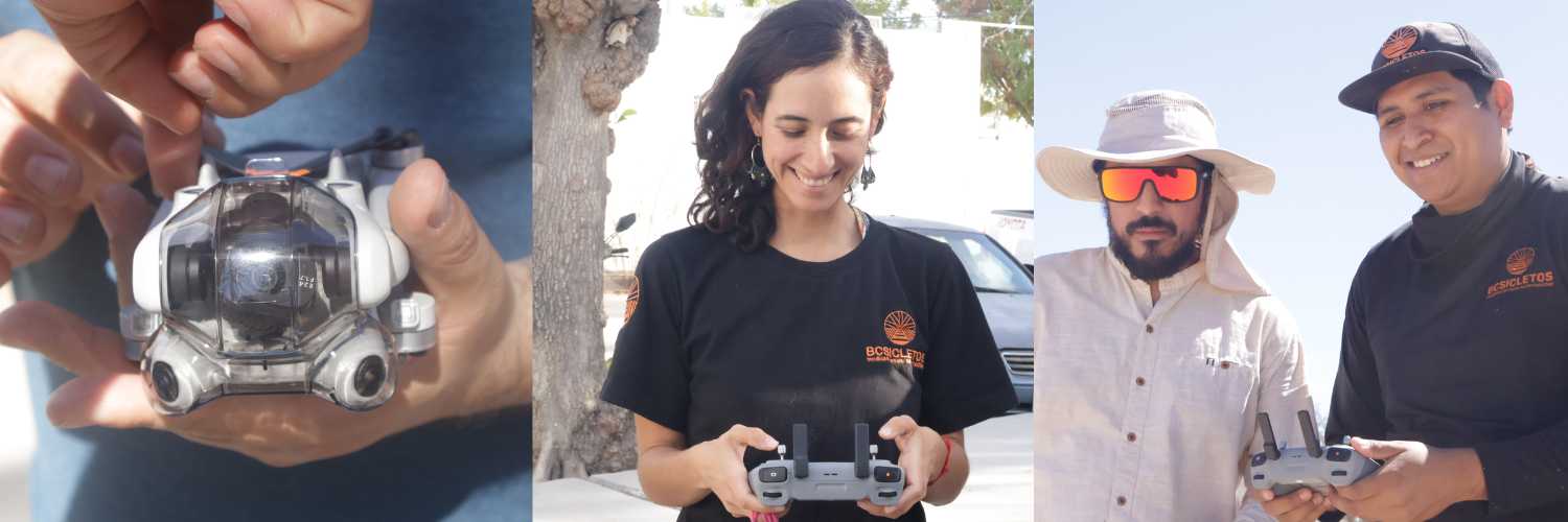
Training in Action: Wikimedia Workshops, Drone Flights and Tasking Manager
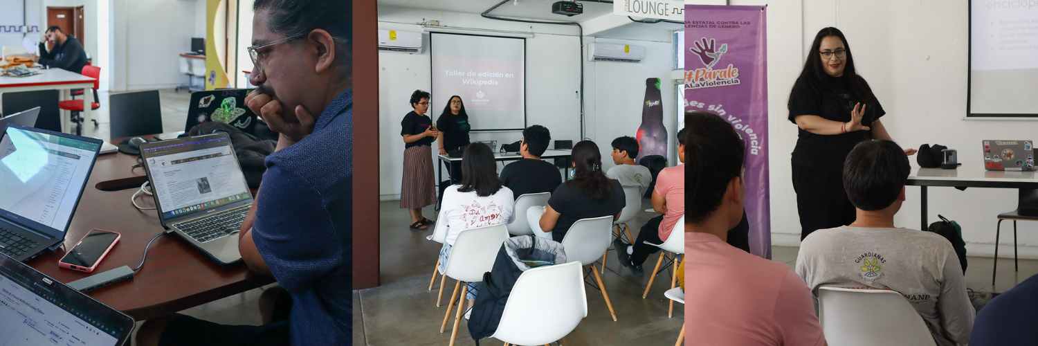
Photos: RollitoDeGuayaba / Wikimedia Commons CC-BY-4.0
As part of the project’s implementation, three days of training workshops were held with 18 participants, including 14 members of allied local organizations.
Carmen Alcázar, director of Wikimedia Mexico, highlights that by learning to edit Wikipedia, upload content to Wikimedia Commons, and use drones and open-source software for mapping, knowledge is strengthened on key tools to document environmental issues and improvements. “In this case, we recorded the rehabilitation of the area through mangrove production and channel restoration, aiming to benefit the community, contribute to ecological conservation, and share this work through Wikipedia and other wiki projects.
Here’s a sneak peek at what we accomplished during this three-day workshop.
Introduction Workshop to Wikipedia and Wikimedia Commons
Exploration of these platforms as advocacy tools in environmental topics in the region. A total of 14 articles were created and 36 articles were edited regarding the participating organizations, the territory, the right to the city, the flora and fauna of La Paz, and more. Additionally, over 3,000 photographs related to mangrove monitoring and protection were uploaded, as well as aerial images forming the orthophotos generated during the flight plans. You can consult the multimedia files created here.
Drone Operator Certification and Automated Missions Workshop
-
Introduction to drone history and types.
-
Principles of photogrammetry and flight planning.
-
Use of Drone Tasking Manager in combination with OpenAerialMap.
-
Drone flight practice with DJI Mini 4 Pro.
-
Practical exercise in Estero de El Conchalito:
-
Flight plan design and execution with both automated and manual drones.
-
Aerial image capture and processing.
-
Generation of orthophotos, point clouds, and 3D visualization.
-
Frame: Orthophoto from three flights conducted by BSCicletos and Mangles del Manglito during Saturday’s practice in El Conchalito. View it here.
Building a Drone Community for Conservation
With the ongoing goal of bridging communities so they can support each other in the future and foster the sustainability of a new ecosystem, we have prioritized training key individuals throughout this initiative. In addition to local organizations engaged in territorial actions, we have focused on professionals in drone usage who are involved in community activities or have a strong interest in collective well-being.
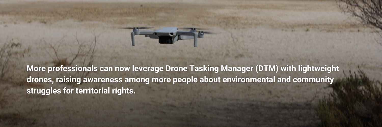
Organizing the drone flight and photogrammetry workshop provided a crucial opportunity to remotely train various professionals in using the Drone Tasking Manager platform across different regions of Mexico. At the same time, we prepared the instructor, Dante Loeza Amaro, who would lead the in-person training with the local organizations. This prior training expanded the instructor’s impact, reaching a broader sector, including surveyors and other photogrammetry specialists. As a result, more professionals can now leverage Drone Tasking Manager (DTM) with lightweight drones, raising awareness among more people about environmental and community struggles for territorial rights.
Additionally, those trained in this initiative can now join a rapid response network for emergencies, facilitating the rapid acquisition of post-disaster aerial imagery. These images are crucial for key emergency response actors and technical organizations like HOT, as they enable the creation of detailed damage maps and provide essential support to communities during critical moments.
The formation of a strategically distributed volunteer community in a vulnerable territory strengthens disaster resilience. It also ensures access to detailed cartographic information after crises—data that is often unavailable when needed most but is essential for both immediate recovery and better preparedness for future events.
Open Invitation to Governments and Organizations
We invite you to explore OpenDroneMap, a platform that integrates open technologies with a focus on technical democratization, enhancing this approach.
This tool allows basic-range drones to perform advanced photogrammetry functions, enabling territorial observations and monitoring that were previously limited to specialized groups with high financial resources.
Thanks to this technology, it is now possible to generate accessible and high-quality data, strengthening local capacities and creating new opportunities for communities that previously lacked access to these tools. This represents a key step in building more inclusive territorial monitoring and management processes, where more people can actively participate in collecting and utilizing geospatial information.
Explore the available resources on this platform and everything it enables at dronetm.org.
You too can amplify the impact of your causes and contribute to the formation of more groups focused on drone usage and open photogrammetry. Sharing and spreading this knowledge is key to strengthening collaborative networks and promoting the strategic use of these technologies for the benefit of territories and communities.