News
HOT Microgrant 2020 Community Capstone Project (by Mental Health AWHEREness)

Mental Health AWHEREness PH shares the work that they did through HOT's Microgrant program.They trained community members in mapping mental health services in the Philippines.
How Users’ Experience Impacts Project Completion and Retention
Gloria Urrea, University of Colorado at Boulder, and Eunae Yoo, University of Tennessee, partnered with HOT to conduct research that has produced valuable insights for HOT and other organizations using the Tasking Manager. Here, they summarize their research project that examines the impact of users’ experience on project completion and retention.

Mentoring a Community Through a Microgrant Application
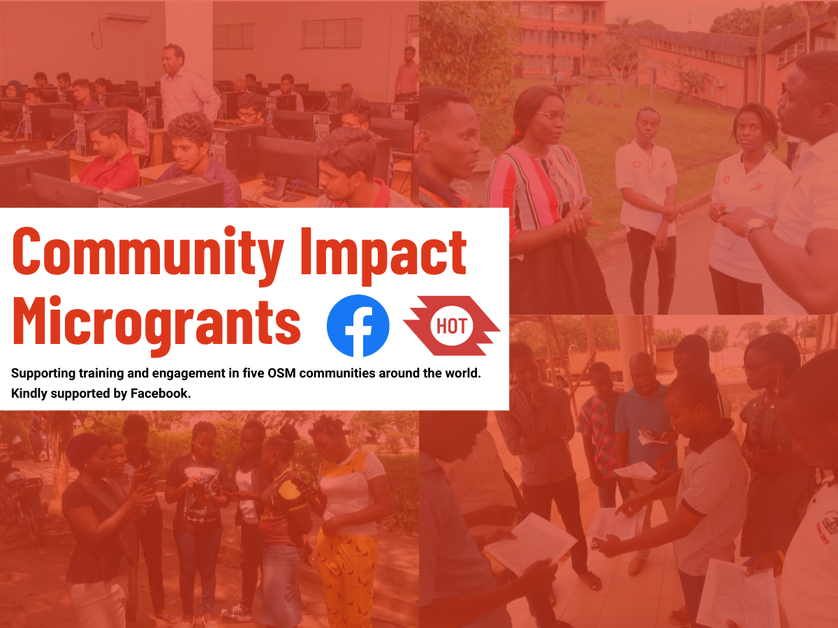
As part of the most recent call for Facebook Community Impact Microgrant applications, HOT tried a new mentorship approach to supporting OpenStreetMap (OSM) community members through the application process.

How We Responded to Covid-19 Pandemic by Mapping Ugandan Border Entry Towns (by MapUganda)
MapUganda has been mapping Ugandan border towns to help local health responders monitor potential avenues for Covid transmission.

Supporting Covid-19 Response in Mongolia via Community Mapping (by Public Lab Mongolia)
In the course of their Covid-19 Rapid Response Microgrant, Public Lab Mongolia has put thousands of health, service, and infrastructure sites on the map while training a team of mappers from across the country.

Exposure Data and Models Shared with Disaster Management Stakeholders in Tanzania
The METEOR project has been a three-year initiative supported by the UK Space Agency International Partnership Programme to generate disaster exposure data and models in two pilot countries — Tanzania and Nepal. The process has since been repeated in another 45 official development assistance countries.

A Joint Approach to Facilitate Covid-19 Vaccine Delivery
"Rolling out a vaccine against Covid-19 is the most pressing challenge of our time - and nobody wins the race until everyone wins." - Global Alliance for Vaccines and Immunization - GAVI

Asia and the Pacific Hub launches Facebook Community Impact Microgrants
Three communities in the Asia-Pacific have been selected as recipients of the Facebook Community Impact Microgrant. Congratulations to OSM Fiji, MapBeks in the Philippines, and the Geomatics Engineering Society at Kathmandu University!
Building a Global Network to Map for COVID-19 Response
With support from the Humanitarian-to-Humanitarian Network, HOT has engaged the global humanitarian mapping community to support local Covid-19 responses in the biggest disaster activation in HOT's history.

Resilience Mappers from Uganda is our Summit 2020 Microgrant awardee!
Congratulations to Resilience Mappers for being selected as the recipient of the hOSM Summit 2020 microgrant!

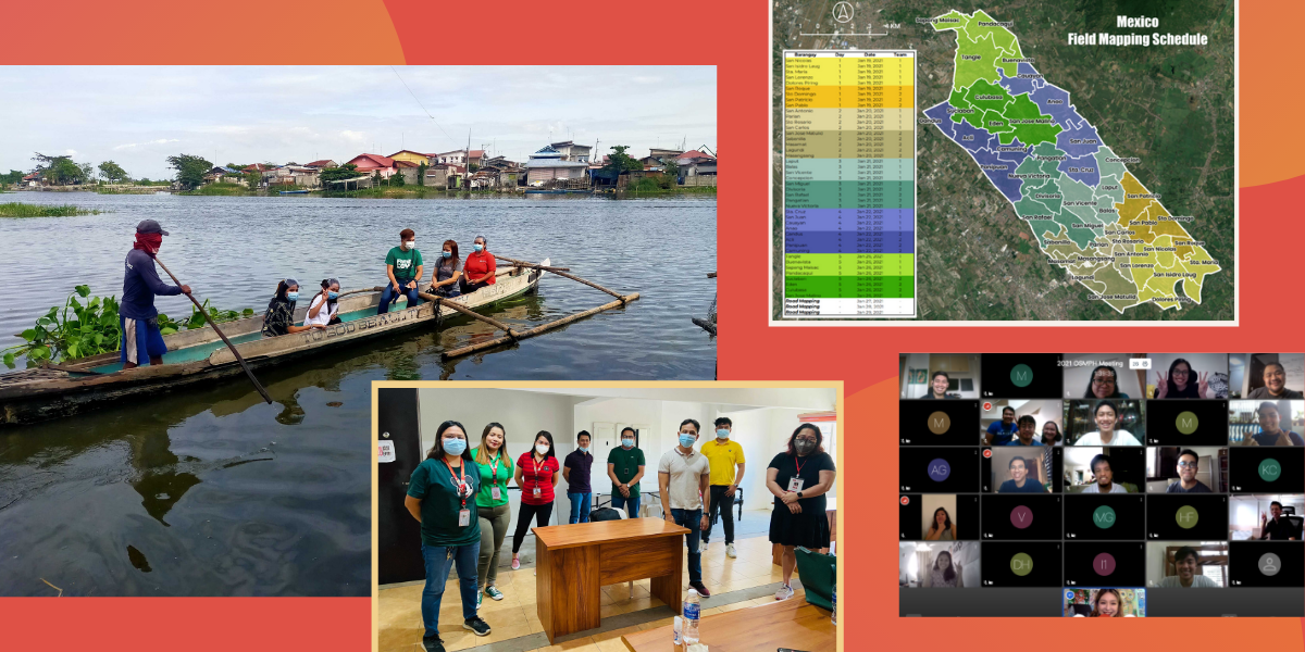
January 2021: New Field Mapping Strategy, Data Validator Selection, OSMPH Meeting — HOT Philippines
In order to speed up the validation process for the PhilAWARE project, the HOT Philippines team is opening a validator selection process for local volunteers. OpenStreetMap Philippines also held our annual planning this month.
Community Data for Improved Disaster Management and Urban Planning — Mwanza, Tanzania (by OMDTZ)
OpenMap Development Tanzania reports on mapping and capacity building in Mwanza City, Tanzania.

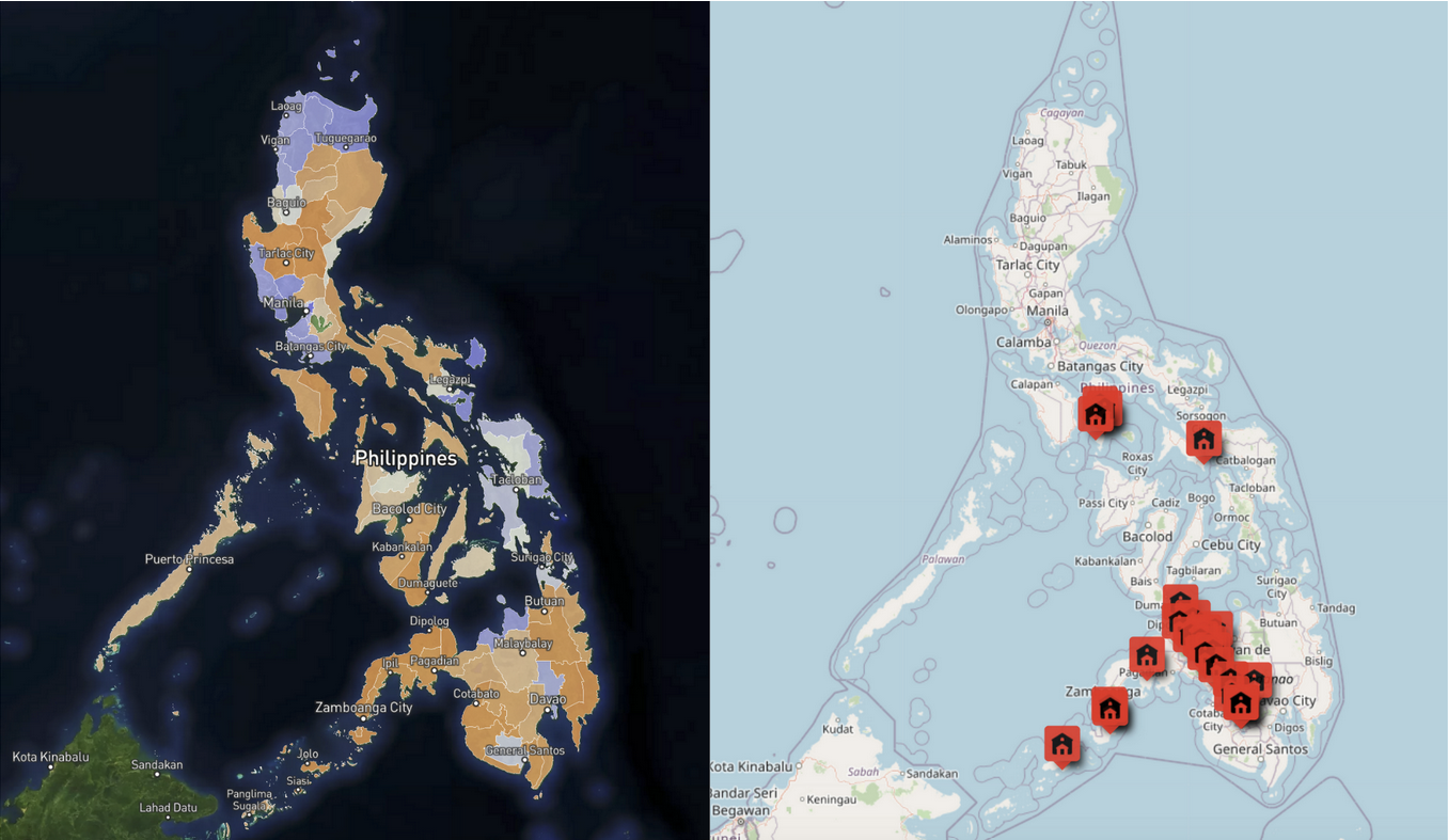
LGBT advocates and allies map the most unmapped towns in the Philippines on OpenStreetMap (by MapBeks)
With support from a Facebook Community Impact Microgrant, MapBeks and the Philippine mapping community have been working to map the most remote and unmapped towns in the Philippines.
Developing a Web Map Repository of Kampala’s Informal Settlements (by Resilience Mappers)
Resilience Mappers has built a web dashboard for geospatial data to support efforts by the Ugandan government to help residents of low-income communities who have been most affected by Covid-19 lockdowns.

Mapping Makoko Using Drones and Canoes
A floating inner-city slum is in the process of being mapped to make a case for improved public services and land ownership.

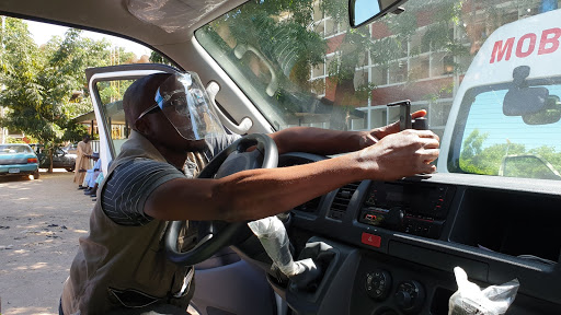
Using OpenStreetMap Data to Support Emergency Ambulance Response Service and Mapping of COVID-19 Amenities in Northeast Nigeria (by Humanitarian Mappers)
Humanitarian Mappers of Nigeria is using collaborative mapping to track Covid and improve ambulance services in a region already facing insecurity and conflict.