News
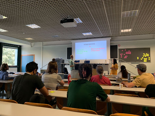
HOT Voting Membership - Welcome 50 New Members!
We are happy to announce that 50 new members have been elected to HOT’s Voting Membership (VM)! HOT’s Voting Membership has grown to 266 members from all across the globe. These 50 new members come from 29 different countries and are helping us build a more diverse and equitable community. A few insights about how our membership is changing.

Reflections and experiences of HOT Data Quality Intern 2021, Rabi Shrestha
Why did you choose to apply for the internship?
Canoa de Tolda: Representing the social dynamics of the São Francisco River through mapping
Early results of HOT's collaboration with Canoa de Tolda to make the social dynamics of the São Francisco River visible through open mapping and the use of drones and other technologies.

Canoa de Tolda: Mapeo para visibilizar la dinámica social del Río São Francisco
Conozca los primeros resultados de la alianza de HOT con Canoa de Tolda para visibilizar la dinámica social del Río São Francisco mediante el mapeo abierto y el uso de drones y otras tecnologías.
Canoa de Tolda: Mapeamento para visualizar a dinâmica social do Rio São Francisco
Conheça os primeiros resultados da parceria da HOT com a Canoa de Tolda para tornar visível a dinâmica social do Rio São Francisco por meio de mapeamento aberto e uso de drones e outras tecnologias.
O mapeamento de campo é o futuro: um fluxo de trabalho do gerenciador de tarefas usando o ODK
O mapeamento de campo pela população local é fundamental para o futuro do mapeamento aberto. No entanto, as ferramentas hoje disponíveis – apesar de...

El mapeo de campo es el futuro: Un flujo de trabajo del Gestor de Tareas utilizando ODK
La cartografía de campo realizada por la población local es clave para el futuro del mapeo abierto. Sin embargo, las herramientas disponibles para la...
La cartographie de terrain est l'avenir : Un flux de travail de Gestionnaire de Tâches utilisant ODK
La cartographie de terrain par les populations locales est la clé de l’avenir de la cartographie ouverte. Cependant, les outils disponibles pour la cartographie...
Field Mapping is the Future: A Tasking Manager Workflow Using ODK (available in English, Spanish, Portuguese & French)
Field mapping by local people is key to the future of open mapping. However, the tools available for field mapping—despite many being of high quality—do not form a coherent ecosystem to unleash the potential of community field mapping. Something is missing! Could it be a Tasking Manager for Field Mapping?
.png)
Data Principles
At HOT, open mapping communities and program teams face unique challenges in how we work with data:
Open Cities Africa: Bamako - Cartographie communautaire pour un Bamako résilient
Le projet Open Cities Africa, " Cartographie communautaire pour un Bamako résilient ", initié en 2020, s'est achevé en mai 2022. L'objectif de ce projet financé par la Banque mondiale consistait à mettre en évidence le besoin d'infrastructures d'information pour développer et renforcer la résilience urbaine à Bamako, au Mali.
Les Données Géospatiales Libres Dans La Gestion De l’environnement : Contexte, Opportunités et Défis
Les données géospatiales libres dans la gestion de l’environnement : contexte, opportunités et défis » fût le thème abordé lors du webinaire organisé par...

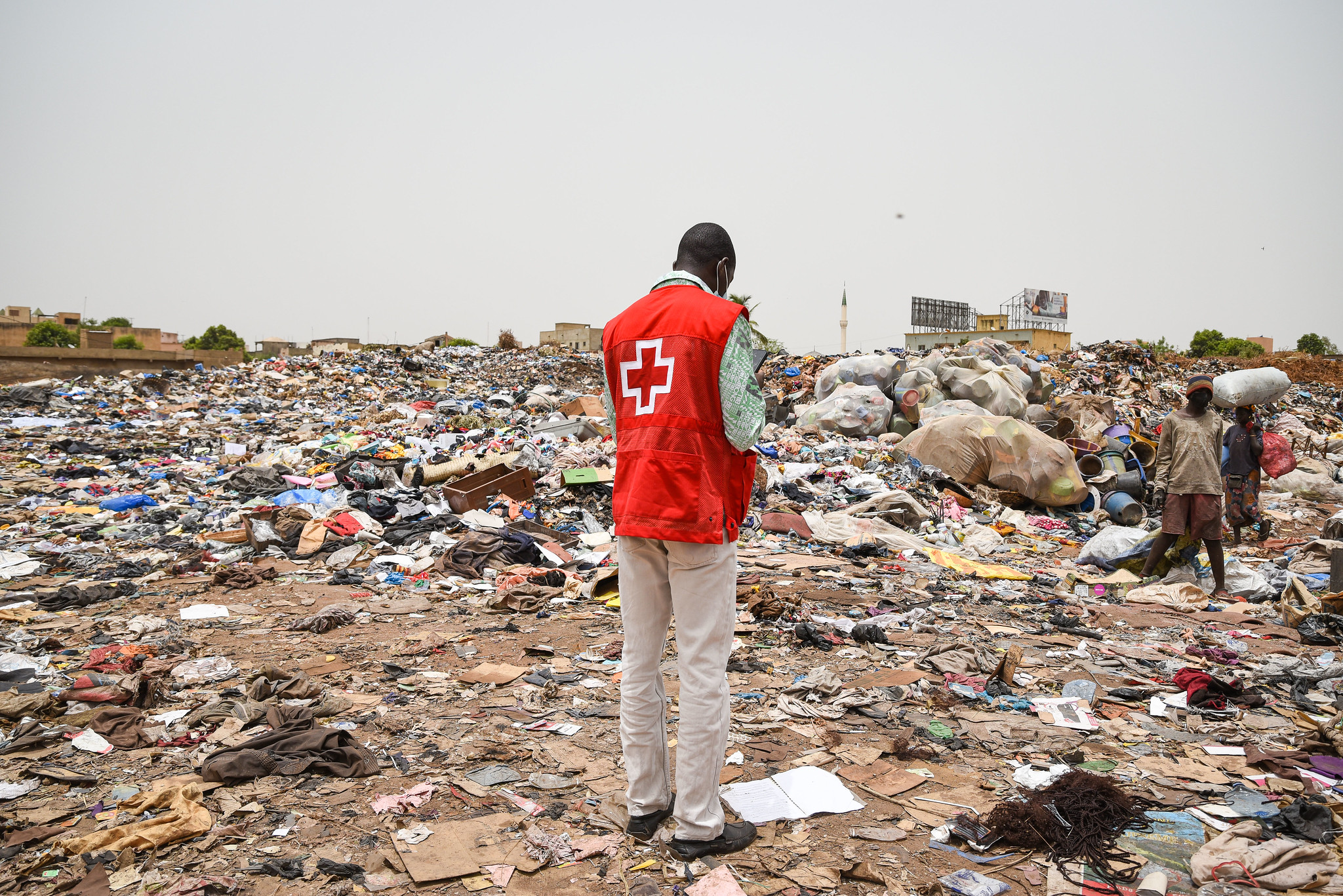
Open Geospatial Data in Environmental Management: Context, Opportunities and Challenges
The webinar was organized by the Humanitarian open mapping Community Working Group. It showcased initiatives that use open source geospatial data for environmental management...

Open Cities Africa: Bamako - Community Mapping for a Resilient Bamako
With ‘Community Mapping for a Resilient Bamako’, HOT was able to contribute to data sharing, raise awareness of flooding, and build the capacity of the community for the collection and use of flood risk data.
MapMalawi’s Dzaleka Mapping Project- OSM Mapping for People Living in Protracted Crisis
MapMalawi is a newly established non-governmental organisation (NGO), founded in December 2020 by two Malawian girls, Ndapile Mkuwu and Zola Manyungwa.
