OpenStreetMap and municipal planning: a reality in Mexico
Posted by Celine Jacquin • Aug. 24, 2023

We tell you how the LAC Hub, in alliance with the Secretariat of Agrarian, Territorial and Urban Development of Mexico, accompanied a group of municipalities to create geospatial open data under OpenStreetMap and thus be able to build thematic cartographies.
One map leads to another map, one project to another. At the beginning of 2022 we (LAC Hub) invited the Secretariat of Agrarian, Territorial and Urban Development of Mexico (SEDATU) to check and monitor the progress of our Open Cities Mexico project in Tulum, since they might be interested in the process of using citizen data for municipal planning, an area where there is a particular lack of spatial data.
In October 2022 SEDATU launched the course called "Territorial Planning: towards the orderly management of municipalities" with the aim of providing tools, guidance and technical skills to all municipalities in the country for an adequate construction of their local development plans.
The Hub contributed to this course with three sessions on technology and tools based on OpenStreetMap, which were followed by more than 300 municipal teams. This educational material it's a permanent feature of SEDATU's MOOC and is also accessible on our channels (in Spanish):
Introducción a OpenStreetMap Taller OpenDataKit ODK Análisis de accesibilidad Open Route Service QGIS
But the success of the integration of collaborative data in local governments depends on follow-up and practice, which is why we proposed developing a 4-month cycle of personalized support for a group of municipalities more interested in the topic, and that they were at the right time of their local plans preparation, so that there would be a concrete and immediate application.
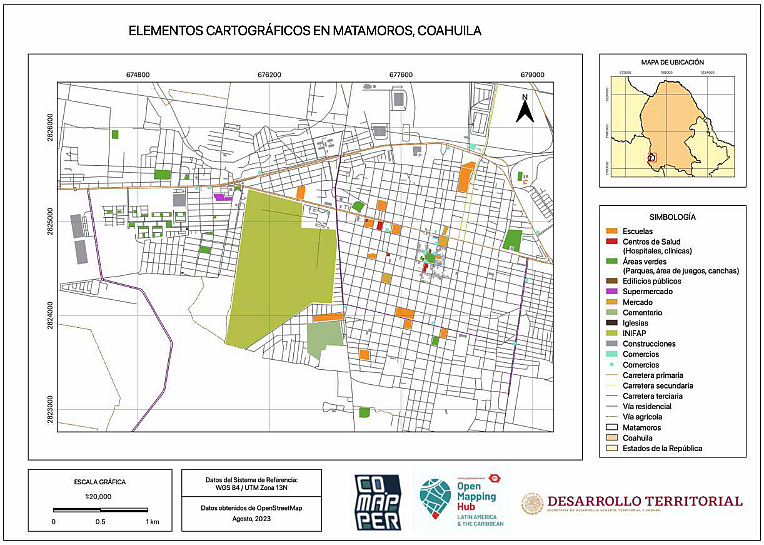
A group of 15 municipalities was then formed, their previous training was reinforced, and were led to generate data both remotely and in place about their territory and finally they were taught the extraction and use of that information, in addition to the construction of thematic cartographies.

Heat map of the mapping area. Source: Where did you contribute to OSM? Web
This accompaniment cycle culminated on August 8, 2023 with the final presentation in an open Sedatu conference with 35 participants from the 15 municipalities and other interested municipalities, showing results and sharing impressions and reflections.
Now we will continue exploring with SEDATU and other actors, the ways to keep on supporting municipalities, in Mexico and in the region, to share experiences and knowledge about the benefit of open and collaborative geographic data, and that way contribute to a finer and more equitable local planning.
Finally, a thank you to GEOID for their training and accompaniment in the preparation of the video sessions, and the recognition for their enthusiasm and participation to the municipalities of Axtla de Terrazas, Apozol, Matamoros, Miguel Alemán, Victoria, Nuevo Laredo, Nombre de Dios,Chiautempan and Rayón.
.
Also find out how we collaborate in a similar way with National Institutes of Geography.
If you want to be part of the community of volunteer mappers of the LAC Open Mapping Hub, write an email to hublatam@hotosm.org with Subject: Volunteer mapper.
If you are part of an organization that wants to explore how to collaborate on a similar project, write an email to hublatam@hotosm.org with Subject: LAC Projects.
Follow us on networks: TikTok, Twitter, Mastodon, Instagram, YouTube, Facebook, Linkedin.


