Open Mapping Experiences at the Rural Secondary School "San Ignacio"
Posted by Luis Miguel Bande Jaramillo • July 15, 2024
Through the Open Mapping for All program, teachers and students at an educational institution in Argentine Patagonia use Open Mapping tools to document, recognize, and improve school physical infrastructure while connecting with their environment and cultural values.
Versión en español / Versão em português
The Rural Secondary School "San Ignacio" (CEI) is the first school of the Patagonian Crusade Foundation (FCP) located 10 km from Junín de los Andes, Argentina. The "CEI" or the "Cruzada," as it is commonly called, is one of the leading educational and development institutions in the south of Neuquén.
The CEI provides regular secondary education. It has a primary education program for adults living in rural Patagonia. Often, both young people and adults reside in remote areas or Mapuche rural communities, the ancestral indigenous people of northern Patagonia (Puel Mapu, in the Mapudungun language) and the Chilean Araucanía. These communities are located in remote areas, subjected to the climatic harshness of both the Patagonian summer and winter, far from or often isolated, hundreds of kilometers away from the nearest towns, hospitals, schools, or basic essential services.
Our story unfolds in a context enriched by rugged nature and cultural diversity. At the Rural Secondary School "San Ignacio," technical education converges with the enthusiasm of teachers and students who have discovered great opportunities in using open mapping tools through our Open Mapping for All (OM4A) program. Teachers like Pablo Norambuena and Christian Hick, supported by Juan Manuel Stagnaro, have embraced the use of open mapping tools to document, through personalized training and digital instruments, both the institution's issues and the individual interests of the students. Next, we will review this effort.
Solving School Infrastructure Problems with Open Mapping
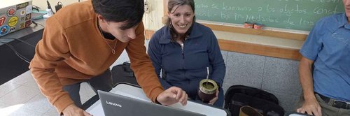
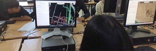
From the end of 2022 to mid-February 2023, a series of meetings were held to coordinate activities between the Humanitarian OpenStreetMap Team (HOT) and the CEI. Additionally, workshops were conducted to train different teachers at the school in the use of available open mapping tools like Editor and UMap.
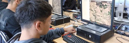
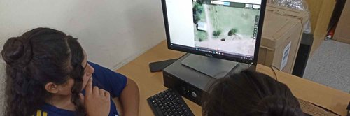
At the beginning of 2023, Juan Manuel Stagnaro conducted a drone flight covering 16 hectares of the school's grounds to analyze pastures, irrigation canal flows, and map the school's buildings and areas with higher definition. Pablo Norambuena, a forage subject teacher, used his Geographic Information Systems (GIS) knowledge and the school's orthomosaic to carry out a reorganization and rematriculation plan for the pasture plots and the relocation and repair of damaged or unused greenhouses.
Pablo needed a digital surface model of the marsh dividing the school to trace a new drainage system and utilize those pastures. These were processed in Web Open Drone Map and published on Open Aerial Map.
Throughout 2023, various training sessions continued to be held for students at the school. In December of that same year, a second drone flight was conducted to analyze and verify changes with the previous year's image.
In February 2024, a gas pipe was broken due to a lack of knowledge about its route and depth. Although there were no injuries or significant damage, this highlighted the need for an updated map of the water, electricity, and gas networks to avoid these accidents. Teacher Christian Hick and his team used drone images and the Field Papers application, walked through the institution marking the routes of all service networks, and took photos in the process. They then structured the information in UMap. Currently, this map is under the control of the Technical Area, allowing them to know the routes to avoid future accidents and facilitate maintenance.
Connecting with the Environment and Cultural Values through Open Mapping
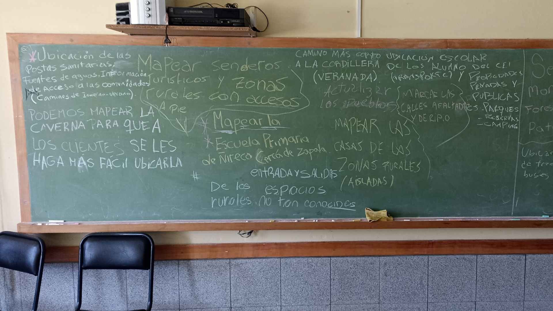
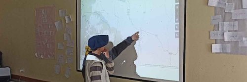
Open mapping has not only solved problems within the institution but also allowed students to document social issues and personal and educational interests. From late January to February 2024, workshops were held for fourth and fifth-year secondary students, many of whom decided to map their localities, remote areas, and communities of origin, such as Aucapán, Chiquilihuín, Atreuco, Espinazo del Zorro, Añelo, Paso Aguerre, Trompul, Laguna Blanca, and Villa del Puente Picún Leufú. A student from Naupa Huen, a small town in Rio Negro, decided to map his community, which is invisible on maps, demonstrating the power of mapping as a visibility tool.
The situation mentioned above became a generalized feeling among students, who found in that indignation a reason to reclaim the identity of their territories, revalue their places of origin. They found in Open Mapping a reclaiming tool that gave them the power to tell the world that they exist in that empty map.
Yamila, a student from Paso Aguerre, mapped her area to plan future irrigation canals and increase agricultural productivity.
Another example was experienced by María and Trinidad, friends and fifth-year students. Both students are from Laguna Blanca, a remote area in the center of the Province of Neuquén within the Laguna Blanca National Park. Many of the inhabitants are ancestral Mapuche practicing transhumant livestock farming. It is an extensive and inhospitable region, where residents' homes are far apart. María and Trinidad created an exhaustive map where they did not leave a single building unreferenced, employing a wide variety of tags. Their work did not end there, as they continued with the same tasks in the Villa del Puente Picún Leufú area, where they mapped more buildings. This shows that many localities deserve to be located to stop being "invisible" to the world.
Other students connected the use of Open Mapping with various experiences. Segundo, a fourth-year student from Pilo Lil, dedicated himself to mapping the scenic beauty of his family's estancia, which includes a cave with geologic formations and 500-year-old rock art. Using UMap, he created an interactive map of the horseback riding routes his family offers.
Juan Bautista, a fourth-year student, digitized in UMap a herbarium he had started in third year. He added 50 species, working with eight between the school and the Nonthué Educational Camps Plant. The project is designed for other students to update with photos, videos, and descriptions, and can be consulted at any time.
Nahuel, a fifth-year student, mapped all the productive buildings at CEI, detailing the activities and subjects taught in these buildings. In four major categories, he added descriptions, photos, videos, and interesting facts, such as a school ram that has an Instagram account.
This project, completed in three weeks, was used at events such as "Tranqueras Abiertas" and the Federation of Private Agricultural Technical Institutes of the Argentine Republic (FEDIAP) summit, marking a milestone in the school's use of Information and Communication Technologies (ICTs).
These examples highlight the learning experiences with Open Mapping at the Rural Secondary School "San Ignacio." Currently, the school has QR codes allowing visitors to access each map freely.
The Utility of Open Mapping Tools
Students and teachers used various digital tools to document the experience, ensuring that every aspect related to their concerns was captured, and they could collect all the necessary data to create their maps. Although many of the applications have already been mentioned throughout this review, it is essential to summarize them below.
These were the tools used:
-
ID Editor: Used to edit information within already created maps.
-
Field Papers: A tool that allows users to create customized map atlases on paper, on which they can make handwritten notes in the field.
-
OSMAND: A navigation and mapping application that uses OpenStreetMap data. It offers offline maps and GPS navigation tools, making it ideal for use in areas without mobile data coverage.
-
OpenAerialMap: A platform that provides access to a collection of publicly available aerial and satellite imagery.
-
OpenDroneMap: Open-source software that converts drone-captured images into 3D models and orthomosaic maps.
-
OpenStreetMap Java Editor (JOSM): Provides first-rate tools for adding data to the map remotely.
-
uMap: Facilitates creating visual narratives by combining traces with photos and videos and allows the creation of maps.
Reflections on Learning Using Open Mapping
Open Mapping tools offer students and teachers the opportunity to make significant contributions to already established maps, becoming an innovative and cost-effective pedagogical resource. These tools reduce costs compared to more expensive options. The greatest advantage is that users, who know the mapped area perfectly, can enrich the maps with precise information, which will later be validated by experts.
These digital tools facilitate the storage, organization, and collection of new data during educational activities. This aspect has been useful for students, who now see themselves as agents of change within society, being able to provide information that was previously invisible to the collective.
This blog was written by:
Share
