News — 12 March, 2025
Introducing Street-Level Imagery Projects to MapSwipe4Web!

MapSwipe4Web is launching a new street-level view! Ready to know the details? Read ahead:
Cover image: Street-level view of Avenida Constituyentes, Querétaro. Source: Mappillary. CC BY-SA 4.0
Big news, MapSwipers! MapSwipe is stepping up its game with the debut of an exciting new project type: street-level imagery projects! Thanks to funding from the Humanitarian OpenStreetMap Team (HOT) and development by the amazing team at HeiGIT, we’re opening up a whole new way for you to contribute to the mapping community.
What’s this new project type all about? Imagine this: you’re looking at ground-level imagery from Mapillary–a street-level view that feels like you’re walking right through the area. Your mission? Spot specific details in the images. For example, you might be asked: is the road paved or unpaved? Or, do you see any solid waste in the image?
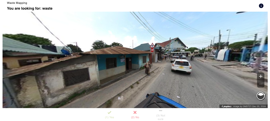 Mapping solid waste in Dar es Salaam, Tanzania-a thesis project based out of the Heidelberg Institute for GeoInformation Technology (HeiGIT). Image source: Mappillary. CC BY-SA 4.0
Why Is This a Big Deal?
These seemingly small observations add up to powerful insights, helping us create richer, more detailed maps that better reflect the reality on the ground.
Traditionally, MapSwipe focused on satellite imagery tasks, like identifying buildings, roads, or areas in need of humanitarian assistance. Now, with street-level imagery, we’re getting up close and personal with the landscape. This level of detail is invaluable for projects like:
- Disaster response planning
- Urban development
- Environmental monitoring
Exclusively on the Web App
This new project type is only available on the MapSwipe web app for now. It’s the perfect excuse to check out MapSwipe’s web platform if you haven’t already done so. Whether you’re a longtime MapSwipe fan or new to the community, this is your chance to try out a fresh, interactive way of mapping.
What Makes MapSwipe So Special?
At its core, MapSwipe is about making mapping easy and accessible for everyone. Whether you have five minutes to spare or an hour to dedicate, you can make a meaningful impact. MapSwipe’s tools are designed for collaboration, enabling volunteers around the world to chip away at big mapping challenges together.
With the launch of MapSwipe4Web’s street-level imagery project, we’re continuing to push boundaries. This isn’t just about identifying features on a landscape – it’s about understanding the world we live in and supporting communities with the data they need to thrive.
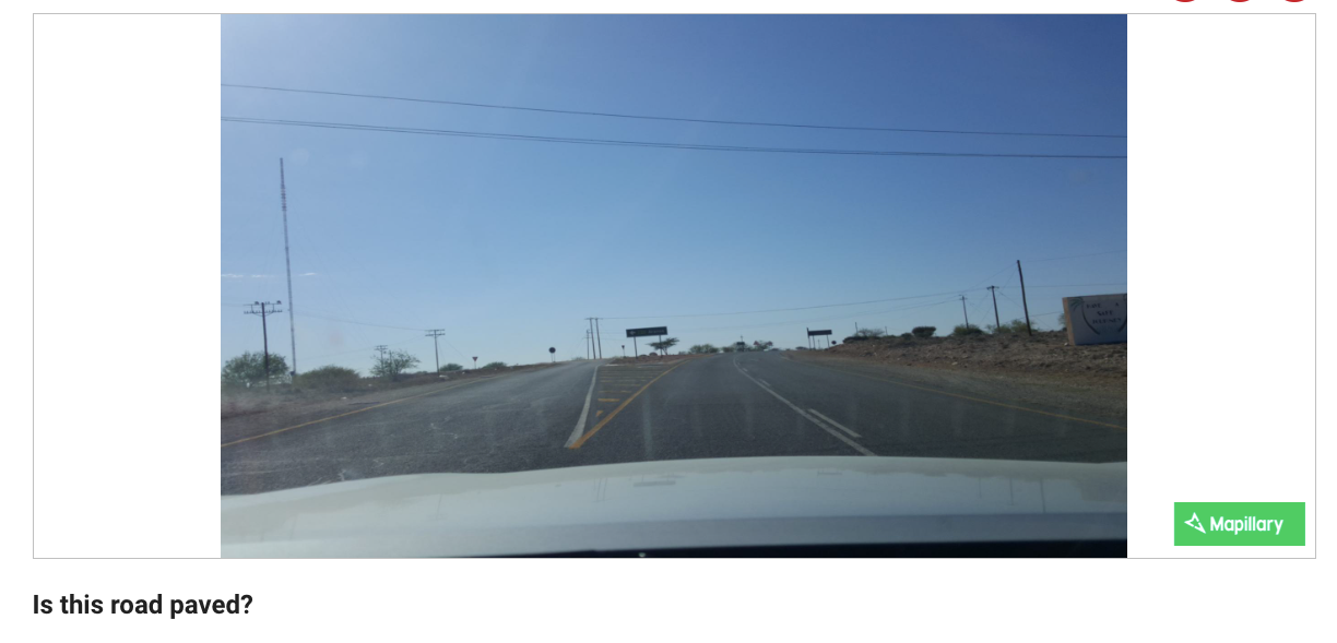 An early prototype asking the user to identify if a road is paved in South Africa, courtesy of the Heidelberg Institute for GeoInformation Technology (HeiGIT). Image source: Mappillary. CC BY-SA 4.0
Get Involved!
Ready to dive in? Here’s how you can join the action:
- Head over to the MapSwipe web app (make sure you’re logged in or create a new account).
- Look for the new Street-Level Imagery projects.
- Start swiping through images, answering questions, and making your mark!
So, grab your favorite device, log on to the web app, and let’s get swiping! Your next adventure in mapping is just a click away.
Thank you to everyone who helped bring this project to life – from the dedicated funders at HOT to the brilliant developers at HeiGIT. And, of course, thank you to our incredible MapSwipe community. You’re the heart of everything we do, and we can’t wait to see what we accomplish together with MapSwipe4Web!