News — 23 January, 2025
Mapping Dhaka’s Informal Settlements for Climate Resilience and Urban Development
Discover how the Dhaka Thrive Project is working with local stakeholders to collect open geospatial data to address rapid urbanization, climate change, and public health challenges in Dhaka's informal settlements.
Launched in March 2024, the Dhaka Thrive Project, a collaboration between the Open Mapping Hub - Asia-Pacific and World Vision Bangladesh, is a transformative initiative that addresses the challenges of informal settlements in Dhaka. Rapid urbanization has strained the city’s infrastructure, public services, and disaster response systems. By working with local stakeholders, including humanitarian organizations, local authorities, and grassroots communities, the project enhances them to generate comprehensive open geospatial data and leverage it to make informed decisions and strengthen local urban resilience.
As Dr. Nama Budhathoki, Regional Director for the Open Mapping Hub Asia-Pacific, explained:
“We are thrilled to collaborate with World Vision Bangladesh, especially due to their strong on-the-ground presence. From the outset, we have prioritized engaging local stakeholders to establish a sustainable map data ecosystem in Bangladesh.”
Project Overview and Milestones
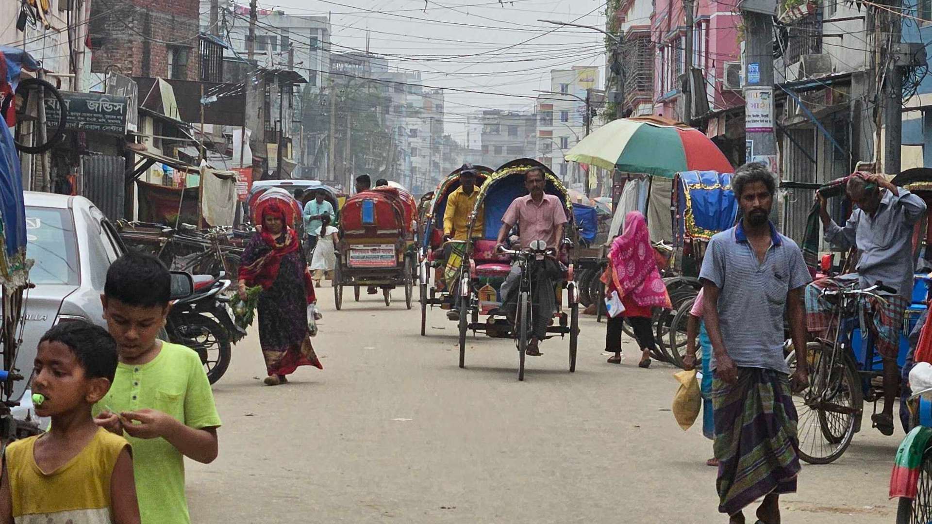
Increasing climate change has intensified urban challenges from Dhaka’s rapid growth in informal settlements like Korail. Maps from 2017 to 2021 highlight significant urbanisation into existing water bodies, exposing already vulnerable populations to further risk such as flooding and dengue. Accurate and up-to-date datasets are essential for understanding these issues and addressing the impacts of climate change on the informal settlements.
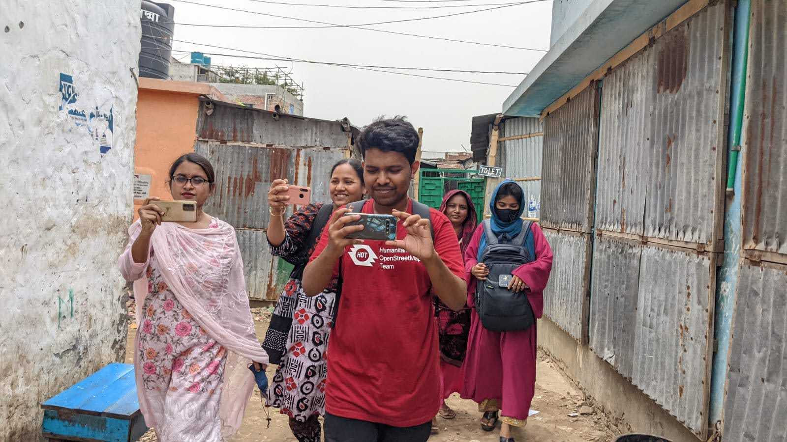
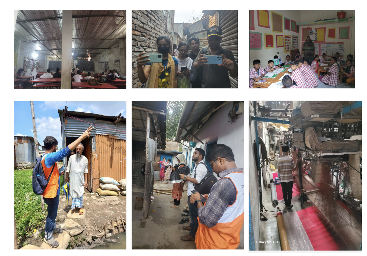
In its first major milestone, the project successfully collected 932 Points of Interest (POIs) across 41 slums in Dhaka with the help of local stakeholders. These include critical infrastructure such as schools, healthcare centers, water sources, and sanitation facilities, alongside hazards like dengue breeding sites, flooding points, and exposed electrical wires. This data not only captures existing vulnerabilities but also informs targeted strategies for urban resilience building.
*In this video, we will explore the Dhaka Thrive Project’s field mapping methodology and its role in improving local urban resilience.*
Key findings
The collected data reveals connected risks between dengue and flooding. For example, focus group discussions with local stakeholders on the collected data found that poorly maintained open drainage infrastructure in the settlements often trap water from floods, creating favourable breeding environments for mosquitos. Stakeholders also pointed out that frequent floods often wash through open dump sites, scattering waste across the informal settlements that creates multiple hotspots for mosquitos to breed and transmit dengue. These insights can guide targeted strategies to enhance public health and urban resilience in these vulnerable communities.
“I had the opportunity to visit Mirpur’s slum population during a field visit to Millat Camp and Duaripara. Demonstrating open mapping tools and data collection methodologies to community members highlighted the gaps and needs in terms of data and information. I found this to be an amazing experience.” – Brazil Singh, Open Mapping Guru, Bangladesh
Interactive dashboard: explore the data
The uMap dashboard for Dhaka Thrive was built using the open-source uMap tool, which leverages the OpenStreetMap database. This platform provides a user-friendly interface for creating interactive maps, visualizing geographic data, and more importantly sharing updated open geospatial data from OSM. The dashboard is designed to showcase open datasets collected from the field mapping project. You can explore the dashboard here: tinyurl.com/dhakathrivedashboard.
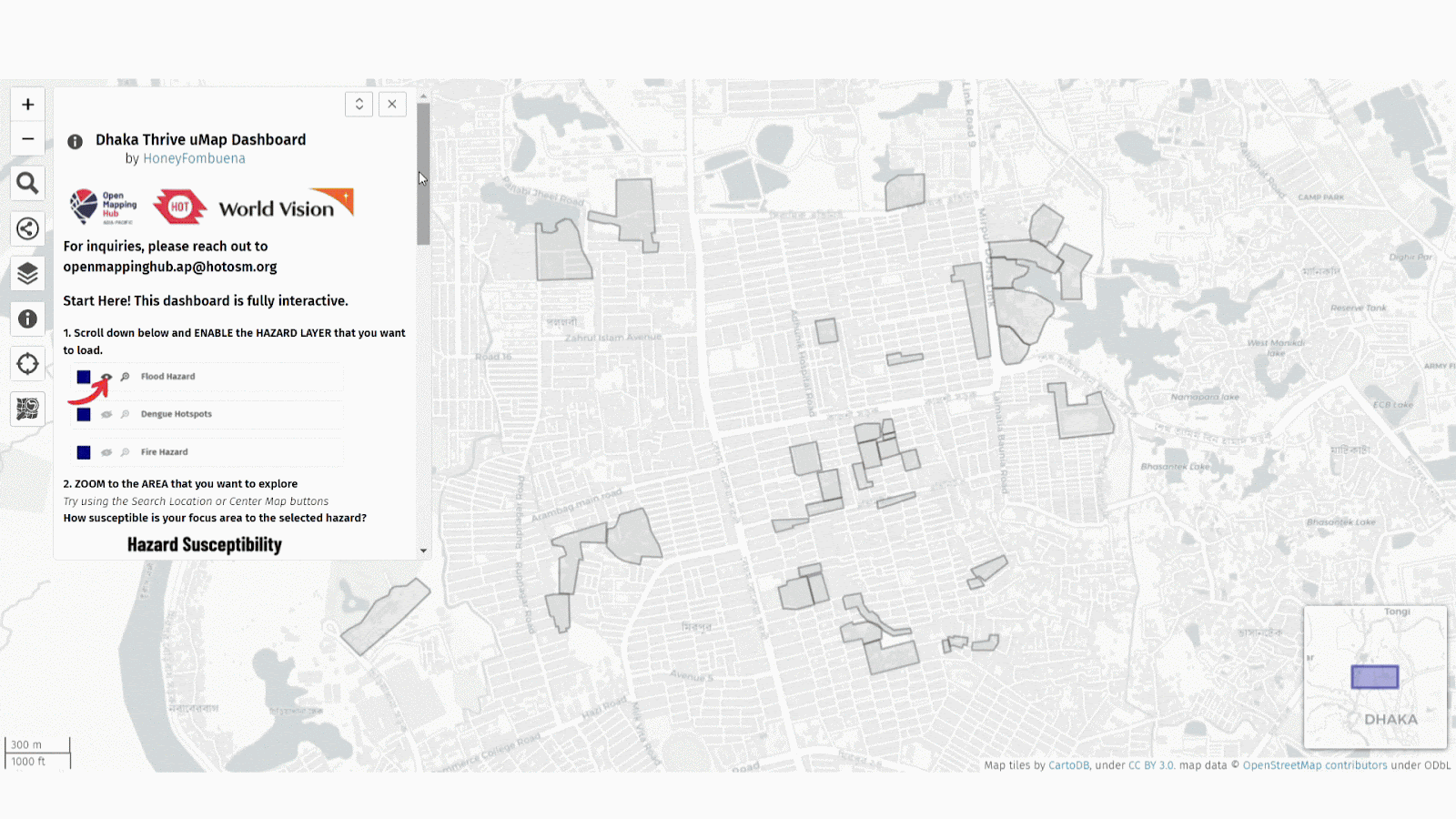 Figure 1: Critical lifeline facilities that are essential for a thriving community
These include healthcare facilities, educational institutions, places of worship, water points, WASH facilities, and others. To avoid visual clutter, these points are clustered on the map. Zooming in reveals individual icons representing each facility, and hovering over a point displays its name. Clicking on a facility opens a pop-up window that provides detailed attributes collected by field mappers and uploaded to OpenStreetMap.
“This [field mapping] will be useful for us, it will be useful for the safety of our children. We will know which part of our area is risky for children.” – Rani Akter, Vice Chairman Urban Neighbourhood Development Committee, Bangladesh
The strength of uMap for Dhaka lies in its connection to OpenStreetMap, enabling real-time updates to the open geospatial database whenever local stakeholders contribute to or update OpenStreetMap. As Dhaka experiences rapid urbanization, having a centralized platform that any stakeholder can update is crucial to ensure that the data is updated and reliable. Moreover, the open geospatial database can be easily downloaded, making it helpful for decision-makers in times of crisis.
Next steps
As the project consolidates the results from its pilot phase, the team will evaluate the findings with local stakeholders and refine the project methodology to develop a tailored end-to-end model that is suited to Dhaka’s context. This involves processing the generated actionable insights, such as identifying fire hazards and gaps in WASH (Water, Sanitation, and Hygiene) facilities, and sharing it with stakeholders through dissemination workshops, where training will be provided to ensure communities, organizations, and policymakers can effectively use the data. These sessions will also serve as a platform to refine insights and explore opportunities to scale the project, creating a sustainable framework to strengthen local urban resilience. Additionally, evaluating and promoting the continued use and contribution of data and enhancing community participation in the project over the next six months will remain a key focus.
In 2025, the project aims to work with relevant stakeholders to:
-
Learn and train other stakeholders on effective data usage and decision-making.
-
Develop comprehensive maps showcasing critical public facilities and hazards.
-
Leverage actionable insights for targeted interventions to improve resilience in informal settlements.
Dr. Rahul Mathew, Deputy Director of World Vision Bangladesh, emphasized the significance of this effort: “Dhaka Thrive is not just a mapping initiative; it is a transformative project designed to tackle the profound challenges of urbanization and climate resilience in Dhaka. By updating and expanding geospatial data accessible to local stakeholders, this project targets critical areas like Mirpur, known for its dense slum populations and significant influx of climate migrants.”
The Dhaka Thrive Project exemplifies the power of open geospatial data in addressing climate change and urban challenges. By combining locally-led open data generation and data-driven insights, it is laying the groundwork for climate-resilient cities. Stakeholders will benefit from comprehensive maps, actionable insights, training resources, and a strong community of open-mapping champions, ensuring the open data collected translates into meaningful and sustainable impacts for all.
The collaboration between Open Mapping Hub Asia-Pacific, World Vision Bangladesh, and local stakeholders is setting a precedent in leveraging local partnerships to address urban challenges against a backdrop of increasing climate change. As Dhaka Thrive moves forward, the focus on empowering communities and decision-makers will drive sustainable urban development and improved living conditions for vulnerable populations.
For further details or inquiries, please contact:
Dr. Nama Raj Budhathoki
Regional Director for Asia-Pacific
Email: nama.budhathoki@hotosm.org