News — 19 December, 2024
Mapillary and GoPro in Action: Contributions to Open Mapping in Medellín
As part of two mapping projects in the city of Medellín, a GoPro camera was used during field mapping activities. The images captured were uploaded to Mapillary, a platform that enables the creation of open Street Views. Yessica de los Ríos, the project lead, shares how the use of the GoPro camera contributed to enriching the open mapping of two neighborhoods vulnerable to different natural hazards.
San Antonio de Prado Project
The mapping project in this district aimed to update four of the eight rural settlements (veredas) that comprise it, with the goal of contributing to landslide risk management. The initiative was carried out over six months and included four phases:
-
Community training
-
Drone mapping
-
Field and remote mapping
-
Results presentation and project closure
The use of images captured with a GoPro camera and uploaded to the Mapillary platform was key in phases two and three.
In the second phase, the goal of using drone imagery was to obtain higher resolution data to update an area with frequent landslides, covering a territory of 150 hectares. To define this area, prior reconnaissance using Mapillary and OSM Tracker was essential. These tools helped identify suitable points for drone flights—wide open spaces with good visibility, minimal overhead wiring, among other criteria—and verify the condition of access roads. Panoramic photos taken with the GoPro and uploaded to Mapillary helped confirm the conditions of these points and define a set of nodes for executing the drone flights.
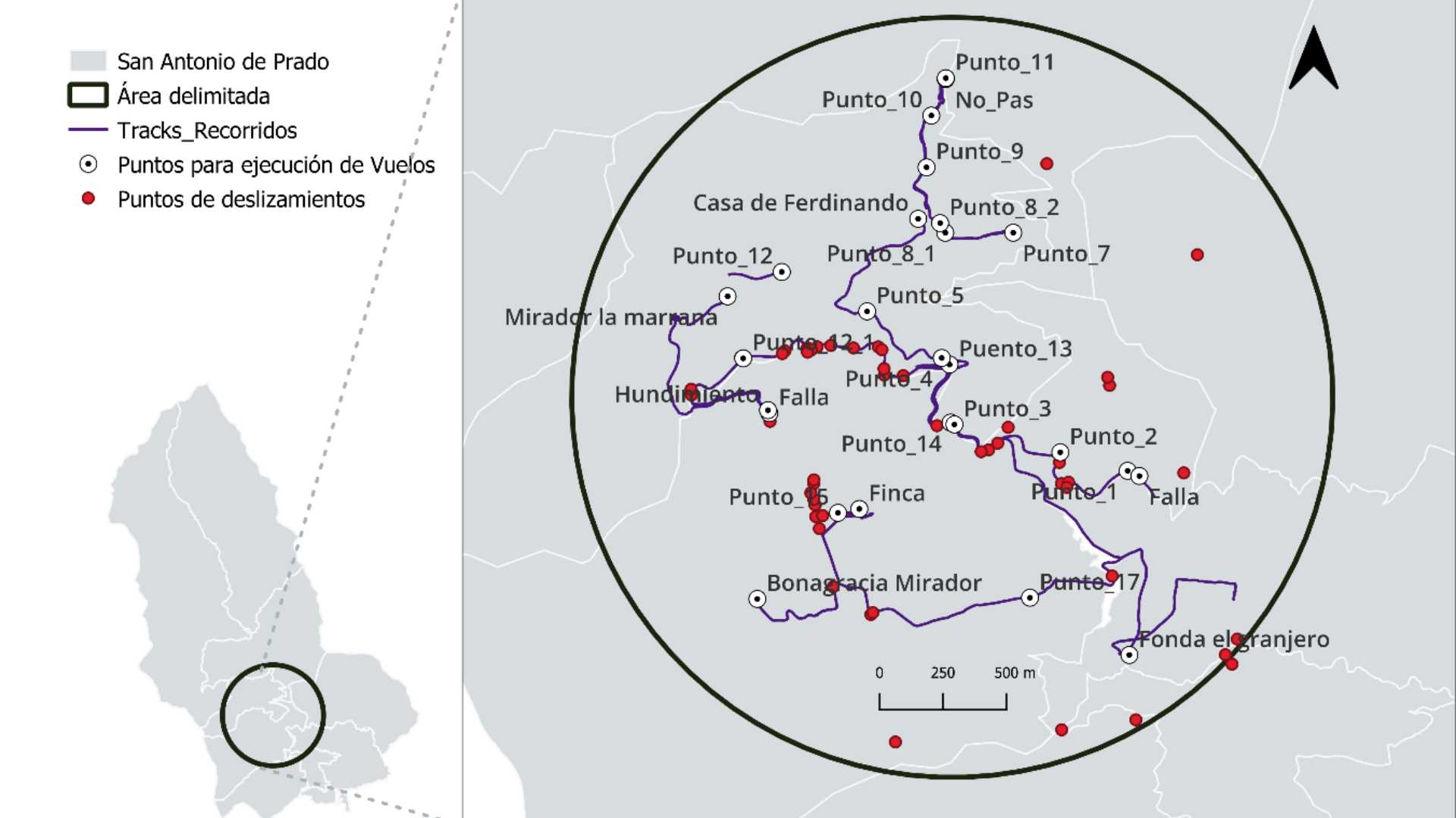
Figure 1. Area prioritized for drone mapping.
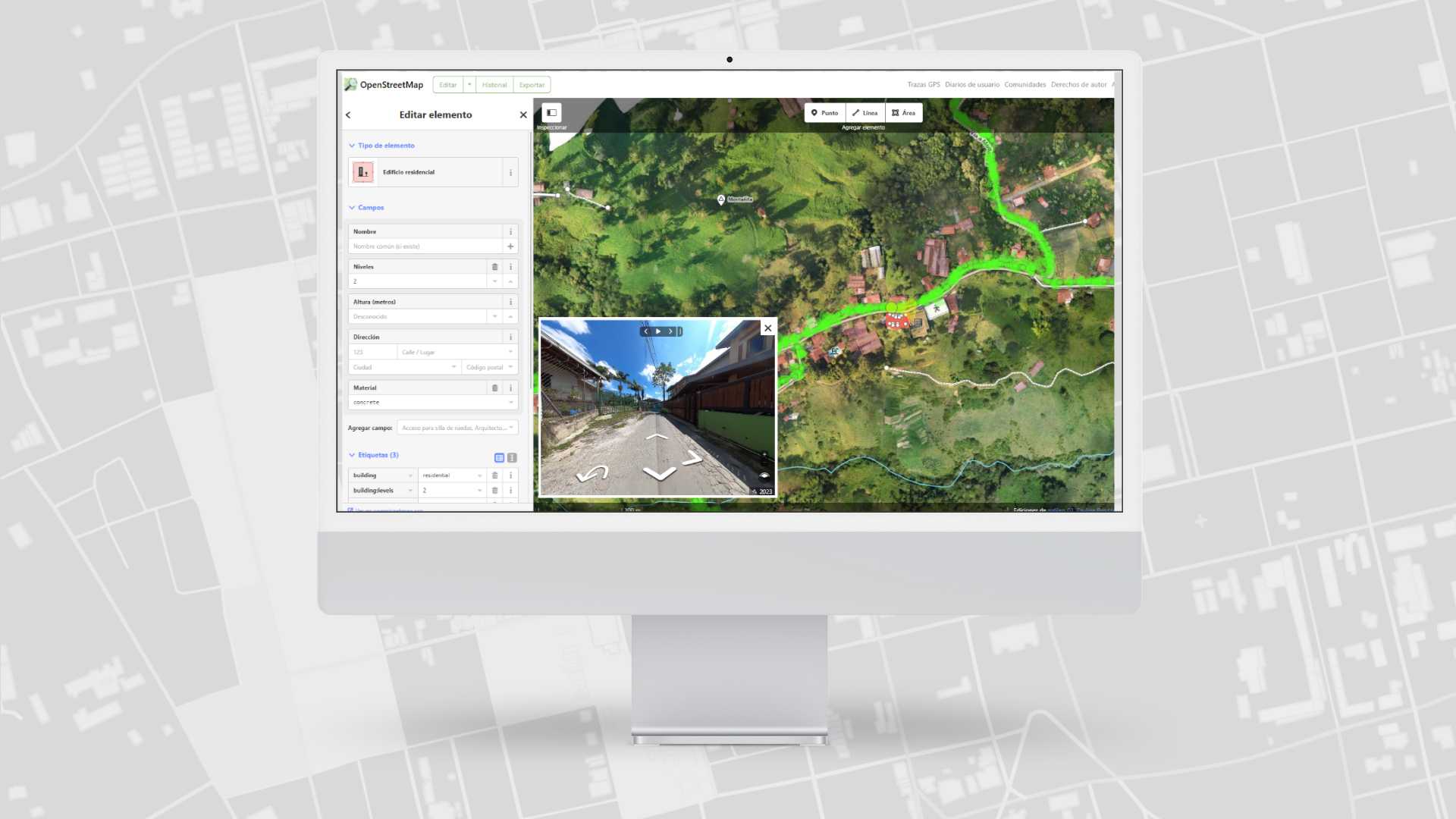
In the third phase, field visits extended to various areas within the four targeted veredas (see link): La Verde, Montañita, El Salado, and Potreritos. These visits were conducted by motorcycle using a mounted GoPro, allowing the capture of high-quality images of these rural areas to be uploaded to the open Mapillary platform. The photos were later linked to OSM and JOSM platforms, where attributes such as road characteristics, buildings, homes, and infrastructure were added (see image 2).
It is important to highlight that during the remote mapping process, Mapillary images played a key role by providing reference points for adding building information. These reference points allowed the area to be divided into smaller mapping zones, organized by blocks or spaces between two utility poles, speed bumps, building colors, manhole covers, and other features. This helped to more precisely determine the number of buildings between reference pairs, facilitating mapping and improving location accuracy.
Figure 2. Editing in OpenStreetMap using the orthophoto and linked Mapillary photographs (green points)
Participatory Mapping Project for Flood Resilience (Nueva Villa La Iguaná)
This project, partially funded by Global Water Partnership and supported by the Humanitarian OpenStreetMap Team—which provided equipment such as a GoPro camera and a drone—aims to help mitigate the flood risk faced by this neighborhood through open and collaborative mapping. The objective is to update information in OpenStreetMap (OSM), with a focus on flood-prone areas.
Several walks through the neighborhood were conducted to capture images using a GoPro camera. These images were later uploaded to the Mapillary platform (see link). Based on this information, the mapping data model will be built—defining the methodology and tools for geographic updates tailored to the specific conditions of the neighborhood.
Since this is an informal settlement, mapping represents a significant challenge, and Mapillary plays a fundamental role as a base image repository for field planning and logistics. In addition, the photographs will also be used for remote mapping—just like in the San Antonio de Prado project—to add neighborhood features to the map in OpenStreetMap (OSM).
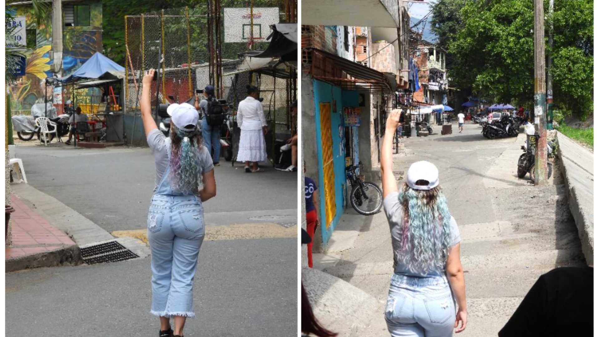
Image 3. Image collection route with GoPro camera in the Nueva Villa La Iguaná neighborhood
Conclusions
Viewer: Captured images are displayed on Mapillary in a Street View-like format.
Its use represents a clear advantage in mapping projects, as it provides up-to-date visual data that can benefit not only emergency teams and institutions but also community self-management in decision-making related to risk management. This tool is especially useful in dynamic territories, such as those affected by mass movements or flooding.
Thanks to its versatility, fast loading, and stability, the GoPro made it possible to capture high-quality images even in motion. This was especially useful for contributing to the cartography of extensive areas via motorcycle rides, as in the San Antonio de Prado project. Its performance shows the potential of this tool for widespread integration in mapping projects, offering a significant and low-cost option for territorial planning and management.