News — 06 August, 2024
Humanitarian OpenStreetMap Team joins the H2H Anticipatory Action Accelerator
The Humanitarian OpenStreetMap Team (HOT) is excited to improve the humanitarian usability of open spatial data through OpenStreetMap (OSM) as part of H2H’s Anticipatory Action Accelerator. With support from the H2H Network, HOT will be working on some of the spatial datasets that are most foundational for when a disaster hits:
- Populated places - used to identify the location and scope of affected communities in a humanitarian crisis
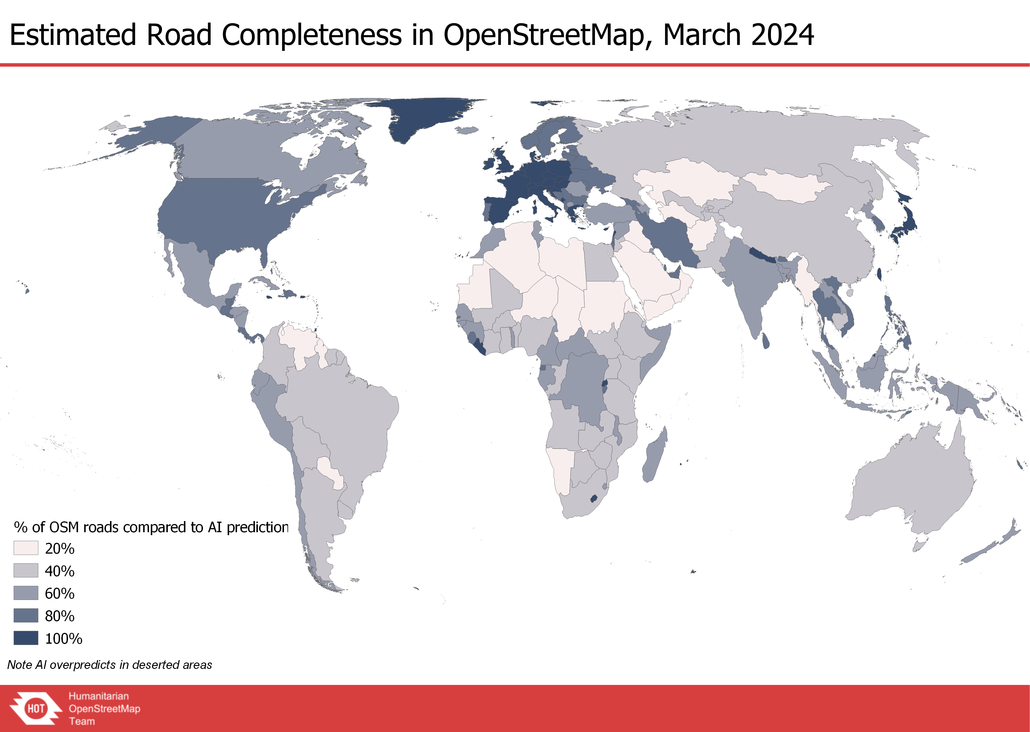
- Roads - used to plan access to affected populations and communities
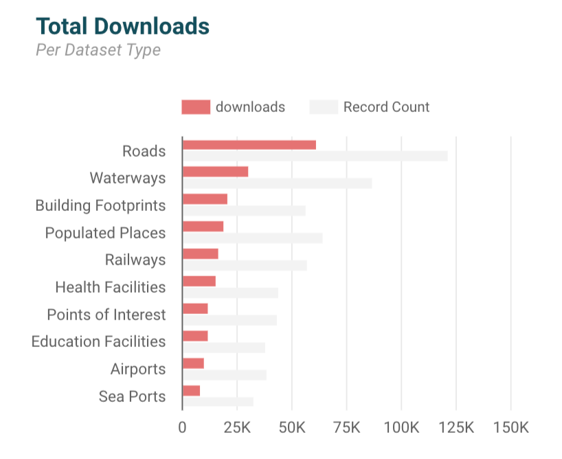
HOT OSM DATASETS IN HDX, 2019-2024
When responding to any humanitarian crisis or disaster, time matters. Users looking to OSM as a data source when responding to a disaster do not have time to thoroughly check if it’s fit enough for purpose, let alone improve the data in a moment of crisis. To address both challenges, this project will improve:
- Dataset user insights: create an easy methodology to help users assess the usability of datasets on populated places and roads for humanitarian needs.
- OSM exports enhancement: improve data usability of HOT’s exports from OSM into the Humanitarian Data Exchange (HDX), starting with better parsing of multiple language availability in OSM for populated place names, and inclusion of humanitarian unique identifiers (OCHA p-codes).
- Data improvements in areas of high humanitarian interest: improve data coverage and attributes/OSM tagging for populated places and roads in Mozambique, South Sudan, Somalia, Ethiopia, and more.
We need your help!
Do you use populated places and/or roads in your humanitarian work? We’d love to hear from you! Tell us what’s most important for you when looking for data quality. Some of the data aspects on our radar are:
- Spatial coverage and accurate geometry
- Road classifications
- Populated place names in coordination and local languages
- Inclusion of p-codes
What are we missing? Please take a few minutes to fill out this survey, or get in touch directly with Jessie Pechmann, HOT’s Global GIS Manager, at jessie.pechmann@hotosm.org to send feedback or stay involved.