News — 22 October, 2024
From Brainstorm to (Almost) Blastoff: Building ClearPath, an Accessible Navigation App
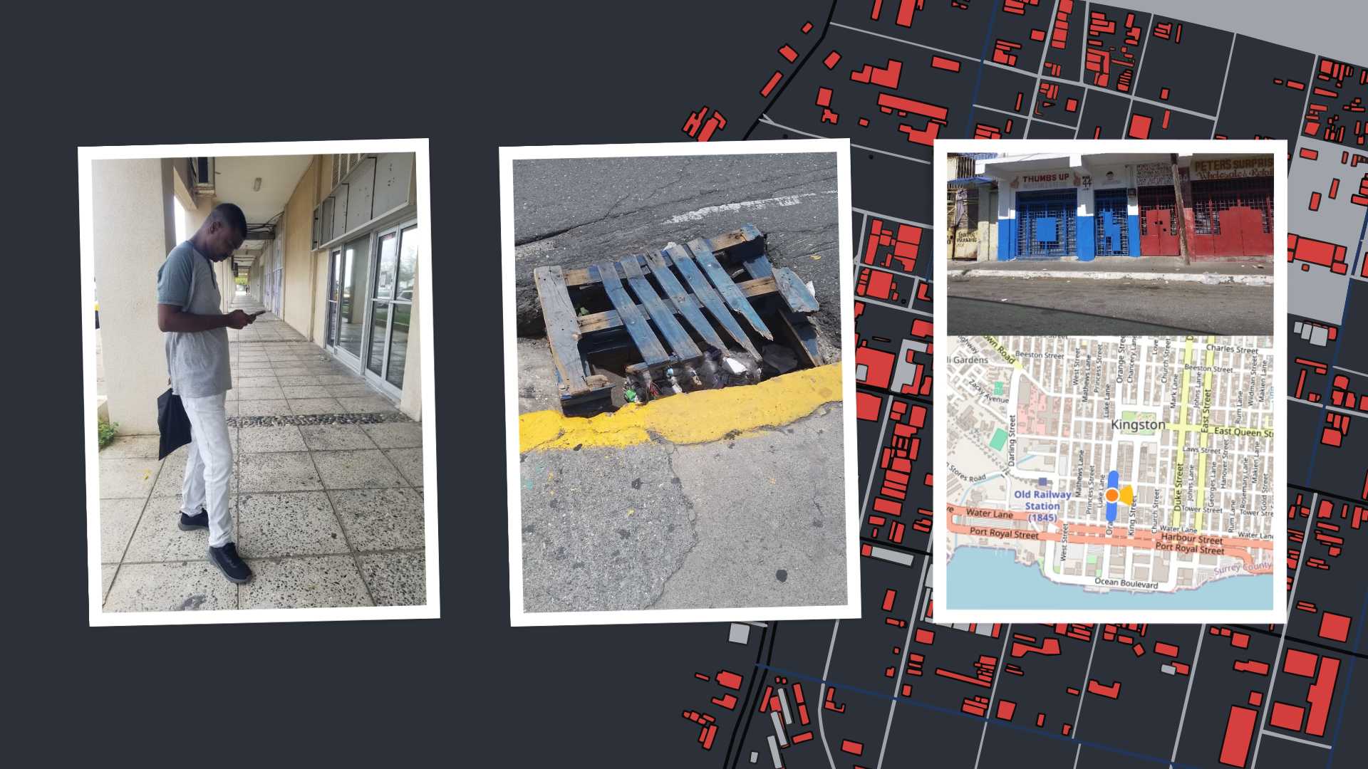
ClearPath, a mobile navigation app, leverages OpenStreetMap to enhance accessibility in Downtown Kingston for persons with disabilities. Developed with support from HOT’s microgrant and collaboration with MSBM, ClearPath aims to map key accessibility features like curb cuts and pedestrian crossings.
Forget roller coasters, the past two months have been a whirlwind adventure in app development! Our goal was ClearPath, a mobile navigation app that uses the power of OpenStreetMap to enhance accessibility in Downtown Kingston for persons with disabilities. This wasn’t all smooth sailing, especially when it came to finding the right developer, but it has been an incredible learning experience fueled by my dedication and deep dives into research (and, of course, Cherika’s invaluable support!). We’re well on our way to creating something impactful.
How did we get here? Let me take you back in time.
Exciting things are happening in the Caribbean. In 2022, the Humanitarian OpenStreetMap Team (HOT) formed a partnership with the Caribbean School of Data Science (CSOD), part of the Mona School of Business and Management (MSBM) at the University of the West Indies (UWI), to fund an Open Mapping Technical Training Programme in the Caribbean Region. This partnership aims to grow and sustain the mapping capabilities in the Caribbean. Mapping under this partnership extends beyond just mapping but to have an impact on society in many ways. Go read more about the work of HOT and the work with CSOD here.
Back in 2022, we were students at CSOD learning to map using OpenStreetMap. Fast forward two years, and we discovered that HOT was offering microgrants for impactful mapping projects. We applied and received one of the microgrants. HOT’s financial support was instrumental in bringing our vision to life, while MSBM’s project management expertise kept us on track.
Mapping Component and the Developer Scramble
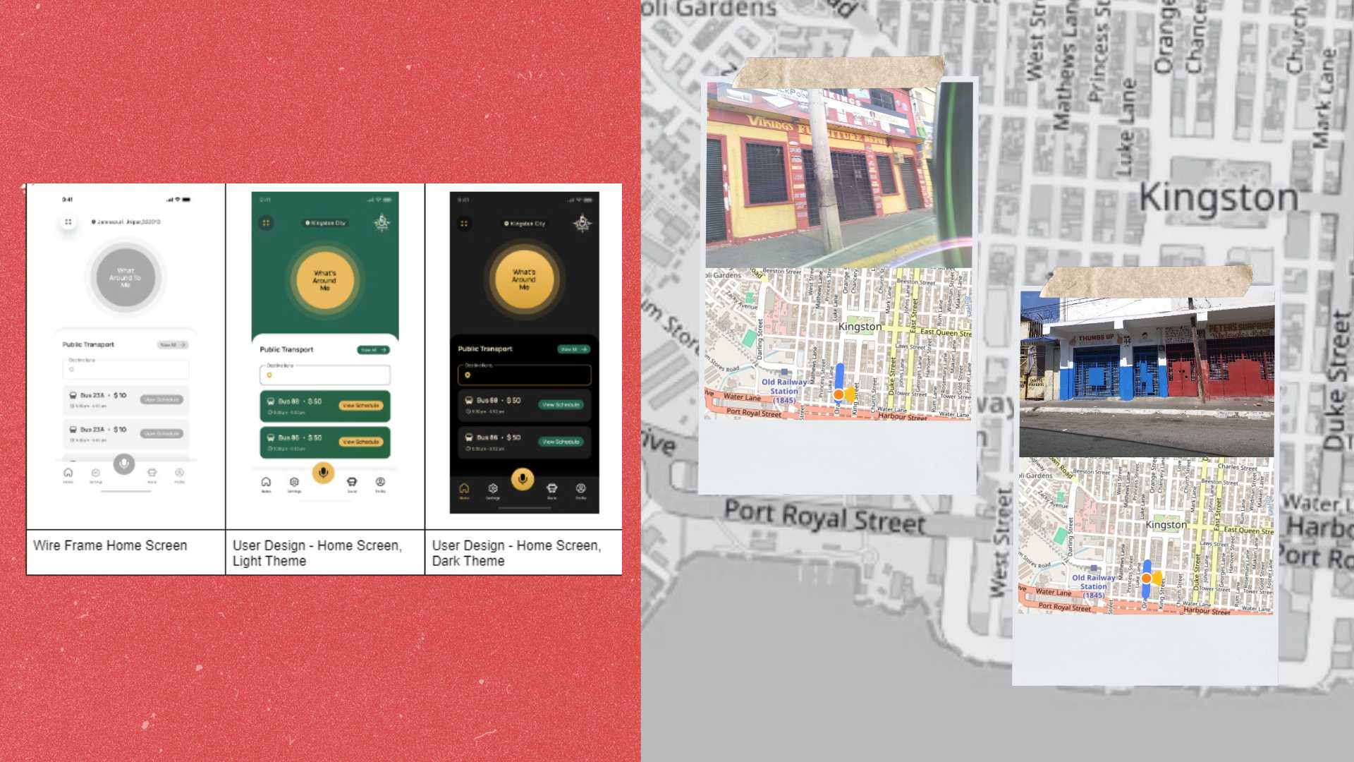
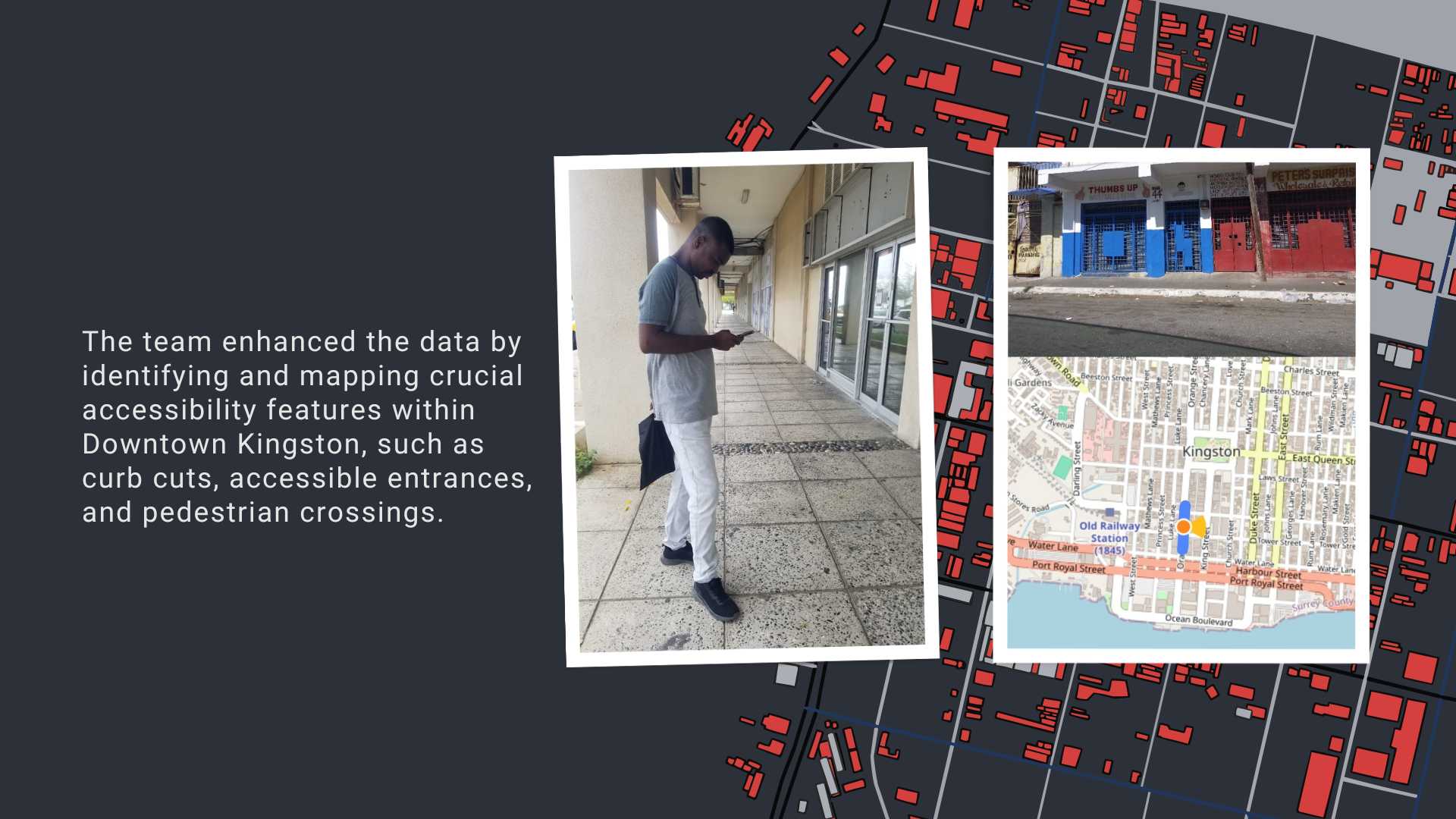
A cornerstone of ClearPath is the robust mapping data provided by OpenStreetMap. Our team of mappers— including my teammate Nicholas and UWI student mappers Aniece, Eyanie and Shaunapage— enhanced this data by identifying and mapping crucial accessibility features within Downtown Kingston, such as curb cuts, accessible entrances, and pedestrian crossings. Armed with their phones and using apps like Mapillary, KoBoCollect, AR Measure and StreetComplete they spent hours meticulously surveying the area, capturing detailed information about the environment for people with disabilities. This invaluable groundwork laid the foundation for the app, and shows that yes we can create a navigation tool that accurately reflects the ground realities for people with disabilities in Jamaica.
We began with grand ambitions—a fully developed mobile accessible navigation app with augmented reality features. However, after exploring options on platforms like Fiverr, we realised our initial budget wouldn’t stretch that far. This is where we learned a valuable lesson: pivoting! We adapted our vision to focus on a Minimum Viable Product (MVP)—a streamlined version of the app with the most essential features for our target users.
Developer Odyssey to the Lingo Learning
Our next hurdle was securing a developer who could bring our vision to life. The initial developers we contacted weren’t quite the right fit, causing a three-week delay in our timeline. However, with some perseverance and extensive internet research on my part, along with a friend’s reference, we connected with Adrian Gordon of AG Software Solutions. Adrian’s passion for working with the disabled community perfectly aligned with our goals, and we were thrilled to partner with him.
Once the developer search was over, we hit the ground running with user research. The Jamaica Society for the Blind (JSB) quickly came on board, providing invaluable insights into the needs and challenges of blind and visually impaired app users. This fueled the creation of critical user briefs such as the MVP, Concept Notes and Logo design brief which were instrumental in clearly communicating our vision to the app developer. A focus group with JSB members on 28 May was a crucial step, allowing us to gather direct feedback and ensure the app addressed real user pain points.
The internet became my best friend and, at times, my worst enemy!. Developing an app involved a whole new world of terms and concepts. There were moments where deciphering developer jargon felt like learning a foreign language! But that’s part of the adventure! Through countless hours of research, I explored app development processes, design principles, and user testing practices.
From Brainstorm to (Almost) Blastoff!
While we haven’t launched the full app yet, these past two months have been an incredible journey. We’ve refined our vision, built a solid foundation with the MVP in progress, and I’ve gained a wealth of knowledge. The road has had a few unexpected turns, but we’re excited to continue building something that will make a real difference.
Key Milestones:
-
03 May 2024: Secured collaboration with the Jamaica Society for the Blind (JSB).
-
21 May 2024: Secured collaboration with the Jamaica Council for Persons with Disabilities.
-
26 May 2024: Brief written for MVP App and Contract for App Developer.
-
28 May 2024: Conducted a crucial focus group with JSB representatives.
-
03 – 12 June 2024: Contracted AG Software Solutions and began working on the app concept, logo, and initial designs.
-
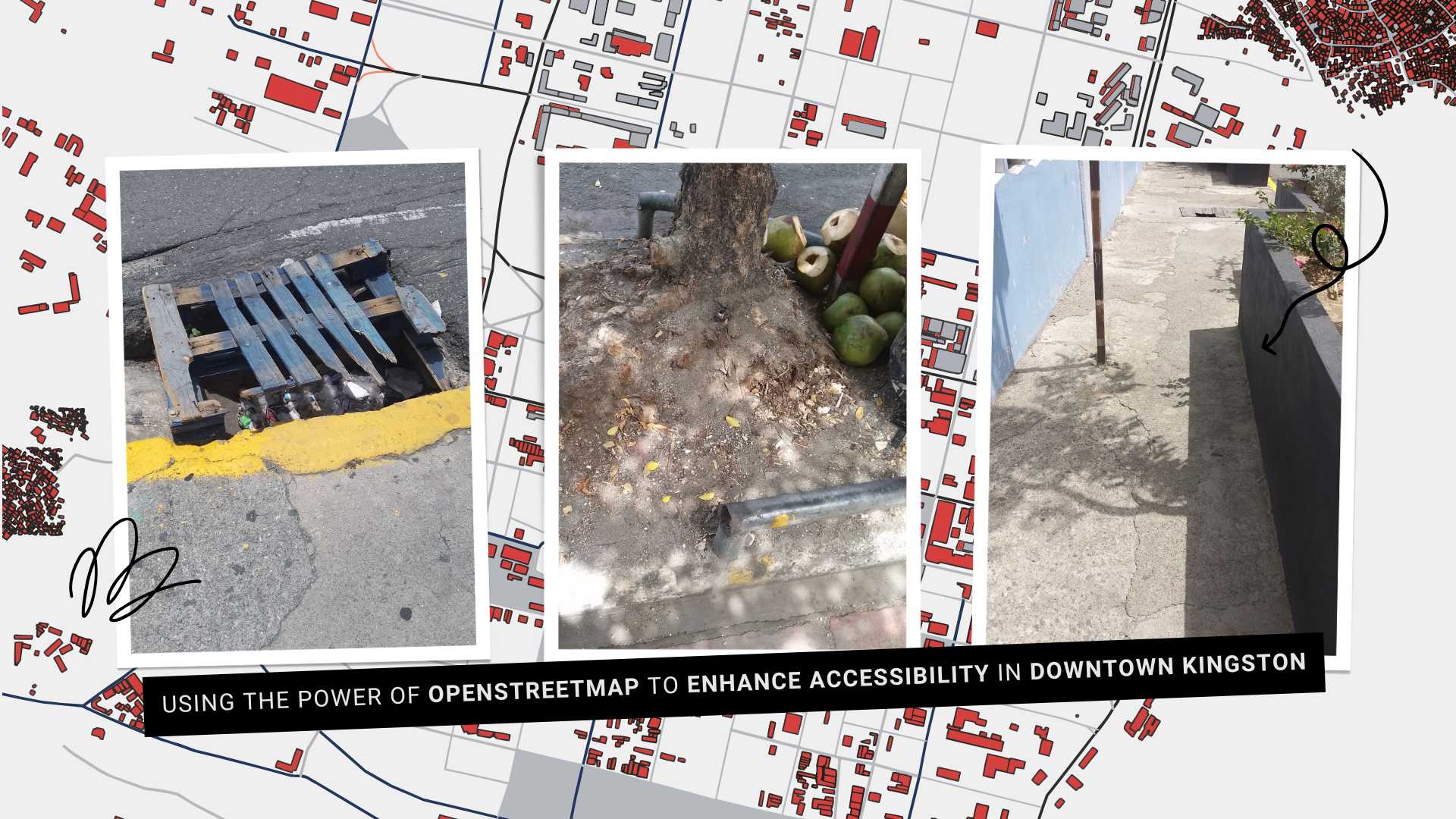
19 June 2024: Received the initial wireframes for the app.
-
24 – 28 June 2024: Finalised the app’s user interface (UI) design.
This blog was written by:
