News — 08 May, 2014
London HOT Congo Mapathon
What happens when you bring together people from Médecins Sans Frontières, with some people who are experienced OpenStreetMappers, and a bunch of people who just want to help humanitarian aid? Well we thought we would give this a try last weekend at an event in London.
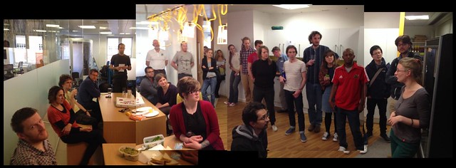
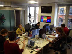
The London HOT Congo Mapathon was a great success, as a fun get-together, as an OpenStreetMap learning/teaching event, and also in driving some important mapping progress in Lubumbashi. This city in the Democratic Republic of Congo has a number of MSF medical centres. At the event we heard from Ivan Gayton from MSF UK, who described how they try to tackle disease outbreaks, how this presents map-related challenges, and how the work of H.O.T. mapping volunteers can save lives in these situations.
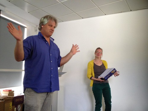
H.O.T. has been working with MSF UK in various ways in the region. Jorieke blogged before about her week in Lubumbashi. Ahead of that there was another mapathon event in Berlin organised by Shoaib. We were lucky enough to have both Jorieke and Shoaib over in London for our event. Jorieke described the use of “field papers” she had been coordinating there (look at the photos on Jorieke’s blog post. That’s a lot of field papers!) At the event she showed these photos, plus some pictures illustrating what the streets look like at ground level. She also described the excitement the local people felt at the idea of mapping volunteers from another part of the world helping to map their city. …so that’s what we tried to do!
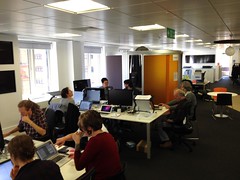
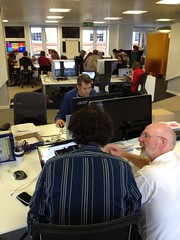
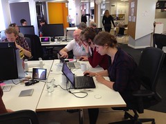
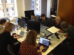
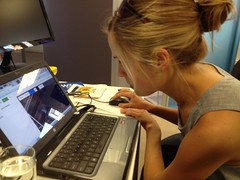
Equipped with scans of these field papers, the fieldpapers.org site, and the field papers JOSM plugin, we were able to digitise their mapping work (For details of this workflow, see the Lubumbashi wiki page) Jorieke also brought the actual original pieces of paper, which was sometimes easier. We were also teaching quite a few new folks how to contribute to OpenStreetMap, starting them on some easy task squares involving building tracing. I think this worked very well because we had a good balance of experienced OpenStreetMappers and folks who were new to it. Everyone seemed to enjoy learning, and hopefully we’ve expanded the number of London-based volunteers we have!
Thank you!
I have a list of people to thank for making this day a success: Thanks to the Open Data Institute for providing a wonderful venue, and also sponsoring the pizzas! Thanks to Earth Relief Network (@AidEarth) who were also inspired by the event and made a donation. Thanks to all our volunteer mappers, the new ones who worked enthusiastically to learn the tools, the pro-OSMers such as Dan and Nick who were teaching them, and the other pro-OSMers such as Derick and Robert who were blasting through the mapping tasks. Thanks also to the mappers who couldn’t be with us face-to-face, but joined in the efforts remotely. Thanks to Jorieke and Ivan for being such an inspiration with your presentations. Thanks to MSF UK for working with H.O.T. on creating free and open maps with OpenStreetMap!
If you’re in London, follow @OSMLondon for more OpenStreetMap London events. But you can join in with volunteer mapping efforts wherever you are. Learn the editing process at learnosm.org. View the current Jobs on the HOT Tasking Manager, and join the HOT mailing list.