Field Tasking Manager
Field-TM helps teams add local knowledge to features on the map by coordinating field mapping.
Field-TM facilitates collaborative mapping by supporting and extending existing mature tools. Field-TM is a standalone mobile and web application that works using OpenDataKit (ODK), a powerful data collection platform that leverages commonly-available mobile Android devices to enable people to input information, including geospatial data in the field.
Mapping Coordination
Field-TM applications improve the mapping productivity (mapped features/person-day) by reducing the duplication of efforts and avoiding missed areas by allocating task areas to mappers.
Data Quality Assurance
Field-TM improves data quality by including a validation mechanism that ensures data completeness and interoperability.
Field Data Coordination
Unlike other ODK based platforms, Field-TM is intended for adding attributes to existing geographical features such as buildings or Points of Interest (POIs).
How does it work?
Mobile data collection and mapping works well with Open Data Kit (ODK), but field coordination is challenging and Field-TM addresses this issue.
Field-TM was designed and built to facilitate mapping by large teams to cover urban areas effectively, efficiently, and with good quality.
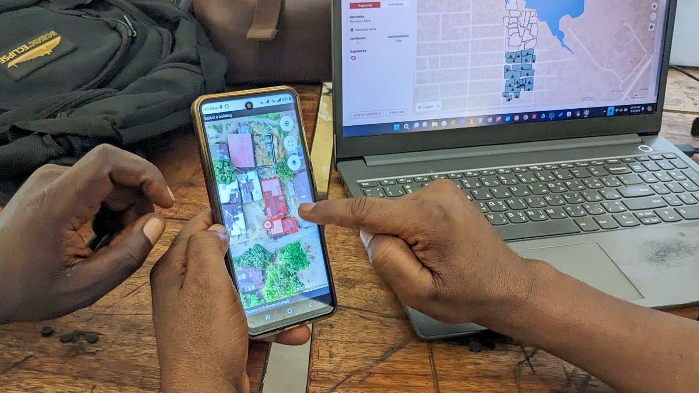
Using the Field-TM, each mapper using ODK Collect on their mobile device can select—or be assigned—a single area at a time to map, with a specific set of features (such as buildings) to visit. They can easily see where they must go and which features they must visit to complete their “tasked” area. Since each task area is specifically defined by a boundary and/or a set of features, it’s easy to avoid missed areas or duplication (whereby more than one person visits the same structure).
Links
Recent News

"Stop the doom scrolling and map the world!": Howden Foundation's CEO recounts mapathon experience
"Stop the doom scrolling and map the world!": Howden Foundation's CEO recounts mapathon experience
