Water Access in Rural Niger (Ruwa)

The "RUWA Niger" project was initiated to map the water resources in Fakara and N'Gonga communes located in the Dosso region of Niger. The project aimed to provide evidence-based information regarding the conditions of existing water sources to the residents of these communes. This knowledge has helped local authorities make informed decisions regarding developing new safe and high-quality drinking water. By mapping water sources based on the elevation model and water quality, the communes have access to adequate and reliable data, which was a significant hurdle for humanitarian and response efforts in constructing water points. With the data and analysis at hand, local authorities can now easily determine where, when, and how to build sustainable water points in the region.
Objective
The Ruwa (Hausa word for water) project aimed to assess the availability of drinking water in the Fakara and N’Gonga communes of the Dosso region. These two communes were chosen based on their different locations. Fakara, which means plateau in the local dialect, is located in an elevated area. At the same time, N’Gonga is primarily situated in the fossil valley of Bosso Dallols in the Boboye department of the Dosso region. The RUWA project had the following objectives:
- To improve water access in the region, we will conduct an inventory of all water sources and related infrastructure in the project areas.
- Strengthen the relationship between the local OpenStreetMap (OSM) community and decision-makers in the government, private, and humanitarian sectors.
- Establish partnerships with key stakeholders to implement practical interventions based on the project’s findings and recommendations.
- To provide reliable and precise datasets and map products to relevant stakeholders based on their data requirements and use cases.
- Map the population and settlements of Fakara and N’Gonga in OpenStreetMap to support the development and humanitarian initiatives.
- Strengthen the capacity of the national and local authorities in open data and mapping tools.

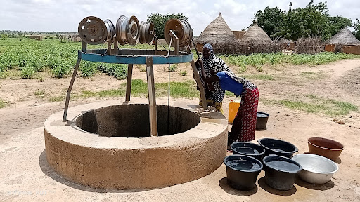
Drinking water well in N’Gonga
During the initial stages of the project, several vital parties were involved in the implementation process. These parties included the Ministry of Water Resources, National WASH Consortium, Local Water Plan and Sanitation (PLEA), Municipal Development Plan (PDC), WaterAid Niger, and city mayors from Fakara and N’Gonga. They contributed to the project by reviewing documents, creating data models, verifying data accuracy to meet their specific needs, and filling in any missing information.
The project conducted data collection campaigns in both communes to obtain information about solid waste management, cemeteries, markets, education facilities, religious centers, waterways, road networks, and water sources. Remote mapping was followed by field data collection, mapping all water points, and collecting amenities of other features of interest.
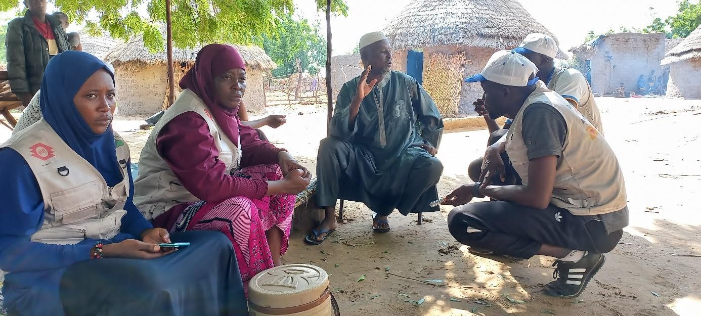
A team was formed to gather field data in the Boboye department. The team consisted of members from youth and women groups who were carefully selected and trained for this task. The fieldwork lasted over three weeks, during the rainy season, and faced several challenges. These challenges included difficulties in accessing townships due to bad road conditions.
Approach
What methodologies did we use?
- Stakeholders mapping, engagements, and Workshops
- Remote mapping and field data collection
- Capacity building of technical stakeholders and local community youth What tools were used:
- Tasking Manager - was used for remote mapping activity
- Central Server - ODK Central server was used to authenticate store data
- JOSM- was used for data cleaning and validation
- Quantum GIS - QGIS was used for data analysis and visualization
- Open DataKit - was used for field data collection What datasets were collected:
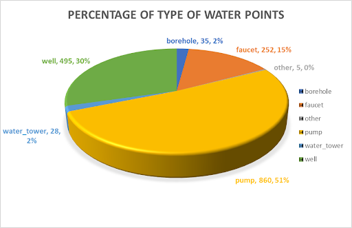
- Water points (boreholes, faucets, pump, water tower, and wells)
- Buildings
- Place names
- Roads and waterways
- Infrastructure ( education, religious facilities, up
Outcome and Impact
A total of 1647 water points, 46 locality names, 22,000 buildings, 3,000 km of primary and secondary roads, 700 kilometers of waterways, nine waste disposal sites, 137 cemeteries, 67 educational facilities, nine markets, 141 religious facilities, and 175 toilets were mapped and added to the OpenStreetMap geospatial database.
Three training sessions were conducted, one for the project’s core team and two in Niamey and the Dosso region for technical stakeholders.


Lessons Learned and Next Steps
Dosso is one of the regions facing a water crisis. Replicating this project in other regions can significantly help address the challenges of accessing safe drinking water in the Sahel regions of Niger.
The success of this project was mainly due to the involvement of the local community from the beginning. Crucial factors for achieving success include planning, executing, and communicating promptly. All stakeholders took on some form of responsibility for the project and supported every aspect of its implementation. Additionally, the project prioritized localization by emphasizing training and involving the youth and other crucial stakeholders as implementation team members.
This approach is vital for every project. When the project is based on community needs and involves community members and technical stakeholders in every phase, it leads to collaborative support and inclusion.

