Strengthening Open Data Processing and Mapping for Disaster Resilience - Mozambique
In partnership with Mozambique's National Disaster Management and Emergency Operations agencies, the Fundação para o Desenvolvimento da Comunidade (FDC) and with funding from the Bill & Melinda Gates Foundation, HOT's East and Southern Africa Hub will strenghten local geospatial data processing capabilities and engage in local participatory mapping in three priority districts, with the goal of enhancing disaster resilience and climate adaptation efforts in Mozambique.
The Need for Open Data in Disaster Resilience in Mozambique
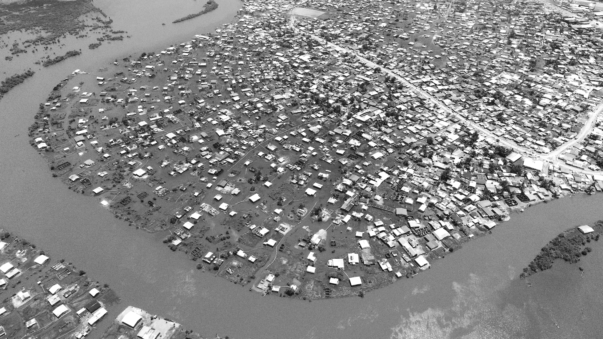
Mozambique, with its extensive coastline and nine major river basins, is highly vulnerable to climate-related disasters such as cyclones, floods, and droughts. These events pose significant risks to both populations and economic assets, making anticipatory action and disaster resilience planning critical. To address these challenges, the Government of Mozambique, through the Instituto Nacional de Gestão e Redução do Risco de Desastres (INGD), has partnered with several international NGOs to strengthen disaster management systems. A key gap, however, remains: the lack of up-to-date data on population locations and critical infrastructure.
Disaster management relies heavily on accurate, timely, and accessible data. In Mozambique, the absence of detailed geospatial data on vulnerable infrastructure, evacuation routes, and population exposure hinders effective preparedness and response. Open map data, particularly through platforms like OpenStreetMap (OSM), offers a solution. It is agile, participatory, and provides localized insights that are critical for decision-making. This is where the Humanitarian OpenStreetMap Team (HOT) steps in. Through a collaborative project with INGD and its National Center for Emergency Operations (CENOE), HOT, through its East and Southern Africa (ESA) Open Mapping Hub, aims to strengthen open data processing and mapping capabilities to enhance disaster resilience and climate adaptation efforts in Mozambique.
HOT’s partnership will focus on enhancing the ability of INGD and CENOE to collect, process, and analyze geospatial data to support disaster resilience and climate adaptation efforts by streamlining drone imagery processing workflows, and improving data collection systems. The project will also strengthen local stakeholders through participatory mapping and training on how to use open-source tools for geospatial data management, in partnership with Fundação para o Desenvolvimento da Comunidade (FDC).
A Roadmap for Resilience
The project will be implemented in two phases, each designed to build on the other for maximum impact.
Phase 1: Strengthening Open Data Processing Methodologies
The first phase focuses on improving INGD and CENOE’s data processing capabilities. HOT will work with these agencies to integrate satellite and street-level imagery, enhancing the accuracy, speed, and usability of open map data. This phase will also involve training government staff on open-source tools to collect, manage, and visualize geospatial data on OpenStreetMap.
Phase 2: Applying Methodologies to Priority Districts
The second phase will apply the methodologies developed in Phase 1 to map populations, key infrastructure, and critical services in the Buzi, Chokwe, and Mapai districts. These areas were selected based on their vulnerability to droughts and floods, the incompleteness of existing open map data, and population density.
In collaboration with FDC, HOT will train community members and local staff on participatory mapping techniques. This approach combines modern technology with local knowledge to identify vulnerabilities, evacuation routes, and safe resettlement sites.
The Road Ahead: Scaling for National Impact
This project represents a significant step forward in Mozambique’s disaster resilience efforts. By strengthening open data processing and mapping capabilities, it addresses critical gaps in preparedness and response. The participatory approach ensures that local communities are not just beneficiaries but active participants in the process.
The ultimate goal is to create a scalable model that can be replicated across Mozambique, empowering all 154 districts to better anticipate, prepare for, and respond to climate-related disasters. With the support of HOT, INGD, CENOE, and FDC, Mozambique is paving the way for a more resilient future.