OSM Buildings for Representation of IDPs in Somalia
Representative humanitarian needs assessments are crucial for effective humanitarian planning. In regions with high numbers of internally displaced people (IDPs), up-to-date maps enable humanitarians to identify vulnerable displaced populations for needs surveys. To support this effort, the Humanitarian OpenStreetMap Team is collaborating with partners to crowdsource updates to OSM building data in Somalia’s displacement-affected areas.
30,403
Total Buildings
55,117
Total Edits
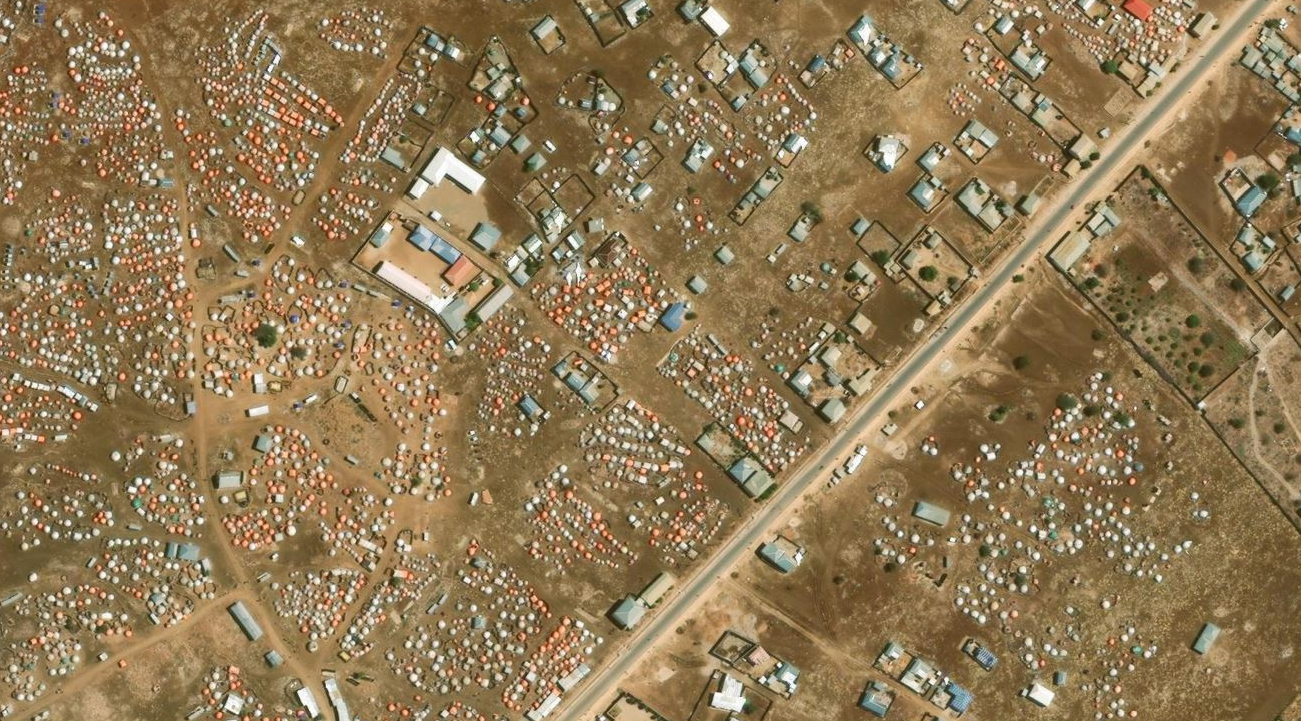
Representation of internally displaced people on a map
Humanitarian needs assessments guide resource allocation and strategic action to tackle today’s most pressing humanitarian challenges. Humanitarians use maps to plan representative surveys and engage with people on the ground about their basic needs. In areas with high displacement, keeping maps updated to reflect population shifts is challenging. Without knowing where internally displaced people are living, it becomes difficult to locate them and assess their humanitarian needs.
OpenStreetMap, as an open editable map and spatial database of the world, allows for collaborative editing to ensure areas of need are up to date on maps. Using open aerial imagery and a global volunteer force, HOT works with humanitarian partners to crowdsource mapping of all buildings in areas of displacement. Mapping all buildings enables a stronger understanding of population density and urban movement.
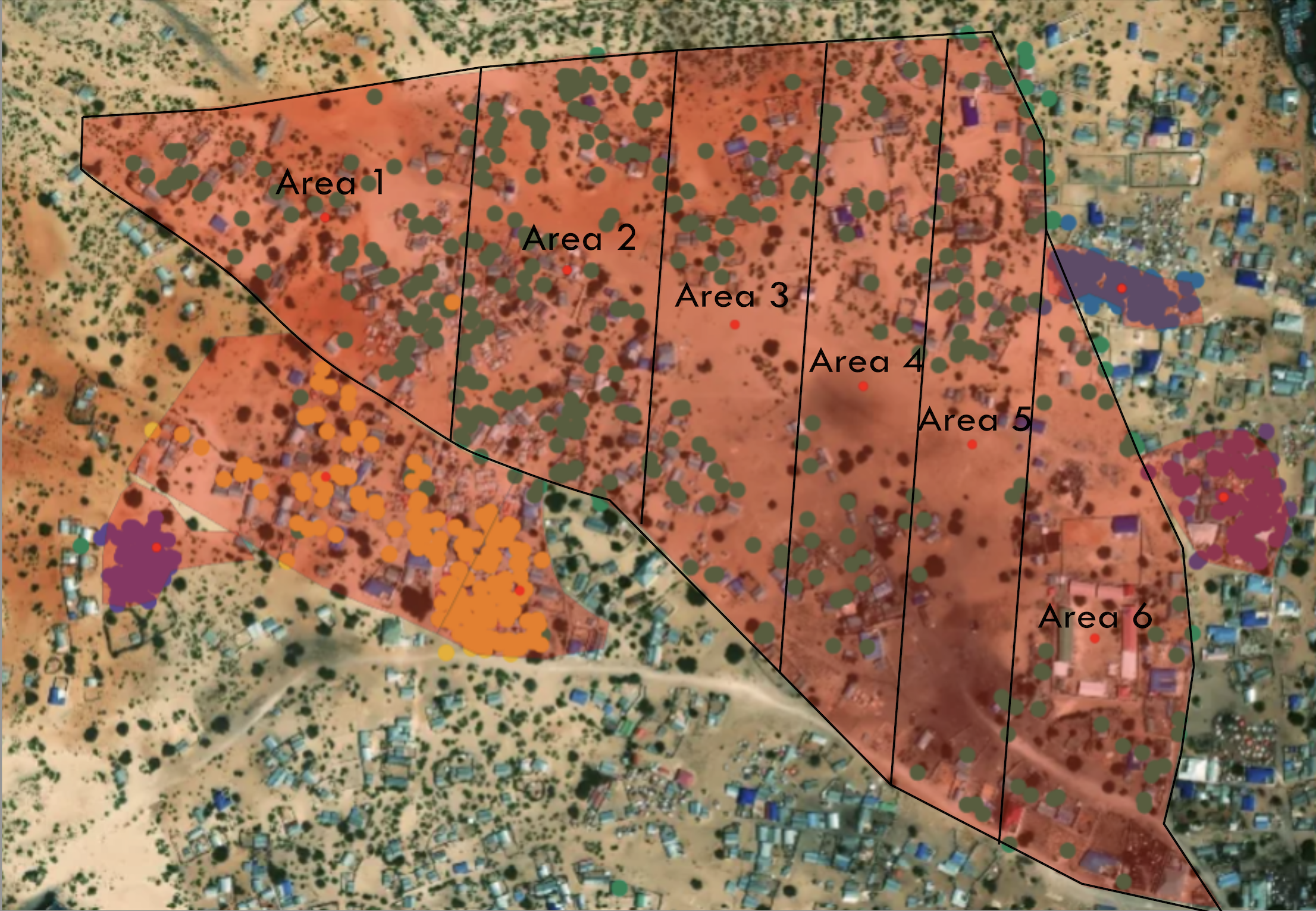
Crowdsourcing of buildings to identify location of populations
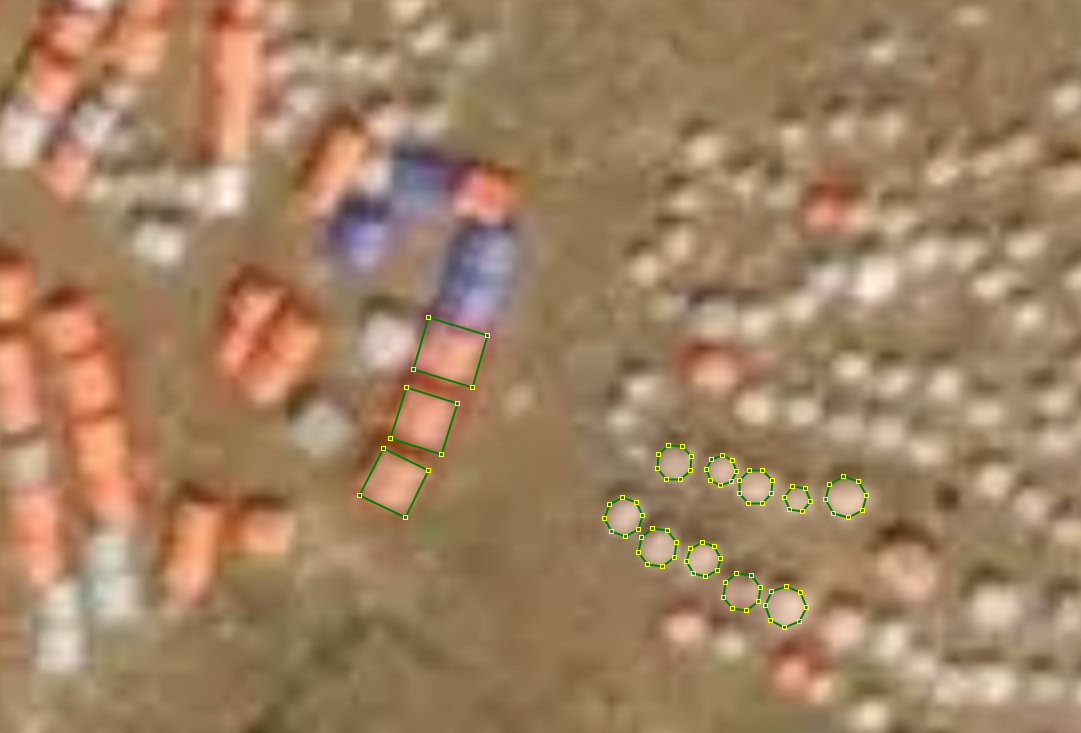
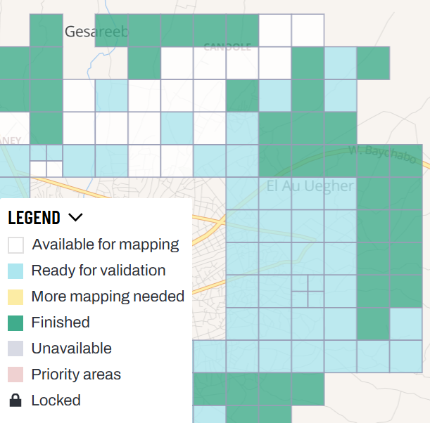
In order to create representative maps in preparation of humanitarian needs assessments, HOT worked with Ground Truth Solutions and IMPACT Initiatives to identify the location of areas they planned on conducting humanitarian need surveys. Using HOT’s Tasking Manager to coordinate, HOT’s Eastern and Southern Africa Open Mapping Hub and global volunteers are working to digitize all buildings in these areas of humanitarian need.
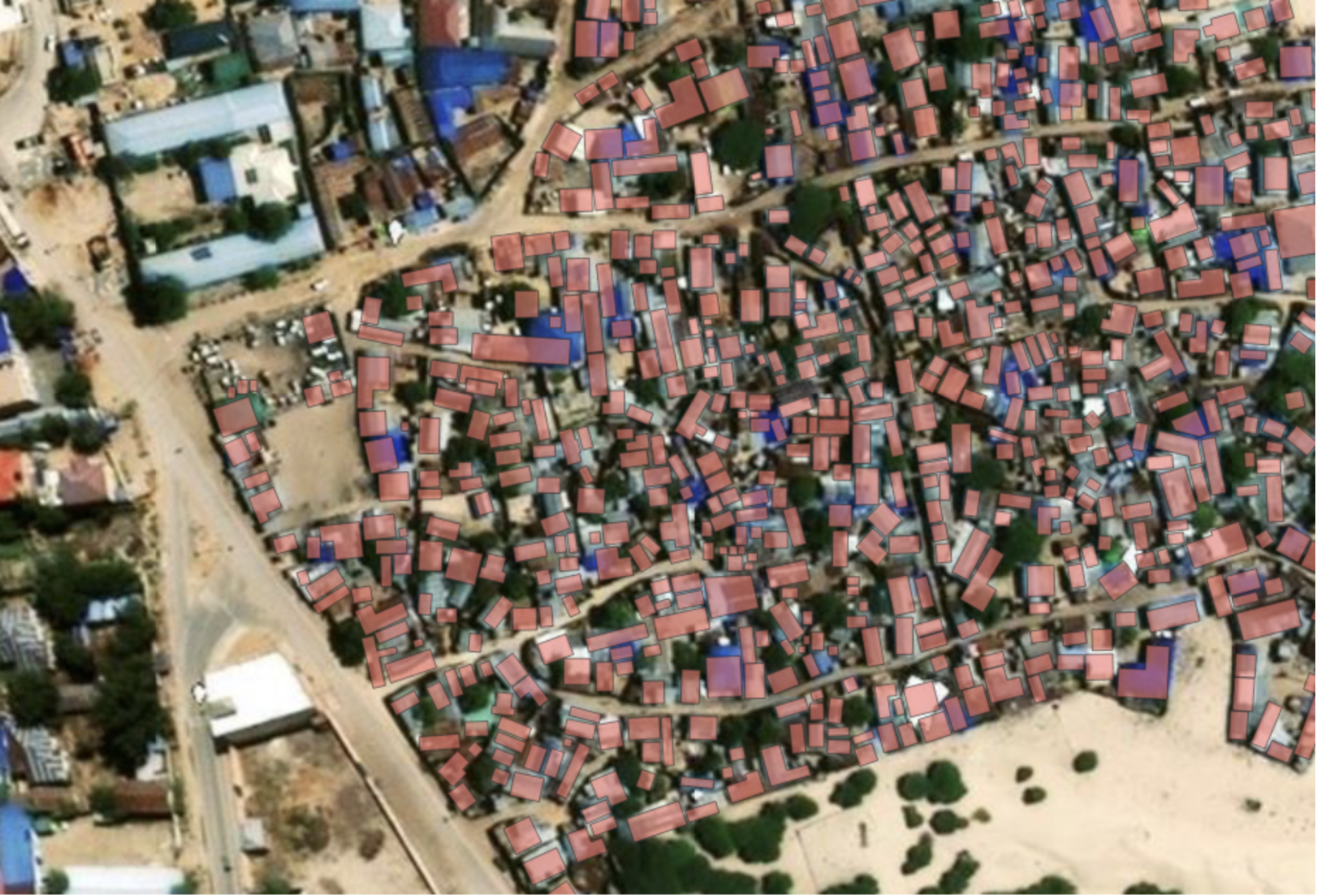
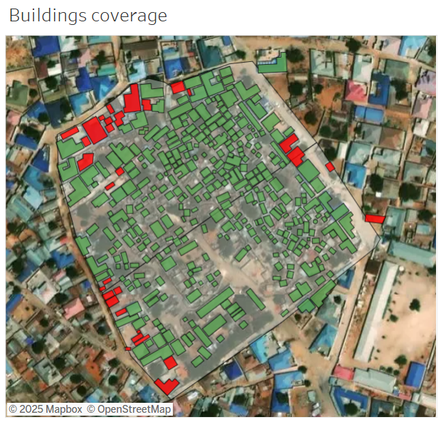
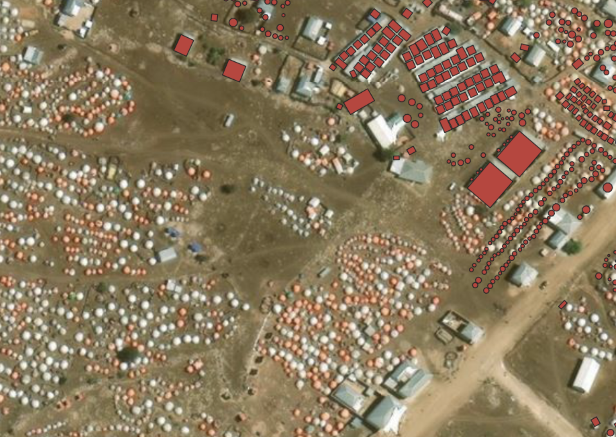
Example digitization of displaced areas in Somalia
More efficient and informed ground surveys
With an updated map of building footprints in OSM, Ground Truth Solutions (GTS) was able to better plan presence in the field by subdividing areas into approximately equal numbers of buildings.
GTS also used the data to track survey progress. They counted the number of completed household interviews and compared it with the estimated number of buildings to better assess the progress made by their survey team throughout the data collection process.
Finally, the updated OSM data provided quality assurance. During daily quality checks GTS visualized the GPS coordinates of the completed interviews and compared them with the mapped buildings. This allowed GTS to focus on areas which had not been targeted and ask for clarifications (e.g. whether that was a market area, public buildings area etc.).
Filling remaining gaps in Somalia
There is still work to be done in OSM in Somalia. Newly displaced arrivals are not represented in OSM and we are looking for volunteers to digitize new IDP shelters and buildings hosting displacement.
Are you interested in supporting our work? If you are an intermediate or above mapper in OSM, find projects to contribute to under the Somalia IDP campaign. If you would like to partner or donate to our work, contact info@hotosm.org.