Open Cities Africa - Accra City Project - Ghana

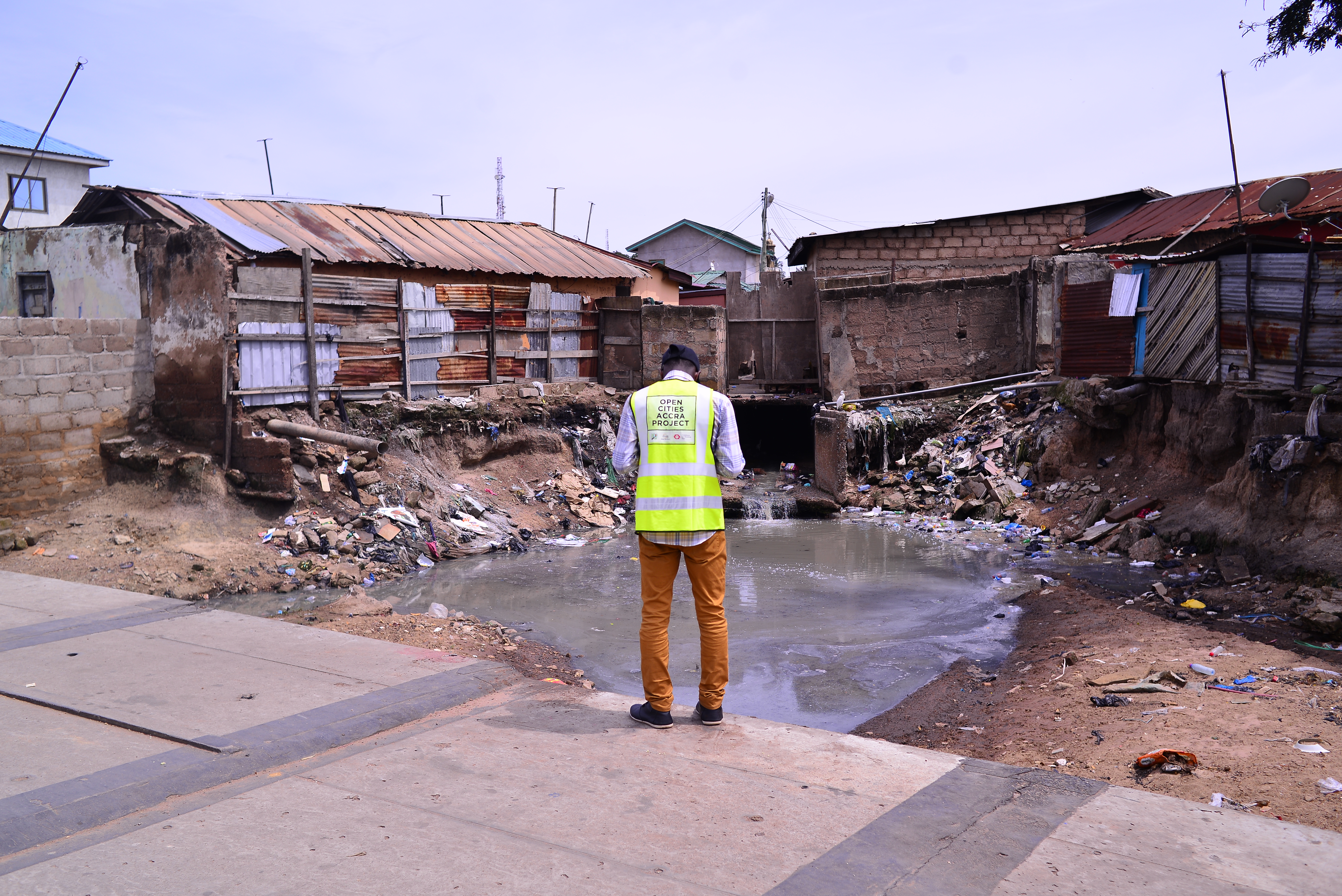
The Open Cities Africa, Accra project sought to make Alogboshie and its environs resilient to natural disasters, especially flooding.
The Open Cities Accra Project was led by Humanitarian OpenStreetMap Team (HOT) in partnership with Mobile Web Ghana and OSM Ghana. The OCA project was carried out in 11 cities across 10 countries in sub-saharan Africa: Accra, Antananarivo, Brazzaville, Kampala, Kinshasa, Monrovia, Ngaoundéré, Pointe-Noire, Saint-Louis, Seychelles and Zanzibar City. In June 2018, delegates from these various cities convened at the Makerere University, Kampala for the official Open Cities Africa kick-off and training event.
The Open Cities Africa, Accra project sought to make Alogboshie and its environs resilient to natural disasters, especially flooding. The project involved the remote mapping of Alogboshie, Akweteyman and Alajo. These are areas of focus in a larger resilience project, Greater Accra Resilience and Integrated Development (GARID), and are all located along the Odaw River which is prone to floods. Alogboshie is a community that is plagued by perennial flooding affecting its residents and those in neighboring communities. The area is usually flooded in the months of June and July during the peak times of the rainy season. The effect of the flood on human life in the community is huge. Often after floods, some community residents are displaced.
The OCA Accra project had the following objectives:
-
Create and/or collate and release open spatial data about the built environment, critical infrastructure, and natural hazards;
-
Develop targeted products and/or tools (e.g., visualization tools, atlas, map series, or mobile application) to assist key stakeholders to utilize risk information towards addressing natural disaster risk in the selected city;
-
Enhance the local capacity and institutional development necessary to support the design and implementation of evidence-driven urban resilience interventions; and
-
Promote peer mentorship and build regional networks across cities.
Data collected in Alogboshie and Akweteyman includes building footprints details (only Alogboshie), drainage networks, flood history, roads, water ways, water points, solid waste points, health facilities, educational facilities among others. The same data was collected in Akweteyman, except for building details.
Recent news from Open Cities Africa - Accra City Project - Ghana (View all news)
HOT Supporting the Greater Accra Resilient and Integrated Development Project to Protect Communities from Flooding
Flooding has plagued the Ghanaian capital of Accra for years, so HOT worked with Mobile Web Ghana and OpenStreetMap Ghana to develop data on local buildings, drainage, and infrastructure that communities and municipal authorities could use to make vulnerable neighborhoods more resilient.


