Mapping for Sherni River Museum Project
Through the Open-Mapping for Social Enterprises (OMSE) Project, HOT's Open Mapping Hub - Asia-Pacific is supporting social enterprises across the Asia-Pacific region in using open map data to improve their operations and decision-making processes. This project highlights our work with Tarun Bharat Sangh in Rajasthan, India.
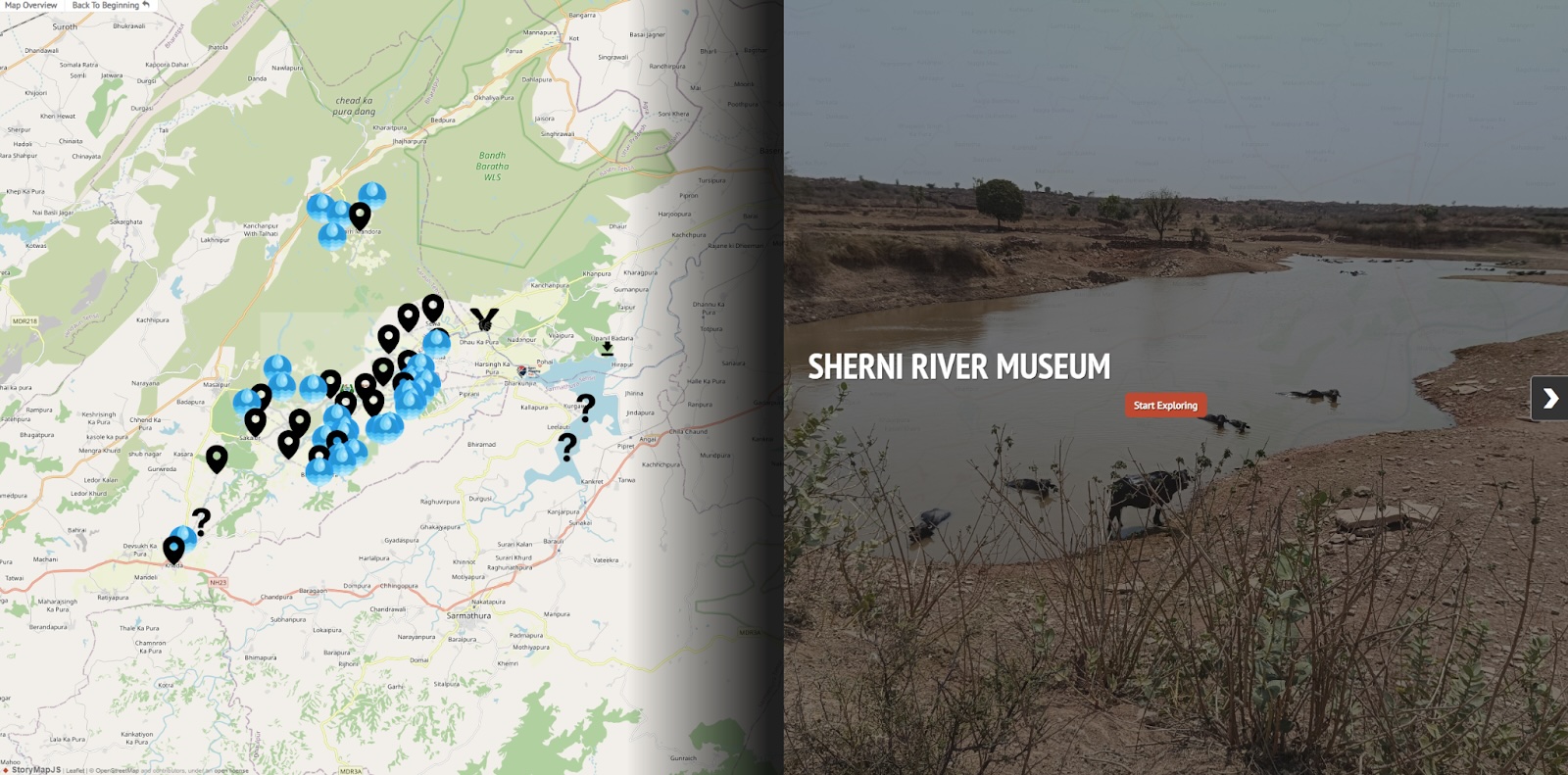
Since 2023, the environmental non-profit Tarun Bharat Sangh (TBS) and HOT’s Open Mapping Hub - Asia Pacific (AP Hub) collaborated with local communities on a pilot to use OpenStreetMap (OSM) to develop an open-source database of the Sherni River Basin, in Rajasthan, India. This “River Museum” aims to share information on the local rivers and to be accessible globally, with the goal to eventually scale it to include other rivers across the country as part of the River Mapping for River Museum project.
The Need for a River Museum
Rivers are important and complex ecosystems that contribute to our economic development, food security, and well-being, with nearly 2 billion people relying on rivers for their drinking water (UNEP, 2022). In India, many communities continue to rely on rivers for direct consumption and are intricately interconnected to them. However, rivers in India face high levels of pollution and have been found to be one of the world’s most polluted bodies of water, as documented by the political scientist Harry Blair (2023).
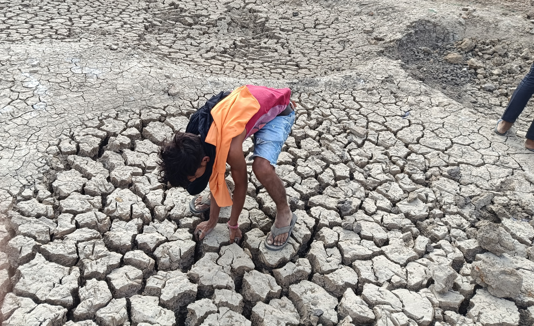
Today, many communities across India have lost interest in their rivers, taking for granted its benefits. One contributing factor, TBS asserts, is a lack of data on the rivers. Desk research on rivers across India only brings up superficial information on national and state-level rivers and insufficient information on smaller water bodies. Without data to illuminate the challenges faced by these rivers and their ongoing deterioration, communities are less inclined to actively participate in their conservation.
Thus, it is important to capture a longitudinal study of the rivers in India, i.e., to collect and analyze data on them over long periods of time. Unfortunately, data collection and analysis of these rivers today is fragmented and limited, and, while communities are best placed to contribute to and maintain the database, they lack the necessary skills to support this.
Mapping India’s Rivers: A Community-Driven Approach
Without representation on maps and local knowledge on its importance, these “invisible” rivers and their communities will be unable to garner support from the region and India to aid their conservation efforts. To overcome this challenge, the AP Hub and TBS co-designed and implemented the following workflow:
1. Remote Mapping & Validation
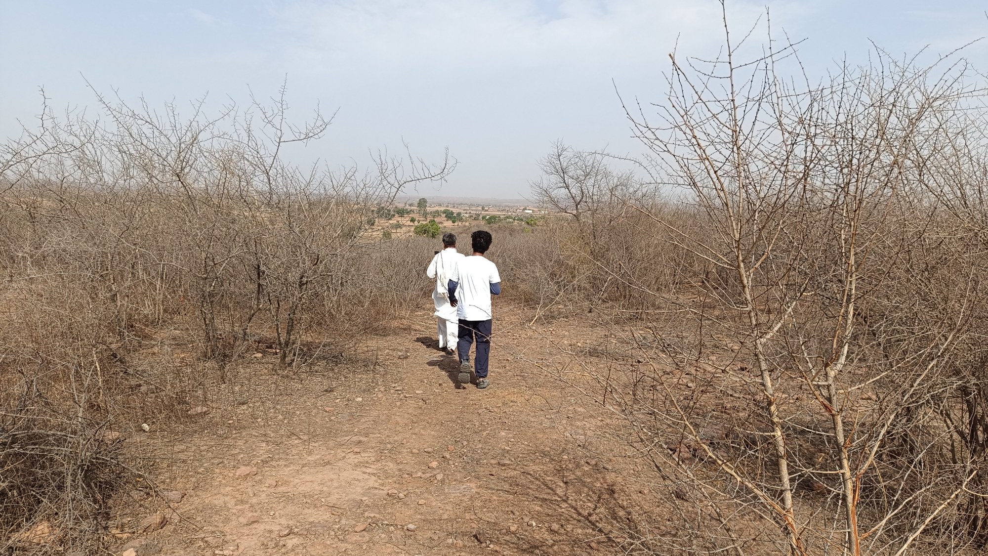
Remote mapping and validation campaigns were launched on the HOT Tasking Manager to map the areas of interest, including the Sherni River and its surrounding communities. We used TM to map buildings and water bodies, which were then validated in the field by two of AP Hub’s Open Mapping Gurus guided by our partner, TBS. The basemap served as a foundation to evaluate existing needs, gaps, and challenges with local stakeholders.
2. Co-creation Planning with TBS
The AP Hub held co-creation planning exercises with TBS to better understand the state of map data in the region, the vision TBS had for the River Museum, and the data TBS was interested in capturing. This included insights into the village’s history, water access, sanitation practices, agricultural activities, and cultural significance of water. With this information, they co-created a localized plan for open-mapping.
3. Field Mapping with TBS
Field mapping was conducted in partnership with the Gurus, who used OSMTracker for Android to map critical lifeline facilities and Mapillary for collecting street-level images. The field plan was designed by TBS, and while using FMTM could have helped organize the collection, time constraints made training for the Gurus difficult. After the field data collection, the Gurus mapped public facilities to OSM while the AP Hub validated their uploads. This project provided exposure to local stakeholders on how they can collaborate with the Gurus to develop local open mapping initiatives. The mapping efforts highlighted key features such as*:
- Buildings: Download mapped buildings
- Schools: Download mapped schools
- Places of Worship: Download mapped places of worship
- Water Points and Water Bodies: Download mapped water points
4. Use Case Discussion and Handover Workshop
The AP Hub held a workshop to discuss possible use cases for the OSM data acquired and the River Museum with TBS. We began building the narrative of the story map from the collected geospatial data and qualitative data from village FGDs, utilizing QGIS for accessibility analysis. The updated OSM data, which reflects the village’s agricultural practices, water access points, and cultural practices surrounding water, were symbolically handed over to the local stakeholders. This collaborative effort aims to enhance the community’s ability to advocate for their conservation needs and improve overall prosperity.

Creating a River Museum
This pilot project focused on improving existing data of local water bodies and settlements in the region. Through the project, the region saw 5.7 K buildings mapped in OSM (from none mapped previously) and a 419% increase in water bodies, through the mapping and validation efforts led by the AP Hub (see graphs below).
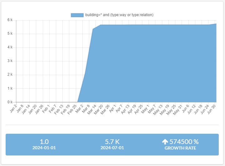
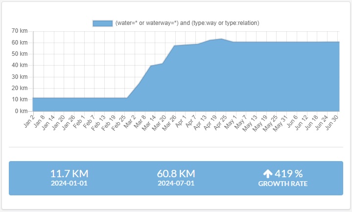
In the long term, it is expected that the mapped and validated data will serve as key base maps that can support the local communities in monitoring the health of the rivers and the impact of river conservation efforts. In the short term, the data will help convey key geo-coded information on these water bodies and support TBS in advocating the importance of protecting these previously uncharted water bodies to stakeholders across India.
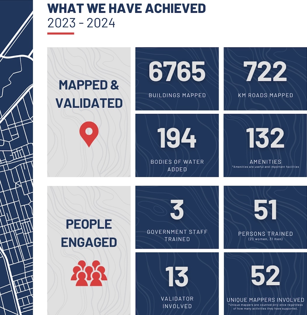
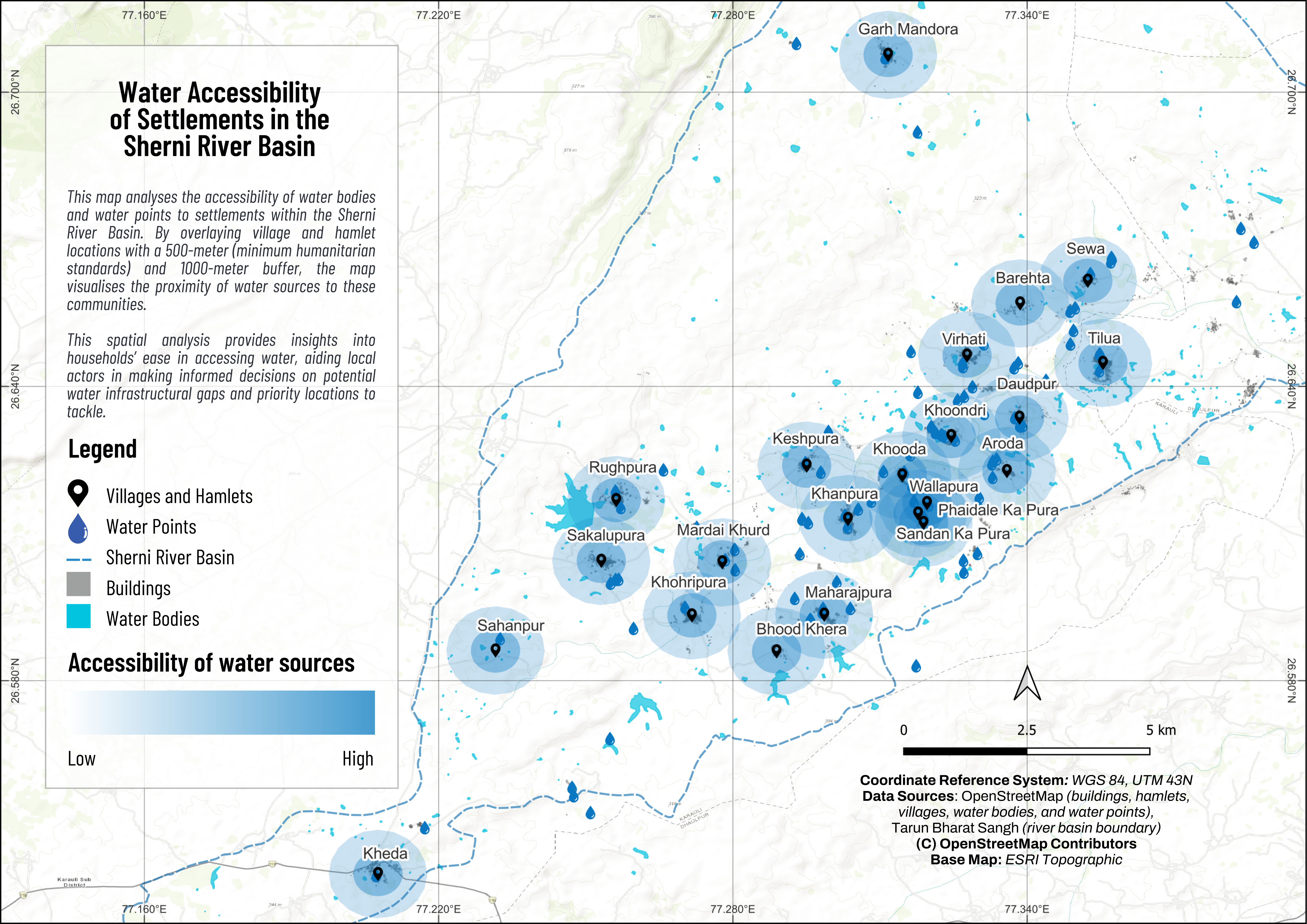
Additionally, in the short term, TBS is able to leverage the insights developed by AP Hub with the data on the accessibility of the water retaining structures in the Sherni River Basin (see fig. below). The insights will help TBS inform its decision-making processes by assessing the impact of its interventions and identifying priority areas to develop its next retaining structure.
The Sherni River Museum will also be an important resource for TBS to convey local knowledge of the water bodies, such as cultural practices and history, and share it extensively with external stakeholders (e.g., the national government) and galvanize action.
Media
Youtube - Reviving the Rivers: A Community-Powered River Museum
Storymap - Sherni River Museum
Data Usage*:
Please use this data responsibly and ethically. Proper citation of the OpenStreetMap Contributors is required when using this data for publications or presentations.
Disclaimer:
While we strive to ensure data accuracy, we cannot guarantee its completeness or error-free nature. Users are responsible for verifying the data before use.
For any questions or issues, please contact us at openmappinghub.ap.hotosm.org.

