Analyzing and Improving OpenStreetMap Data for Anticipatory Action in the Humanitarian System
“Is an OpenStreetMap dataset good enough to use?” is a question we often get, and we’d like to answer it better and more quickly. Understanding the strengths of open spatial data sources is critical when preparing maps for a crisis response. As part of H2H’s Anticipatory Action Accelerator, HOT is working to develop more data insights through data completeness statistics. Our aim is to provide more transparency on the usability of OpenStreetMap (OSM) data and other open spatial datasets.
Background
Like many who work in humanitarian response, there is increased awareness at HOT of the need to be more targeted in our activities to prepare for a disaster before it hits. Our landmark and active volunteer-led disaster response program has grown since its inception in 2010, and with the greater OSM community, OSM data is now widely available for use in disaster response and preparedness.
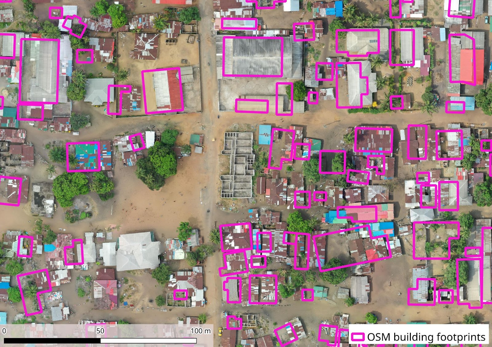
With all this open spatial data, it can be hard for a user to know what source is the best for their intended use case. In this project, HOT is developing resources to support data users in preparing better before a crisis hits. This includes making OSM data more usable in a humanitarian context and providing easy access to OSM data insights to better understand data “completeness,” which by the Humanitarian Data Exchange’s standards means that a dataset 1) is in a readable format, 2) covers the whole country and 3) follows an update cycle.
Through consultation with humanitarian partners, we are starting this work focusing on roads and populated places, as both datasets are critical to planning immediate aid response in a crisis. For example, creating isochrone maps will allow first responders to visualize areas accessible from key points within specific time thresholds, helping aid organizations assess medium distances to essential services and improve the efficiency of their response efforts. HOT enables access to OSM through both the Humanitarian Data Exchange (HDX, pre-defined exports) and HOT’s Export Tool (custom exports). All resources developed – such as enhanced metadata, and a dashboard that allows comparing different datasets – are intended to enhance the user experience of both platforms.
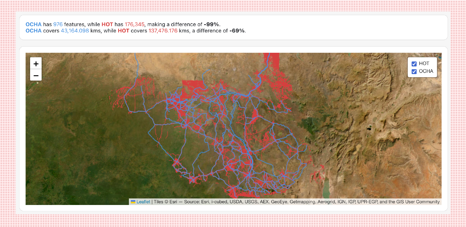 H2H dashboard showing comparison between OSM and OCHA datasets for Roads in South Sudan
Planned project activities
To make OSM data more useful for anticipatory action, HOT intends to standardize information for OSM exports from HOT’s Export Tool and HDX by: adding humanitarian unique identifiers (OCHA p-codes) for all admin levels to OSM data on populated places, pilot if it’s possible to parse place names in OSM based on transliterations and including additional statistics on spatial and attribute data completeness to the metadata.
Moreover, we aim to create a data statistics visualizer to better understand spatial coverage and attribute completeness before downloading an OSM dataset. Finally, we will create sample data quality reports based on roads and populated places to inform data improvement priorities and direct future inquiries on OSM completeness analyses.
Next steps and how to get involved
Besides informing potential data use, we intended to use these data quality statistics to inform data improvement priorities.
After fulfilling this project’s scope, we intend to expand this work to all datasets listed in HDX’s Data Grids, depending on available resources, so stay tuned.
Are you a user of OSM datasets and have any feedback? Contact us at data@hotosm.org to partner, volunteer, or donate to ongoing efforts in data accessibility, insights, transparency, and usability.
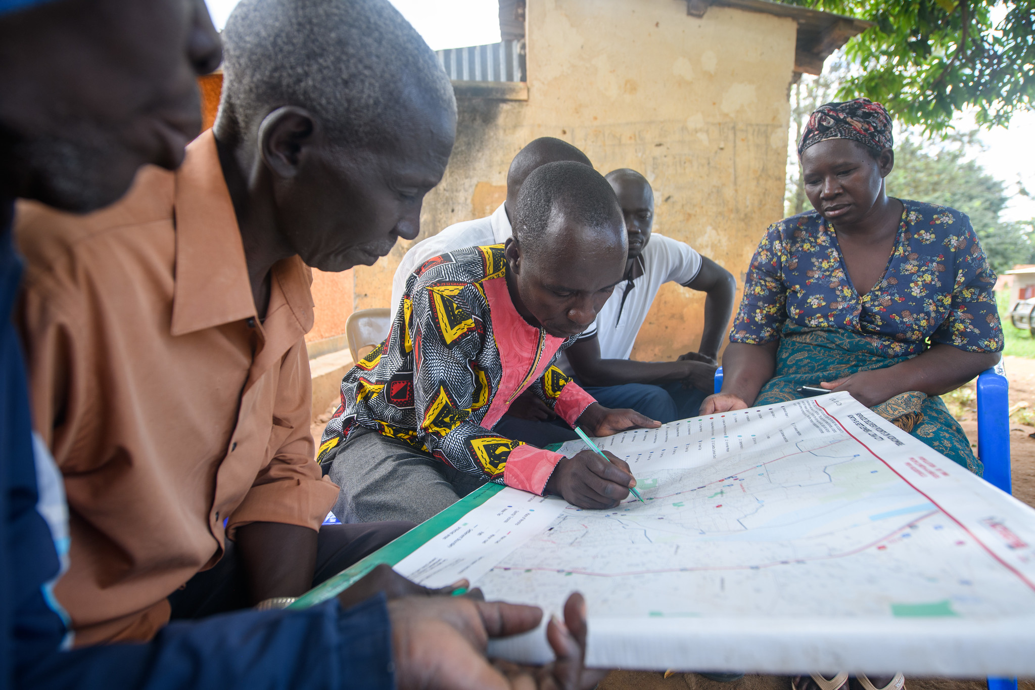
Cover Photo: Mapping in the Newly Formed Cities in Northern Uganda, HOTOSM
Recent news from Analyzing and Improving OpenStreetMap Data for Anticipatory Action in the Humanitarian System (View all news)
Will OpenStreetMap meet your needs? HOT’s move towards more data insights
In the spirit of FAIR data (findable, accessible, interoperable, and reusable) and with support from the H2H Network, HOT is improving the reusability of OpenStreetMap (OSM) data through improved metadata of its datasets.