
Juan Melo Luna
StaffSenior Associate, Data Quality - Latin America and Caribbean Hub
Bio
I’m a Civil engineer with experience in geographical information management and web geo services. I have worked with native communities in my country Colombia. I really like to teach; I’ve been a teacher for more than five years. I’ve been working with OSM data as a user and editor for some years.
Posts
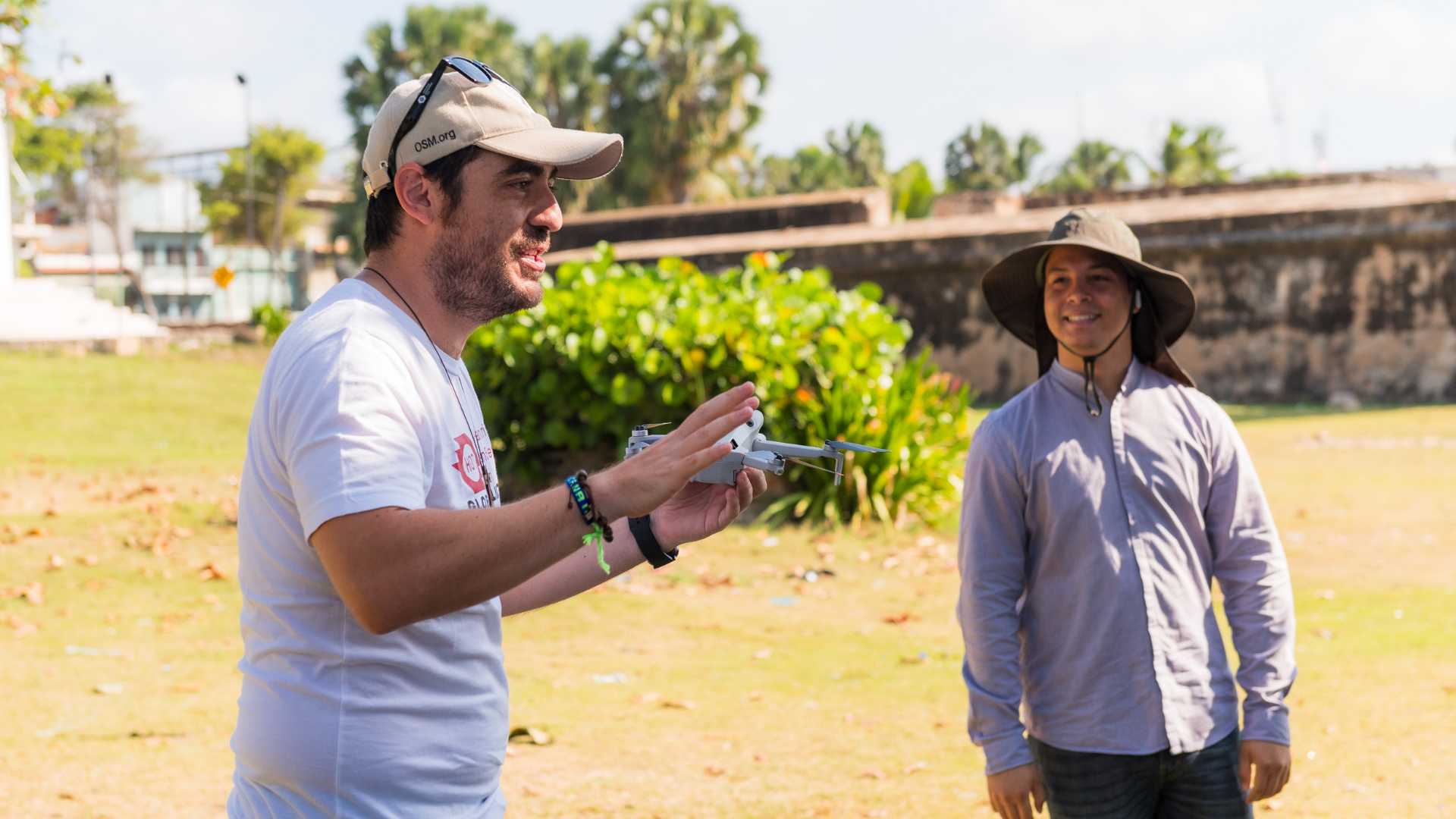
Sargassum Monitoring with Drones in Santo Domingo: Open Technologies to Tackle Environmental Challenges
HOT, together with the Global Partnership for Sustainable Development Data and the National Statistics Office of the Dominican Republic, organized a regional workshop on sargassum monitoring. The training focused on the use of drones and open technologies for generating geospatial data. Participants included representatives from civil society, academia, and public institutions. This experience strengthens Caribbean collaboration in the face of growing environmental challenges.
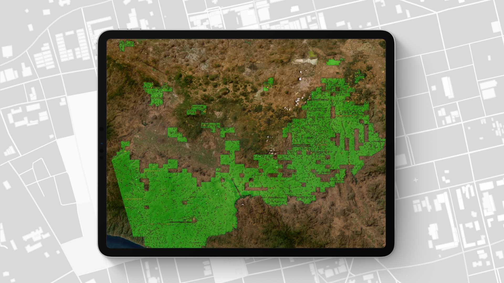
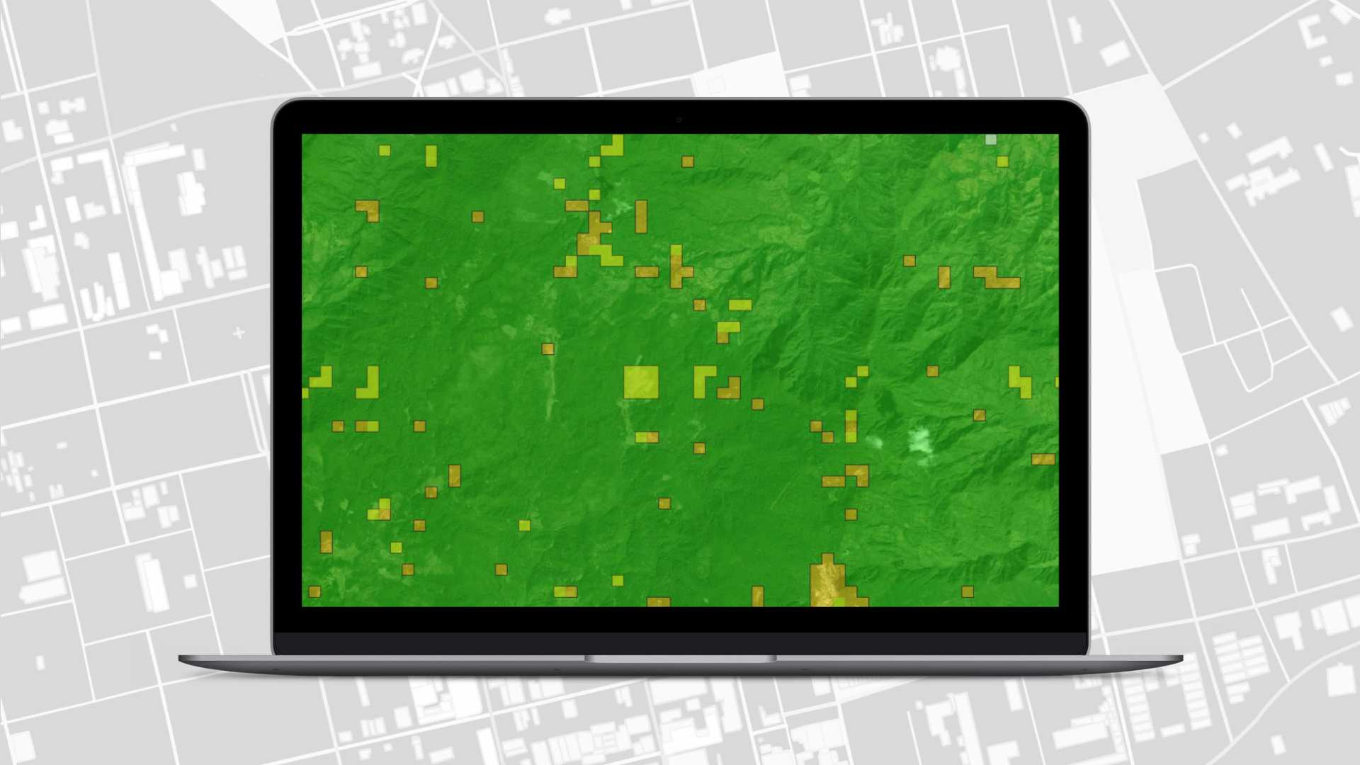
Innovando con MapSwipe: ciencia ciudadana para clasificar coberturas naturales
Un proyecto piloto que involucró a CONABIO y la Iniciativa Climática Mexicana junto a HOT explora el uso de MapSwipe para identificar coberturas naturales del suelo, mostrando su potencial para la ciencia ciudadana y el monitoreo participativo ambiental.
Monitoreo de sargazo con drones en Santo Domingo: tecnologías abiertas para enfrentar desafíos ambientales
HOT, junto al Global Partnership for Sustainable Development Data y la Oficina Nacional de Estadística de República Dominicana, impulsó un taller regional sobre el monitoreo del sargazo. La capacitación se enfocó en el uso de drones y tecnologías abiertas para la generación de datos geoespaciales. Participaron representantes de la sociedad civil, academia e instituciones públicas. Esta experiencia refuerza la colaboración caribeña ante desafíos ambientales crecientes.

Innovating with MapSwipe: Citizen Science to Classify Natural Land Cover
A pilot project involving CONABIO, the Mexican Climate Initiative, and HOT explores the use of MapSwipe to identify natural land cover, showcasing its potential for citizen science and participatory environmental monitoring.
Mapeo Comunitario en el Resguardo Indígena Andoke de Aduche en la Amazonía Colombiana
Mapeo comunitario en Araracuara fortalece la gestión territorial del pueblo Andoque mediante el uso de drones, OpenStreetMap y SIG. La iniciativa combina conocimientos ancestrales y tecnología para documentar y proteger su territorio frente a la deforestación y el cambio climático.

Community Mapping in the Andoke Indigenous Reserve of Aduche in the Colombian Amazon
Community Mapping in Araracuara Strengthens the Andoque People’s Territorial Management Using Drones, OpenStreetMap, and GIS. The initiative combines ancestral knowledge and technology to document and protect their territory against deforestation and climate change.
Mapping as a response to the disaster in Esmeraldas, Ecuador
The LAC Open Mapping Hub supported the response efforts to the disaster caused by the floods in Esmeraldas, Ecuador in coordination with the Ecuadorian Risk Management Secretariat.

El mapeo como respuesta al desastre en Esmeraldas, Ecuador
El Hub de Mapeo Abierto LAC apoyó en las labores de respuesta al desastre provocado por las inundaciones en Esmeraldas, Ecuador en coordinación con la Secretaria de Gestión de Riesgos de Ecuador.