From Maps to Action: Strengthening Volcanic Disaster Preparedness Around Mount Agung
Posted by Tony Liong, Dana De Guzman, Harry Mahardhika Machmud • Oct. 16, 2026
Understanding the Context
Mount Agung in Karangasem, Bali, is one of Indonesia’s active volcanoes. It is also a sacred place deeply rooted in Balinese traditions and religious life, with many communities living around it and religious ceremonies taking place throughout the year. In 2017–2019, the volcanic activity at Mount Agung increased significantly, leading to several eruptions and prompting thousands of people to evacuate. Although volcanic activity and alert status have since returned to normal, preparedness remains essential.
Local disaster management agencies (BPBD Karangasem and BPBD Bali) have been leading evacuation planning and the installation of early warning systems, but there were gaps in up-to-date spatial data, technical capacity, and tools needed to produce usable maps for official contingency planning.
BPBD noted, existing maps were often static, difficult to update, and lacked detailed village-level information, such as evacuation routes, assembly or safe points, and critical infrastructure. This limited their usability during emergencies, especially for communities living closest to the volcano.
“Every volcano has its own characteristics,” explained I Wayan Pika Wiadnya (Pika), Disaster Analyst at BPBD Karangasem. “It is difficult to precisely predict or analyze when a volcano will erupt. Some volcanoes gradually progress through the four alert levels before erupting, while others can directly move from a lower alert level to an eruption. [That’s why] we need to anticipate.”
This led to the launch of the End-to-End Mapping Solution (E2E) Bali project.
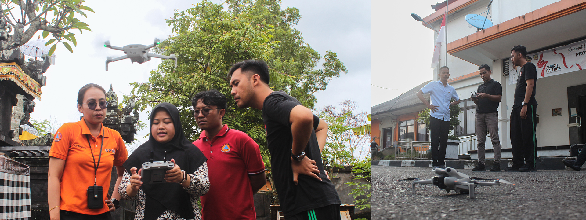
BPBD Karangasem staff participate in hands-on training on HOT’s E2E tools, facilitated in the local language by Open Mapping Gurus and the AP Hub team | Photo: Tony Liong / Open Mapping Hub - Asia-Pacific
Our Approach in Action
Implemented in 2025, the E2E Bali project focused on strengthening local capacity to independently collect, analyze, and use geospatial data for volcano-related disaster preparedness around Mount Agung. This was achieved through training, and mapping with BPBD and local communities.
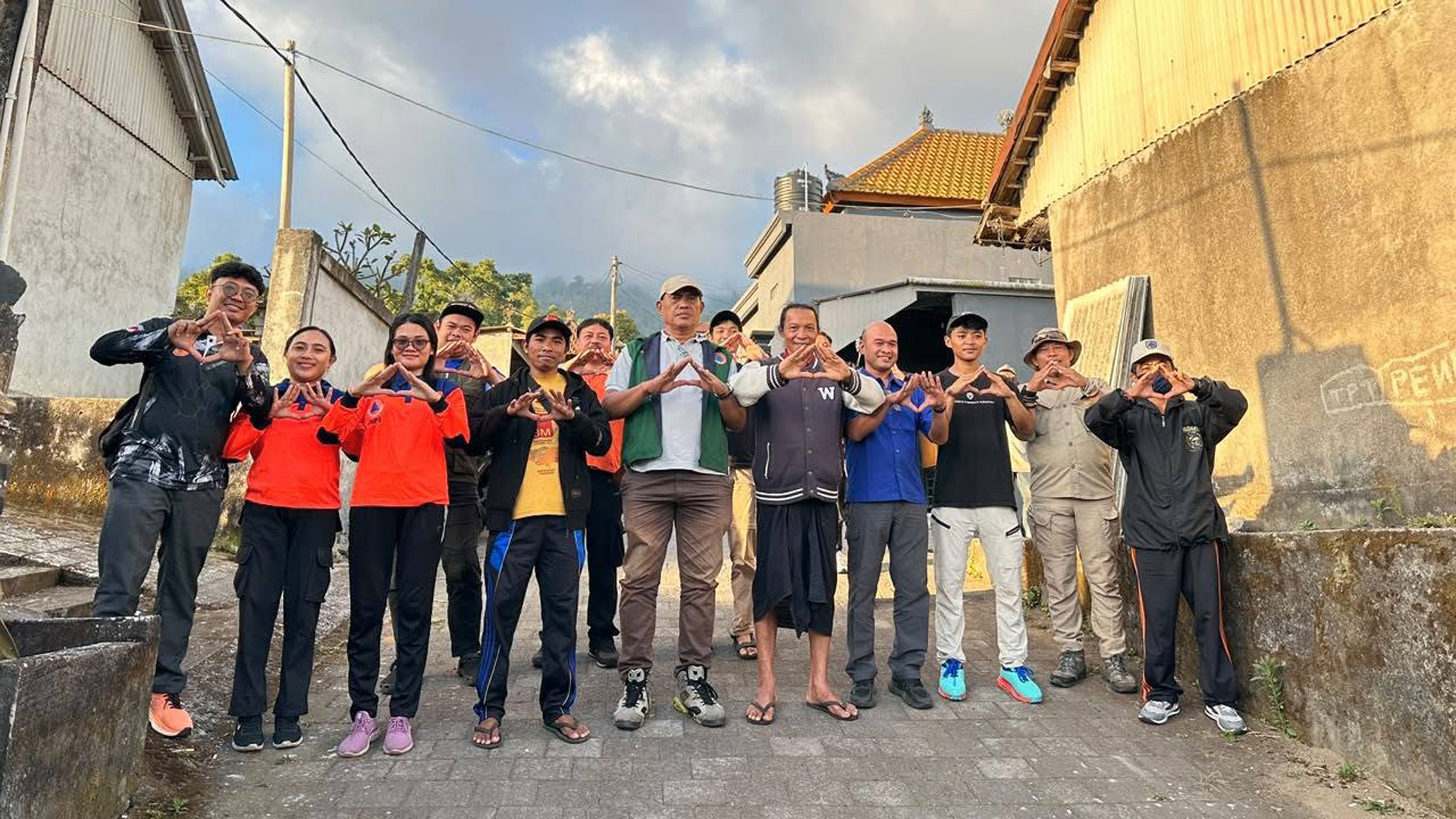
The initiative was implemented through close collaboration between HOT, HOT's Open Mapping Hub - Asia-Pacific (AP Hub), BPBD Karangasem, BPBD Bali, and local communities.
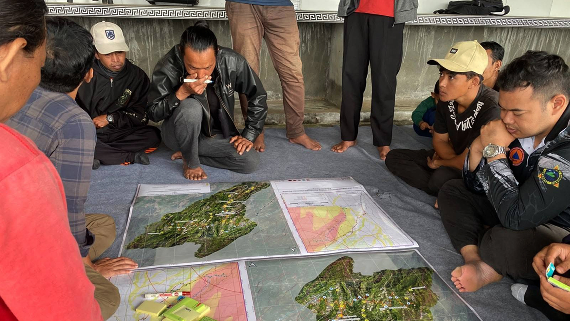
Covering five villages, BPBD and community members were trained to collect data on evacuation routes, critical infrastructure, and safe points using ChatMap. Collected data was then visualized directly on maps and integrated into uMap for interactive, dynamic exploration.
Focusing on Ban Village, the BPBD team used the Drone Tasking Manager (DroneTM) to capture high-resolution aerial imagery that was then used to map the locations of existing early warning systems and analyze suitable locations for future systems installations. Imagery is also made publicly available via OpenAerialMap (OAM).
Making mapping more accessible also meant having local people with local knowledge guide the process.
"There are many criteria in determining a feature that should be mapped. The selection comes from discussions with local communities, including village officials. Temporary assembly points ideally have sufficient capacity, and we prioritize permanent buildings that meet earthquake-resistant standards. Local communities also [help identify] places that cannot be used as assembly points due to local rules or customary restrictions." – AA Ngurah Gede Mahesmara (Ngurah), Emergency and Logistics Coordinator at BPBD Karangasem
The project resulted in over 1,000 village-level datasets on evacuation routes, safe points, critical infrastructure, and early warning system locations across high-risk areas around Mount Agung.
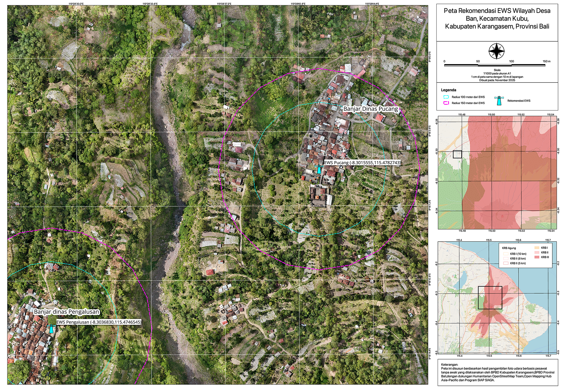
Map showing recommended potential locations for future early warning system installations in Ban Village, Karangasem. This map was created through collaboration between BPBD Karangasem and BPBD Bali, with support from HOT, AP Hub, and the SIAP SIAGA Program.
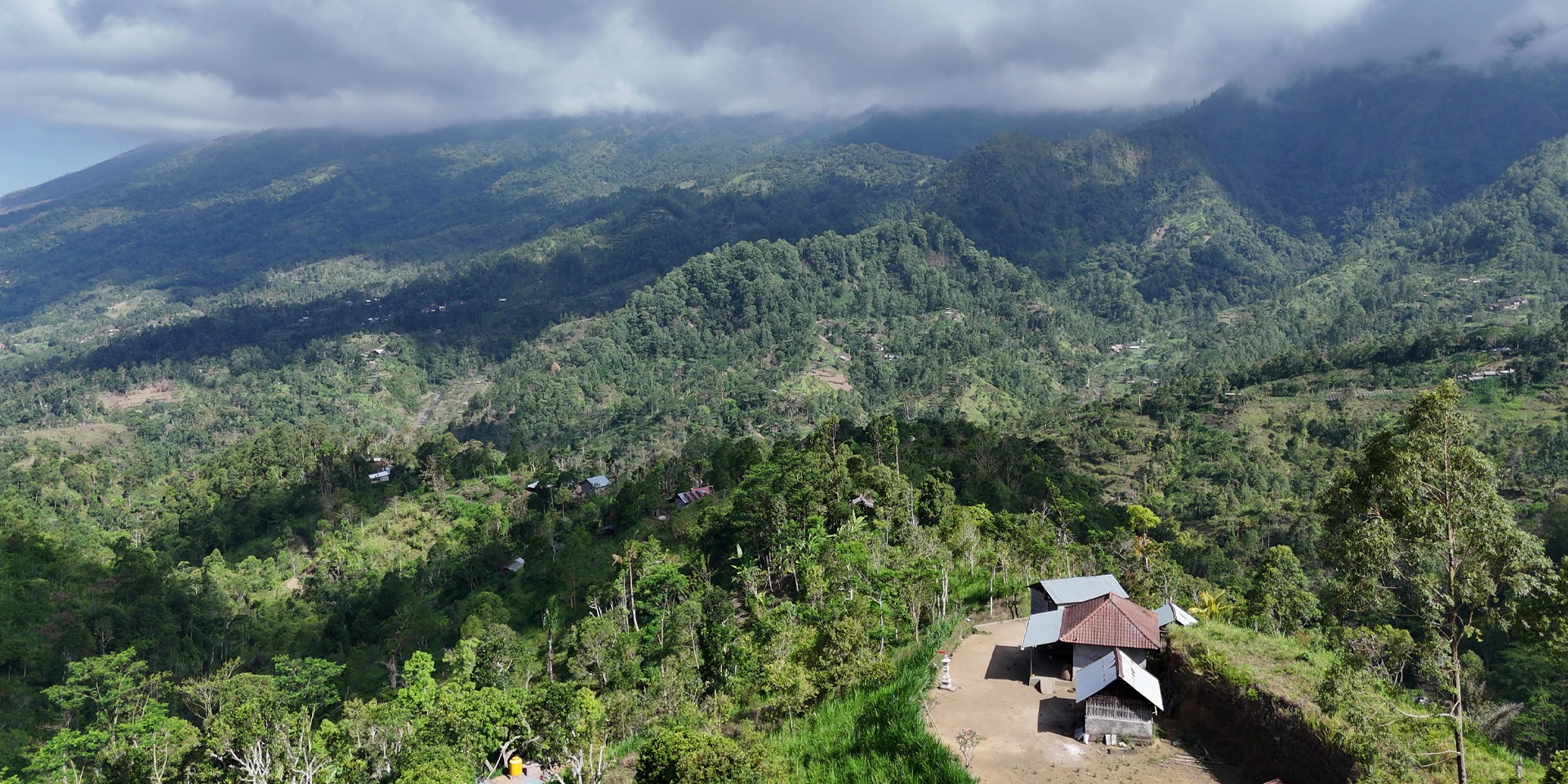
Aerial view of Ban Village in Mount Agung, with hamlets and communities spread across its green volcanic landscape | Photo: Rizky Hadwiyanti
Outcomes & Impact on People and Communities
Reflecting on the entire field mapping experience, Pika highlighted how HOT’s E2E tools had really sped up their work:
"Previously, with satellite data or the data that we collected, the process took a long time and the results were not up-to-date. Now, we can obtain data and map information that is actual and real – on the same day, at the exact second when we collect them."
BPBD Bali and Karangasem used the datasets to produce and integrate official maps (ex. Evacuation Route Maps, and proposed location for Early Warning Systems (EWS) Map) into the latest official Agung Volcano Contingency Plan, used at both the regional and provincial level.
"A contingency plan outlines the strategies for who will do what and with what resources in a specific disaster scenario," explained Pika. "The goal is: before an eruption happens, we have already evacuated the communities, starting with those who are considered part of vulnerable groups and the livestock."
With the Early Warning System Map, BPBD Karangasem was better able to identify sites in high-risk zones. This would support informed planning for future EWS installations and improve safety for more villages.
"EWS is very important for my villagers, because recently, during disasters such as earthquakes, they were able to know in advance and prepare. So far, there is only one EWS unit that has been facilitated by BPBD Karangasem… Meanwhile, there are 15 hamlets located within the high-risk zones. I hope there can be more units, because evacuation routes for our villagers are extremely difficult." – I Gede Tamu S., Chief of Ban Village
With a well-developed contingency plan in place, should the risk of a volcanic eruption arise, communities will already have clearer guidance and directions on how and where to evacuate. This enables faster, more informed decisions during emergencies for a combined population of at least 43,000 people, with additional potential reach to surrounding villages involved in the coordinated evacuation efforts.
Printed and digital versions of the maps were then shared with village offices.
"With these maps, communities have a better understanding of the conditions in their area. The maps are easier to use as a guide for evacuation, or when evacuation drills are needed in their respective villages.
In Tulamben Village, the information dissemination has been very good. Even the tourists there already know about the digital evacuation route maps." – Pika
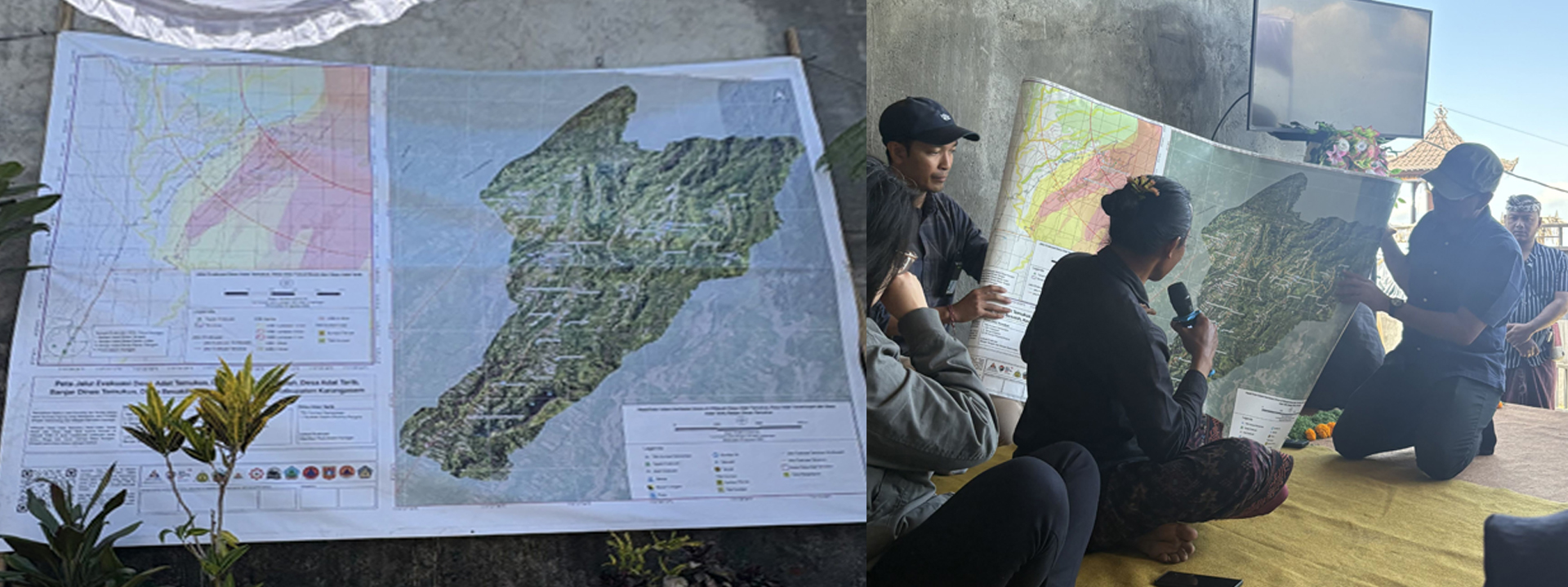
The village head of Temukus explains evacuation plans and routes using maps created with HOT’s E2E tools. Building on previous evacuation maps created for other villages, this newer map incorporates drone imagery to provide a more detailed view of the area. | Photo: Harry Mahardhika / Open Mapping Hub - Asia-Pacific
How Change Can Last
At its core, E2E Bali is not just about making maps. It’s about strengthening people’s capacity to make their own maps. Through the project, BPBD and community members gained skills and tools needed to independently keep the data updated and adapt the workflow to other areas and types of disaster risks.
Pika noted:
"Before, only those with specialized mapping skills could map an area. Even collecting geotagging data required people with specific mapping knowledge [and] GPS devices. Now, through the collaboration, knowledge sharing, and technology from HOT, people from across the community can contribute to mapping their areas."
Following the project’s conclusion, Pika co-founded "Garudeya Kemanusiaan Global" (GKG, or Garudeya Global Humanity). Since then, its network has expanded to include other disaster actors and communities across Bali. Through this broader network, GKG can advance drone technology and mapping for humanitarian needs in areas beyond Karangasem.
The work in Karangasem was recently replicated in Temukus Customary Village at Mount Agung and Sanur, Bali. In August 2026, BPBD Karangasem, together with the SIAP SIAGA Program and members of GKG, collaborated with the communities in Temukus to map evacuation routes. Apart from evacuating residents, the value of livestock evacuation was also highlighted.
The same year, HOT collaborated with BPBD Bali to map evacuation sites in Sanur, Bali, a coastal area vulnerable to tsunami. Through this activity, BPBD Bali integrated the up-to-date data into their Disaster Monitoring Dashboard that supports them in planning and monitoring disaster risk response.
While at national level, National Disaster Management Agency (BNPB) shared their interest to replicate HOT’s E2E Mapping methodology into capacity building program in other areas in Indonesia.
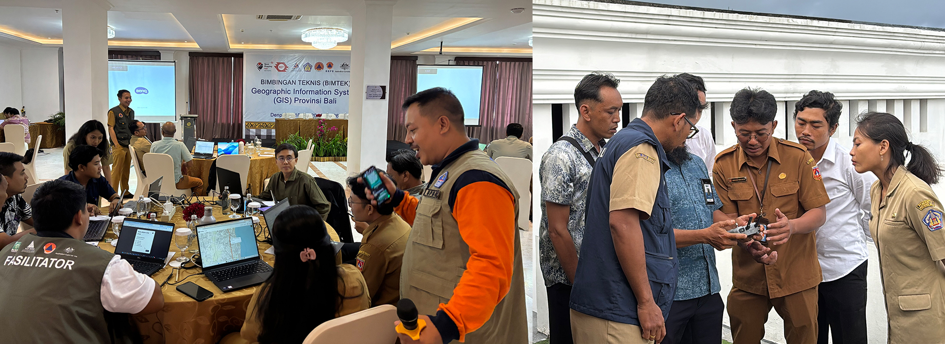
BPBD Karangasem facilitated sessions on HOT’s E2E tools during a provincial-level GIS training for disaster management agencies and other disaster actors across Bali (May 2026). | Photo: Diah Pramesti / SIAP SIAGA
Insight for the Future
As shown through BPBD Karangasem’s work with communities, especially most recently in Temukus, the journey that began with E2E Bali has demonstrated what is possible when local communities own the knowledge and tools to shape their own preparedness.
When asked about his hopes for the future, Pika’s answer remained much the same as back in 2025: that "the work we have implemented and the technology developed here in Karangasem can serve as an example for other places – not only in Bali or Indonesia, but around the world."
Thank you to I Wayan Pika Wiadnya and AA Ngurah Gede Mahesmara from BPBD Karangasem for sharing their insights, voices, and experiences through interviews that made this article possible.
Learn more about the project on this page, or read our latest blog and watch the documentary video below.
Share


Related Projects
Related News
Oct. 16, 2026
A Journey Beyond the Maps: Community-Led Volcanic Preparedness in Karangasem, Bali