Monitoring for Seagrass: Community Mapping for Coastal Conservation - Timor-Leste
Timor-Leste
Seagrass ecosystems along the Metinaro coastline in Timor-Leste are essential for sustaining local livelihoods and biodiversity. The Monitoring for Seagrass project works with local communities to map and monitor these ecosystems using open mapping tools and participatory approach, strengthening conservation and community stewardship.
Seagrass and Coastal Communities in Timor-Leste
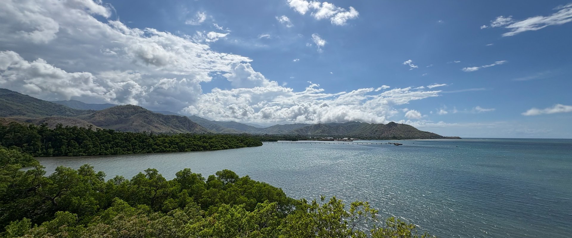
Along the Metinaro coastline in Dili, Timor-Leste, seagrass meadows play a vital role in supporting local food security, livelihoods, and biodiversity. Healthy seagrass meadows provide habitat for fish and other marine species that sustain and boost the local economy. They also protect endangered species such as dugongs, serve as natural barriers against coastal erosion, and help maintain clear waters so nearby coral reefs can flourish.
Monitoring these ecosystems is important to understand changes over time, identify threats early, and support informed management. Additionally, enhancing community awareness of the importance of seagrass and improving collaborative efforts to conserve it are equally essential.
Open Mapping for Seagrass Conservation
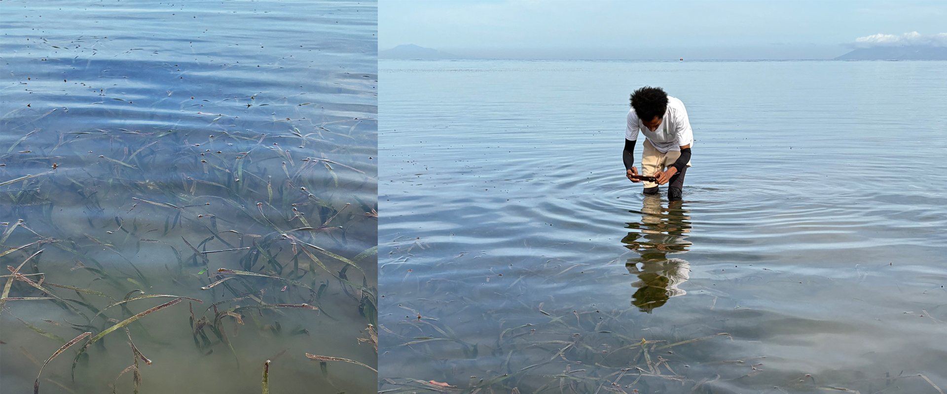
While coastal communities possess deep local ecological knowledge, there are gaps in how seagrass ecosystems are documented and monitored, including limited tangible evidence such as maps and data.
To address this, HOT’s Open Mapping Hub - Asia-Pacific (AP Hub) is partnering with Konservasaun Flora no Fauna (KFF) through the Monitoring for Seagrass (M4S) project, a two-year initiative that integrates community-led participation with open mapping technologies.
By collaborating with local coastal communities to map seagrass habitats using open, low-barrier data collection tools, the project aims to generate Metinaro’s first baseline seagrass data – creating a foundation for data-driven conservation and increased community awareness.
With accurate, up-to-date maps and data, it will be easier to effectively track seagrass health, identify species, and monitor habitat condition and change.
Participatory Mapping Toward Community-Owned Data
– Phase 1 (2026): Capacity Building and Field Mapping
In the first year, the project focuses on mapping the extent and condition of seagrass habitats using a participatory approach, placing data generation and analysis directly in the hands of local communities.
This begins with the training of trainers for KFF on open mapping tools, followed by KFF-led training for local communities. Once trained, collaborative mapping activities will be carried out following the established workflow.
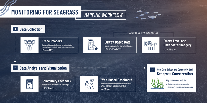
In the end, the collected data will be transformed into an accessible, evidence-based map of local seagrass resources that supports more effective monitoring, decision-making, and long-term conservation planning.
– Phase 2 (2027): Targeted Awareness-Raising Campaigns
Using the map developed in Phase 1, KFF will lead community campaigns and workshops to highlight the importance of seagrass and promote sustainable fishing and environmental practices.
By seeing their own community map, supported by simple learning guides, community members gain a fresh perspective on how daily human activities, local livelihoods, and seagrass health are heavily interconnected.
Understanding these connections will help them move from observers to active stewards. In this case, the map goes beyond supporting technical conservation work and acts as a powerful tool for advocacy.
Community Leadership in Mapping and Managing Coastal Ecosystems
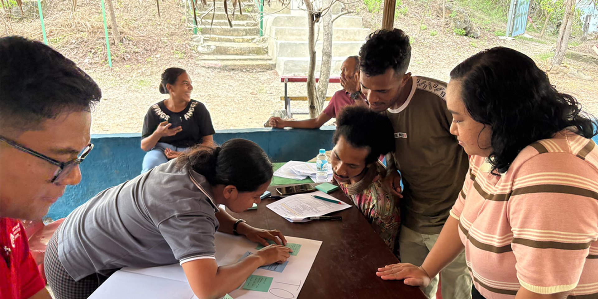
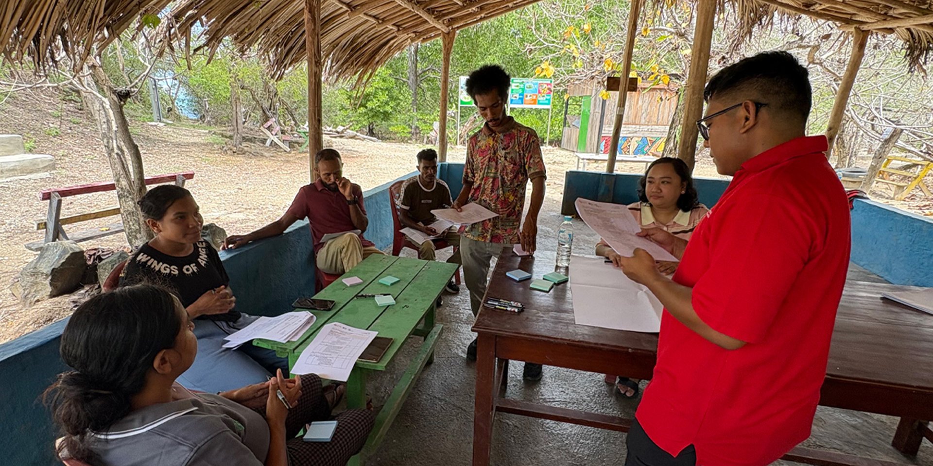
Co-design workshop with KFF (November 2025) to explore impact, data needs, and co-develop a methodology that is fully aligned with local expertise | Photo: Harry Mahardhika / Open Mapping Hub - Asia-Pacific
By the end of the project, local communities, government agencies, and other stakeholders will have increased knowledge and hands-on experience with open mapping tools, along with access to publicly available map and data on seagrass habitats.
Additionally, the project’s participatory approach will help bridge the gap between scientific evidence and local practice, promoting collective action for long-term, community-led conservation and marine resilience.
Current Progress (January 2026)
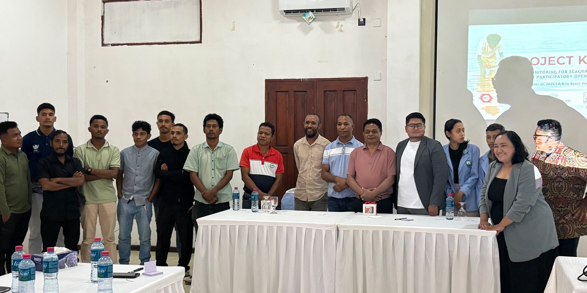
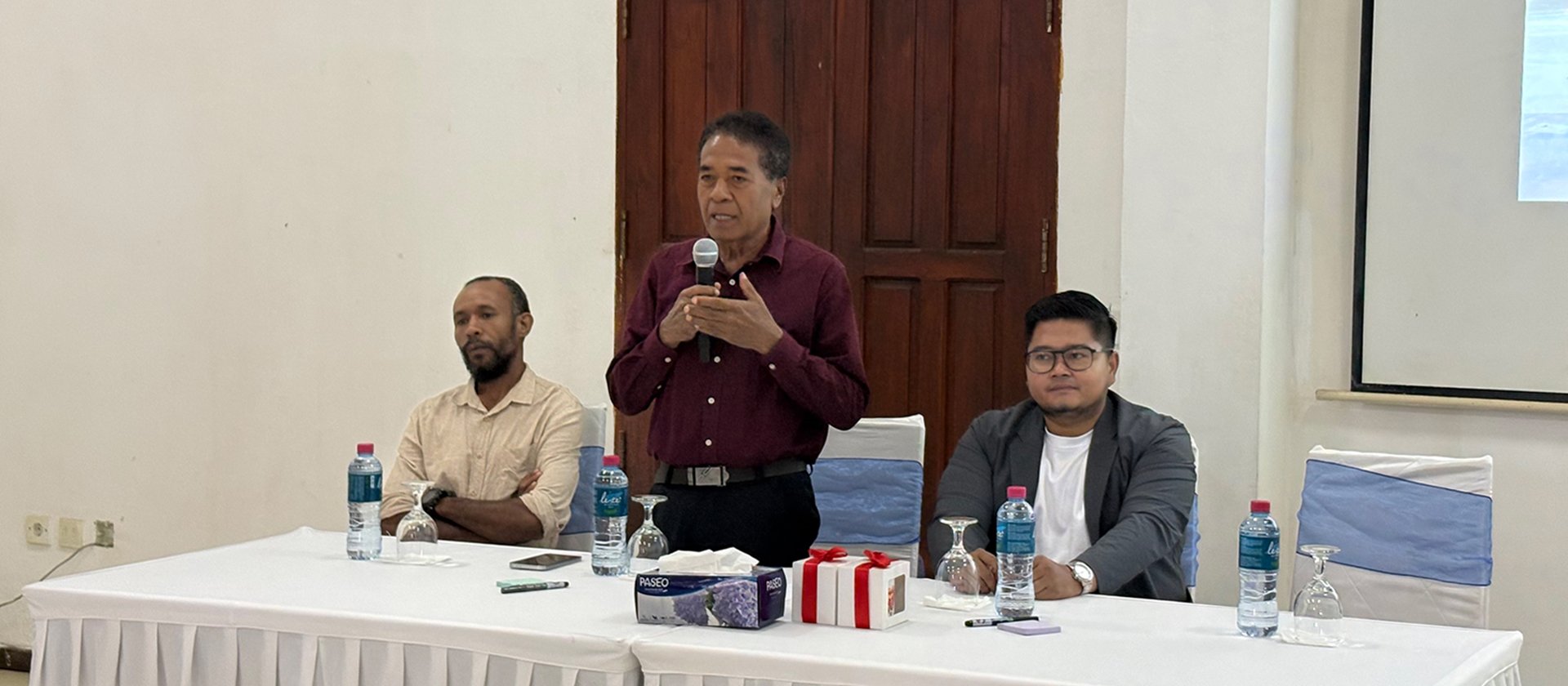
In November 2025, an official kickoff event was held with local stakeholders, including government officials, academics, students, village heads, and non-profit organizations working in marine conservation. With positive responses and valuable feedback from guests, the event marks a promising beginning for the project and the future of Timor-Leste’s seagrass conservation.
Currently, we are preparing for the training of trainers, which will take place in the coming months. Grounded in Gender Equality and Social Inclusion (GESI), the training will bring together participants of all genders, age groups, and backgrounds.
The learning materials will be available in three languages (Tetum, Indonesian, and English) and provided in both digital and printed formats to improve accessibility for participants with varying levels of digital access.
Stay updated with the project’s latest progress on our social media!
Cover photo credit: Harry Mahardhika / Open Mapping Hub - Asia-Pacific
![]()
