Macro Anticipatory Mapathons: toward a regional risk preparedness strategy in Latin America and the Caribbean
Publié par Céline Jacquin, Mar Marín Villagrana • 13 mai 2026
Anticipatory Mapathons have established themselves as one of the most robust strategies in Latin America and the Caribbean. Led by HOT in Latin America and the Caribbean, the Macro Mapathons respond to a structural challenge of the region: the lack of open, up-to-date, and usable geospatial data before emergencies occur.
In a context of growing climate crisis, where floods, landslides, droughts and fires disproportionately affect the most vulnerable territories, mapathons are built on a clear logic: to anticipate, providing data at the right moments in territorial planning, enabling not only disaster response action, but also long-term impact for greater spatial justice.
For us this information is very important: including it in the National Risk Atlas and having data on the different areas that may be affected by some natural phenomenon. In a country like ours, where so many phenomena occur, this is very relevant. — Cecilia Izcapa, Director of Risk Analysis and Management at CENAPRED.
By contributing through citizen science, you are strengthening territorial planning and the more equitable distribution of public services. In that sense, this work contributes to spatial justice, which is the heart of what we are advancing with OpenStreetMap. — Celine Jacquin, Senior Manager for Latin America.
The Macro Mapathons are extended collaborative mapping exercises (1 to 2 months) developed at national or regional level to close critical cartographic gaps in areas of known risk. Unlike reactive responses, these ensure that geospatial data is available to support, beyond risk management (including the definition of evacuation routes, scenario modeling, etc.), territorial planning and evidence-based decision-making.
Their strength lies in combining large-scale citizen participation, the use of technologies and public digital goods, expert validation processes that guarantee data quality, and multisectoral collaboration among governments, academia, youth and technical communities.
Legend
🔴 Countries with results from 2025 National Mapathons scaling up in 2026
🩵 Countries joining the regional initiative for the first time
OpenStreetMap as shared infrastructure
The foundation of the Mapathons is OpenStreetMap (OSM), the world's largest collaborative open mapping platform. Within this strategy, OSM functions as a shared public infrastructure that makes it possible to produce reusable and updatable data, reduce costs and time compared to traditional schemes, and recognize local knowledge as a key technical input.
MANAs not only produce cartographic data that can be used for risk management and territorial planning. They also strengthen digital communities, local and youth capacities, consolidate national technical communities, generate institutional trust in open mapping, and position OpenStreetMap as a legitimate input for governance processes, proving to be a key link in Public Digital Infrastructures.
This approach has allowed several countries to move from one-off exercises to recurring processes, with ever-greater local ownership.

HOT's role
HOT acts as a technical partner, regional articulator and methodological guarantor of the mapathons, seeking technical coherence, raising data quality and enabling local ownership:
- Methodological design and prioritization
- Creation and management of distributed mapping projects
- Training in mapping and validation
- Mobilization and accompaniment of local and regional communities
- Quality assurance of the data produced
- Introduction of local officials to the use of the generated data
- Methodological guidance in conducting complementary mapping exercises (including qualitative fieldwork), using tools such as ChatMap
From 2023 to 2025, a balance
The Macro Mapathons have reached an unprecedented scale in Colombia, Peru, Ecuador and Mexico, demonstrating the potential of open mapping as support for anticipatory policy. Together, they mobilized 1,447 participants, who mapped 547,408 buildings, 2,088 km of roads and 184 km of rivers and bodies of water.
The national mapathons have involved national institutions responsible for territorial planning and disaster risk management, national geography institutes and local governments (state and provincial, but also municipal), as well as development agencies, NGOs and universities, including universities with specialties in comprehensive risk management or civil protection.
This series of mapathons does not only represent "another mapathon." It raises awareness of the chronic lack of data for responding to emergencies by local actors, articulating and analyzing the type of data needed, the types of areas of interest and the real timeframes of response and humanitarian action; also understanding the systemic limitations of these various professions as reflected in their data management and use to prepare action in the field. From this analysis, over time, the mapathons were organized, making it possible to anticipate and provide cartography well before emergencies occur, and to socialize it through early engagement of stakeholders, thus streamlining access to and assimilation of information when it is needed. From this same logic, the cartography is not necessarily used immediately, but its existence is ensured with sufficient detail in areas where disasters occur with known frequency.
The timely definition of priority areas and objects to be mapped is therefore critical, grounded in deep local and political knowledge.
This is how, across the various National Macro Mapathons, together with authorities from risk and disaster management, territorial planning, local development, civil protection, environmental agencies, and others, lists were built of municipalities, localities, sometimes entire provinces, watersheds, forest areas prone to fires and floods, and buffers around communication corridors, in a careful priority order constructed by crossing the visions of multiple actors, which each mapathon ultimately follows. Depending on the volume of voluntary participation (which is expected and encouraged, but cannot be guaranteed), the mapping covers more or fewer territories from these lists, but ensures that the most critical areas have been mapped.
From one year to the next, territories are progressively completed and priorities can be redefined according to local political context: contributing where there is the greatest current need and readiness to use data in a local planning instrument or community intervention (training sessions, participatory diagnostics in isolated communities, among others).
In Mexico, the process followed the National Atlas of Vulnerability to Climate Change (ANVCC) of INECC, which, through various prioritization criteria based on climate exposure, socio-environmental sensitivity and adaptive capacity, highlighted 20 of the most critical municipalities. These (and others) were also in the process of developing new local plans.
In Colombia, the selection responded to a diverse geography with multiple natural hazards, where the national authority (UNGRD) worked with communities to integrate ancestral knowledge and local expertise, identifying their own vulnerabilities for territorial planning. Ecuador, for its part, consolidated its preparedness exercise through coordination between the Secretariat for Risk Management and local governments (provincial and municipal), enabling, beyond voluntary mapping, the building of capacities in the use of open cartography. In Peru, the space agency CONIDA linked aerospace technology and young talent to strengthen base cartography for risk management at a national scale, each time in a different district.
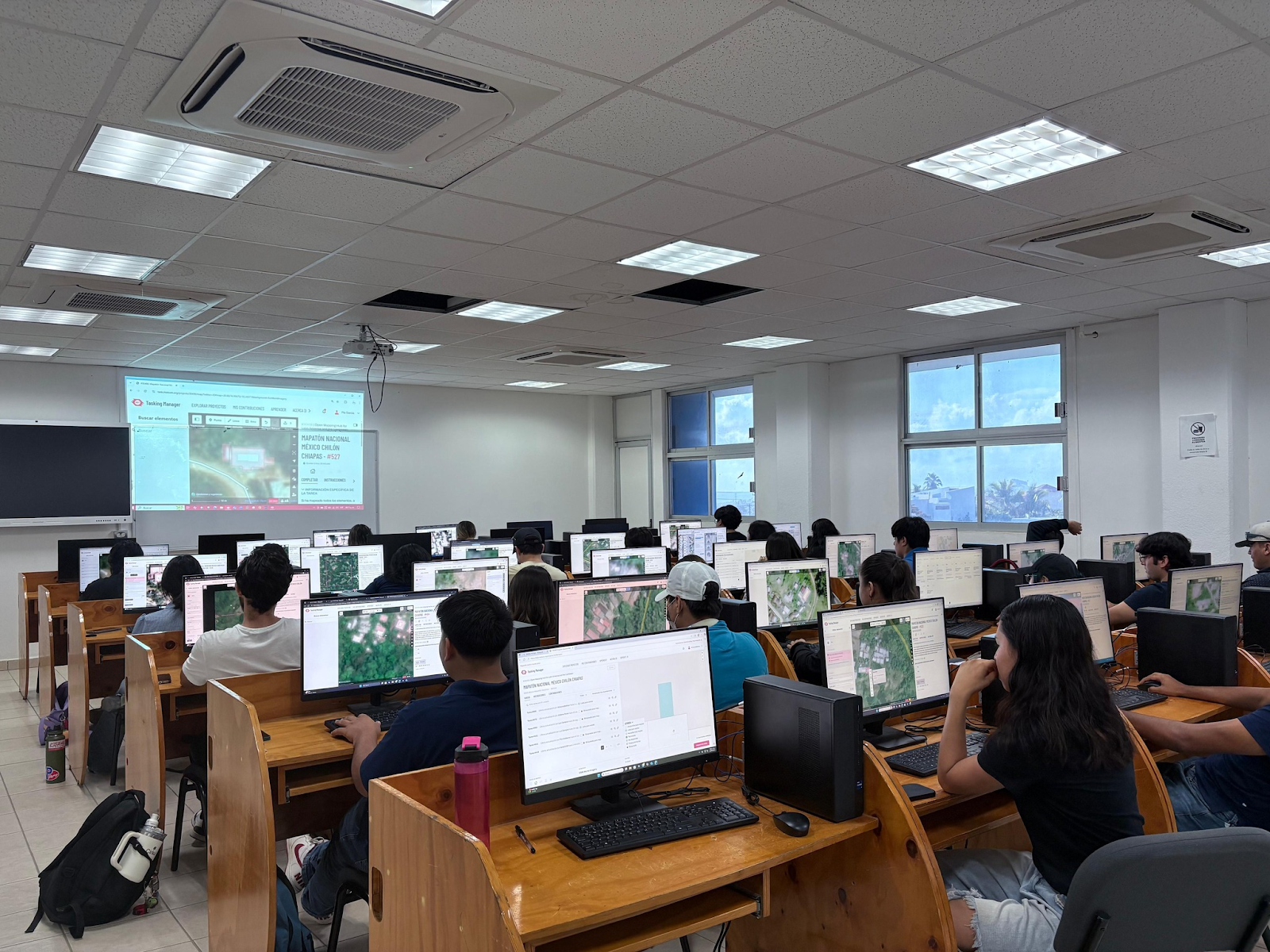
 Geog. Melanie Pía García Bustos, Head of the Geomatics Unit at IMPLAN Los Cabos, teaching students how to map on OpenStreetMap as part of the Mexico National Mapathon 2025. Credits: IMPLAN Los Cabos
The 2026 Regional Macro Mapathon: Save the Date!
Building on four years of national mapathons, HOT is scaling up to a Regional Macro Mapathon, bringing multiple Latin American countries together under a shared methodology and a common goal. From June 22 to July 31, 2026, the initiative will activate existing capacities, communities, and alliances to make a meaningful leap in both scale and impact.
This regional approach seeks to:
- Address shared risks (watersheds, climate corridors, coastal systems, cross-border zones)
- Scale citizen participation to a regional level, more actively integrating global mappers
- Strengthen data interoperability across countries
- Consolidate OpenStreetMap as a regional infrastructure for risk anticipation
The vision for the future is clear: that mapathons be understood as a community mobilization of the map, as a tool that we can all activate, capable of being fully adopted by institutions in coordination with universities and local digital communities.
In a scenario of climate crisis, every unmapped territory is a decision made in the dark. Macro Mapathons demonstrate that another way of preparing is possible: collaborative, open and anticipatory.

Share
