SDI REDAA / Lusaka City Community Drone Mapping Initiative
Zambia
This project brings together two complementary initiatives; the Lusaka City Open Drone Mapping project, which aims to create open 5 cm accuracy aerial imagery mosaics of Lusaka, Zambia and the Slum Dwellers International REDAA project, in which community members use drones to create imagery for monitoring urban ecosystem degradation and restoration.
Lusaka City Open Drone Mapping project
The Ministry of Local Government and Rural Development is currently working with the University of Zambia and other stakeholders, including JICA, to plan, implement, and evaluate ambitious urban development plans. The plans cover a diverse range of issues and sectors, including urban planning & unplanned settlements, land management & titling, environmental management & climate change, infrastructure & transport planning, water, sanitation & drainage systems, and waste management.
For all of the above use cases, high-quality aerial imagery is considered a foundational data set for everything from planning to implementation to monitoring and evaluation. The data is initially needed at a city scale, but the capability to repeat and adapt the data collection is also important, especially for change detection and monitoring.

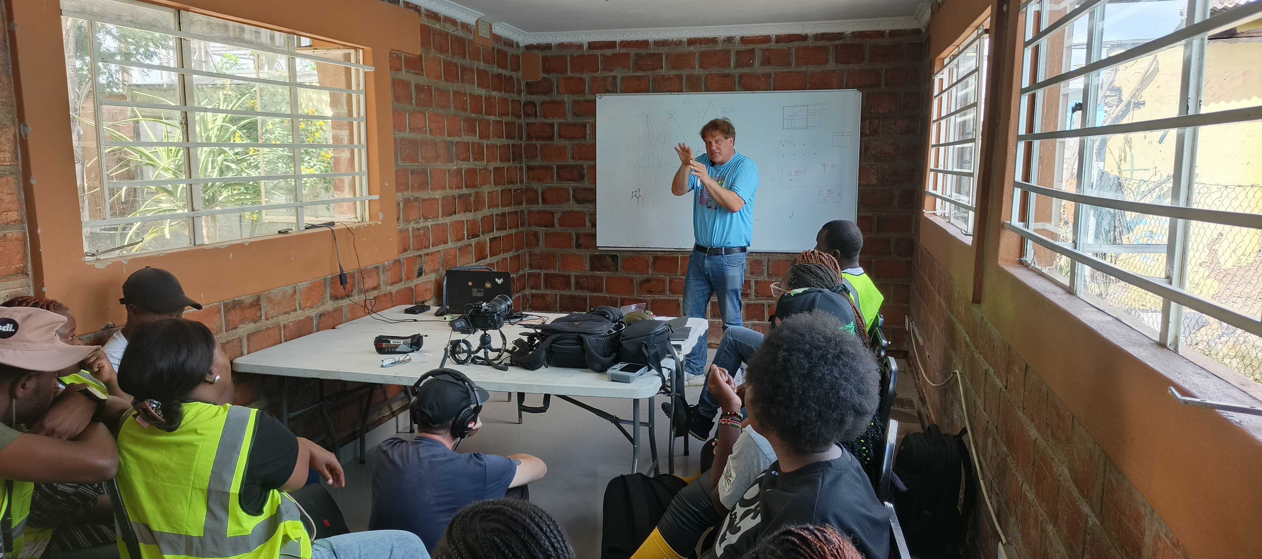
Maxwell Kaluba speaking at the project launch, March 2026. | Photo: HOT
"The common challenges in Lusaka are poor drainage systems that lead to devastating floods, poor solid waste management, and less community engagement with local leaders and decision makers."
Maxwell Kaluba — Federation Youth Leader, Zambia Homeless and People's Federation
Slum Dwellers International REDAA project:
Communities in informal settlements in Zambia, Zimbabwe, Malawi and South Africa are embarking on the implementation of urban ecosystem restoration projects. These projects, designed by local community members seek to reverse degradation and promote sustainable restoration and conservation approaches.
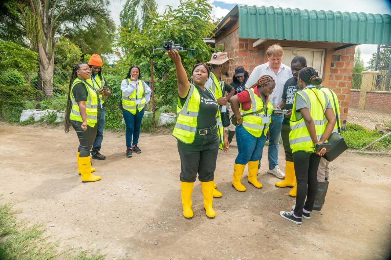
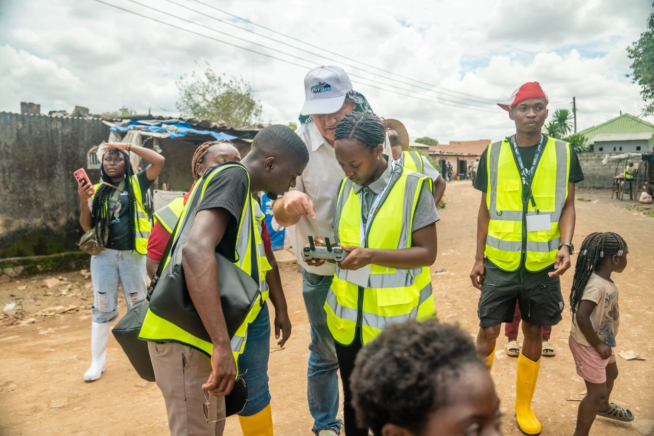
In each country, three community members will be trained to fly low-cost drones and use open source software to generate aerial imagery of the degradation / restoration project locations. Being able to fly and generate imagery on a regular basis will give these communities valuable baseline and comparison datasets, so they can track the progress of their projects and communicate the challenges and the impact in a data-informed, and compelling, manner.
JICA on why existing satellite data falls short: "Some satellite data is free of charge, but when we look at very detailed data, it will cost a lot, and the resolution is not enough for us to design specific infrastructure." — Yuki Chika, JICA Representative
Our Approach
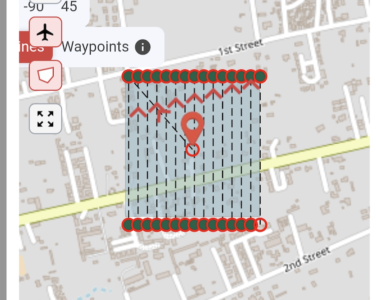
HOT’s open drone mapping approach builds capacity in local community groups, organisations and institutions to leverage free and open source software and low-cost, lightweight drones in order to create high-resolution, professional grade aerial imagery. This approach makes the creation of necessary data as accessible as possible to diverse stakeholders and means that high quality imagery can play an impactful role in urban development projects, even when the budget can’t stretch to commercial products and suppliers. The imagery can then be hosted openly, and for free, on OpenAerialMap where other collaborators and partners can access and use it, creating additional value and a digital public good asset.
Outcomes
- High quality imagery data integrated into planning, implementation and monitoring and evaluation processes in urban development projects in Lusaka.
- Community groups, academic institutions and government entities have the ability to generate and access high quality imagery as and when they need it.
- SDI REDAA restoration projects use aerial imagery to conduct high qualty monitoring and present compelling evidence of impact.
- An open drone community of practice is formed in Zambia, shepharded by the National Centre for Uncrewed Aircraft Systems.
Deliverables
- High quality 2d aerial imagery for 200-250km2 of Lusaka
- 12 SDI drone pilots trained in the acquisition, processing and hosting of open aerial imagery
- 5-10 local Zambian drone pilots on boarded onto the open drone methodology
- Local government capacity built for accessing and using the imagery in their work.
More from the Lusaka Citywide Community Open Drone Mapping Project: data and imagery
Once collected, all open datasets and imagery will be published and freely accessible:
1) Settlement and urban data — available on OpenStreetMap and HDX
2) Drone imagery — available on OpenAerialMap
Data and imagery will be posted here as the project progresses. Watch this space.
The Lusaka Citywide Community Open Drone Mapping Project is led by NCUAS at the University of Zambia in partnership with HOT, JICA, the Zambia Civil Aviation Authority, PPHPZ, and SDI-affiliated organisations across the region. Cover photo by Abednego Chanda.
