Before the Next Storm: Microgrants Powering Community Mapping Across the Caribbean
Posted by Louise Mathurin Serieux • May 20, 2026
Among the World's Most Disaster-Prone Regions

The Caribbean is a region of immense beauty but extreme vulnerability. As Small Island Developing States (SIDS), these nations face a "perfect storm" of hazards: rising sea levels, intensifying hurricanes, volcanic activity, and aging infrastructure. Historically, the central problem has been a lack of granular, up-to-date data. Large-scale global maps often overlook the winding alleys of a Haitian commune or the specific drainage patterns of a Saint Lucian village. Without this data, disaster response is reactive, and long-term planning is sometimes based on guesswork.
To bridge this gap, the Humanitarian OpenStreetMap Team (HOT) Latin America and the Caribbean Hub launched the 2025 Microgrant Program. The goal was simple but ambitious: provide $1,500 to $5,000 grants to local entities to execute high-impact mapping projects between November 2025 and April 2026. These projects were about capacity building. By training local youth, drone pilots, and community volunteers, the program ensured that the ability to generate and manage data remains within the islands long after the grant period ends.
Each project was a collaborative effort. We allied with diverse partners, from the Sonje Ayiti Organization in Haiti and Youth Emergency Action Committees (YEACs) in Saint Lucia and Grenada to the GIS Society of Trinidad and Tobago (GISSTT). These organizations worked hand-in-hand with municipal governments, national disaster offices like NaDMA and ODPM, local youth committees and community representatives. Our primary objectives were to geolocate critical infrastructure, identify high-risk environmental zones, and promote open data sharing to inform government policy and community preparedness.
Limonade, Haiti: Securing the Foundations of Education

In the North Department of Haiti, the municipality of Limonade faces constant threats from flooding and soil erosion. The central issue here is the safety of the educational system. When disaster strikes, schools often serve as shelters, but if the schools themselves are in high-risk zones, the entire safety net collapses. Beyond this, the schools are not mapped, and even officials responsible for supporting these institutions struggle to locate them when needed.
The Sonje Ayiti Organization (SAO), in partnership with HOT, approached this by training a coordinator and four field agents to conduct a rapid, high-intensity mapping mission. Their project focused on the intersection of geography and social vulnerability. Over two days of fieldwork in November 2025, the team mapped 68 schools and 4 major risk zones. This data was immediately integrated into OSM databases and shared with the Limonade Town Hall and the District Education Office. An unexpected but vital impact of this project was the immediate commitment from the Mayor's office to install physical signage in the identified risk areas, proving that digital maps lead to direct physical interventions. Further, new schools that were not previously listed were identified and added to the map, ensuring they are more likely to receive timely response and support when needed.

Saint Lucia: Turning Debris into Data

Further south in Saint Lucia, the challenge tackled was coastal pollution. In Soufrière and Castries South East, littering on beaches threatens both the marine ecosystem and the natural resources that drive the tourism-focused economy. YEAC Saint Lucia recognized that cleaning up the trash was only a temporary fix; to solve the problem, they needed to map the "waste flow."
The project, From Debris to Data, used the ChatMap tool to turn 20 youth volunteers into digital environmental stewards. Throughout November and December 2025, these volunteers logged every piece of trash they collected, not just picking up bottles, but recording exact GPS coordinates and categorizing each material.
The team collected 364 items weighing over 234 pounds. The data revealed that aluminum cans and plastic cups were the primary offenders. This specific data allowed YEAC to propose "Recycling Hubs" at exact high-traffic entry points and a "Clean Anchor" incentive program for local beach vendors. The outcome was clear: a data-backed roadmap for municipal waste management that replaces generic "No Littering" signs with data-driven advocacy.
The Project Manager of YEAC Saint Lucia captured it well: "The HOT Caribbean Collective Microgrants is a supportive tool for youth in the region where we could apply our youthfulness, our ingenuity and our love for technology and fun backed by finances."

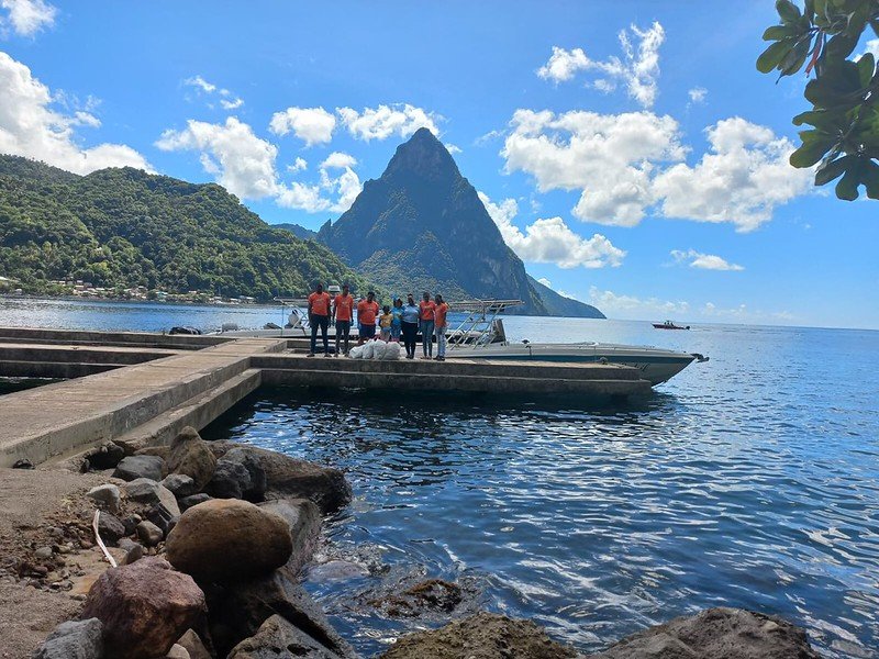
Trinidad and Tobago: Resilience from a Bird’s Eye View
Guayaguayare, Trinidad, is recorded as a "highly vulnerable" community on the Coastal Vulnerability Index, due to severe erosion and storm surges. The Geographic Information Systems Society of Trinidad and Tobago (GISSTT) recognized the urgent need for updated geospatial data and worked in collaboration with local drone operators and emergency planning officials to help community members in their fight against this challenge.
Under their project, From Sky to Shore, GISSTT delivered a five-module training program for 17 local drone operators. Working together, the team collected a critical dataset and produced high-resolution orthomosaics, detailed, georeferenced aerial maps of the area, for those who need them most.
Using HOT's open-source Drone Tasking Manager (DroneTM), the team produced a foundational dataset of the Guayaguayare coastal zone, now a critical tool for the Institute of Marine Affairs (IMA) and the Office of Disaster Preparedness and Management (ODPM). The project successfully demonstrated that high-tech tools like drones, when paired with open-source processing software, can be managed locally without the need for expensive, proprietary licenses.
Rayna Sookdeo, Director of GISSTT, reflected on what the project achieved: "The impact of these achievements goes beyond the deliverables themselves; this project has strengthened community engagement, advanced open mapping efforts, and contributed meaningful data to support coastal resilience and planning in the region."
Grenada: Navigating the Tsunami Threat

In the parish of St. Patrick, Grenada, the looming presence of the underwater volcano Kick 'em Jenny makes tsunami preparedness a matter of life and death. While the National Disaster Management Agency (NaDMA) had established evacuation routes, many residents were unaware of them, and the physical signage was insufficient for a panicked evacuation.
Caritas Grenada and YEAC Grenada launched Navigate to Safety to digitize these routes. In early 2026, nine youth mappers from the HOT Youth Champions for Emergency Mapping (YCEM) cohort conducted field missions in Sauteurs, first using the tasking manager to remotely update the map, then going into the field to document assembly points, medical stations, and warning signs.
The project resulted in a functional, user-friendly digital map identifying three primary evacuation roads and clearly marking the "Tsunami Flood Area." A significant lesson learned was the time-intensive nature of validation: the team had to perform physical walkthroughs to ensure the digital map accurately reflected the terrain. The project also made a point of centering female participation, over 71% of the team were women, underscoring an unexpected outcome: a new generation of women stepping into open mapping.
The Project Manager for YEAC Grenada, Rose-Anne Redhead, shared the team's experience: "The Youth described it as mind-blowing to not only know that these tools exist but to also get the opportunity to learn to use them and then to apply them."
Mapper Torie-Ann James put it simply: "This experience has given me the exposure that I needed to put my mapping skills into practice. I can now say that I am more confident in my mapping skills as a YEAC member."

Lessons Learned and the Path Forward
Across all four projects, officials, community representatives, and emergency organizations have benefited from having access to the resulting datasets. The 2025 Caribbean Collective Microgrants have proven that resilience is built from the ground up. By combining local knowledge with open-source technology, communities across the archipelago have shown how open data can be a tool for communities to lead their own path toward a safer future.
Share
