News — 25 March, 2024
Coordination and Action: The Articulation of Humanitarian Mapping Response after Hurricane Otis

After Hurricane Otis in October 2023, the Hub LAC led a digital humanitarian mapping effort in Acapulco, identifying damaged structures and priority needs in collaboration with the national community and international organizations, highlighting the importance of participatory mapping and laying the groundwork for future mitigation actions through interinstitutional collaboration in building community resilience.
Versión en español / Versão em português
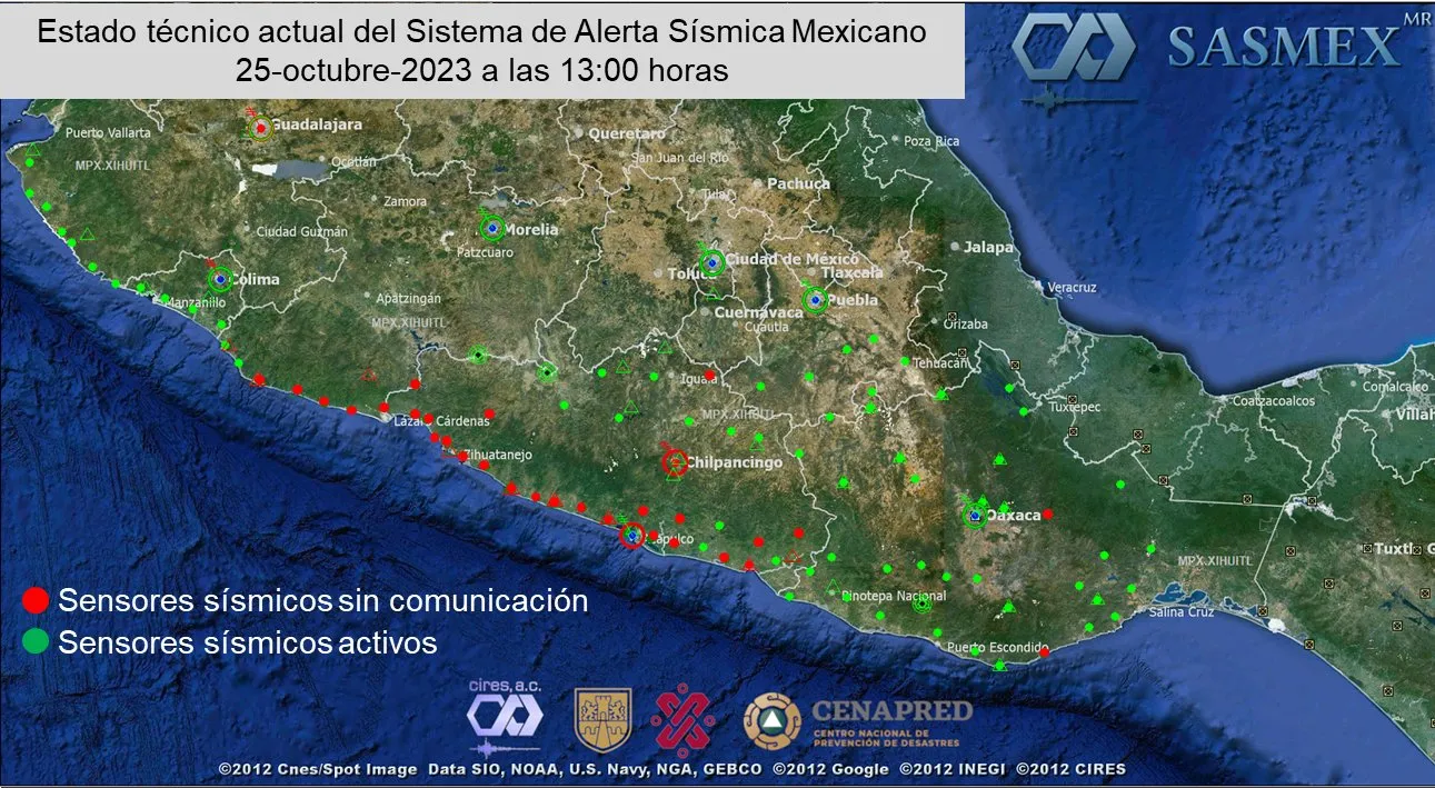
On October 25, 2023, Hurricane Otis battered the coast of Acapulco, Guerrero (Mexico), with sustained winds of up to 315 km/h, marking a milestone as the most powerful cyclone recorded in the history of the Mexican Pacific coast. The impact was devastating: power lines knocked down, seismic sensors halted, trees uprooted, floods, and landslides. Thousands of homes and businesses were reduced to rubble, with an official death toll of 50 and 30 missing, in addition to hundreds of homeless people.
Initial Activation Phase
In response to this situation, the international mapping community swiftly mobilized to offer aid and support. Actions were initiated from the Open Mapping Hub in Latin America and the Caribbean (Hub LAC) to coordinate the response and assist local authorities in the reconstruction of Acapulco.
The first activation phase involved establishing contact with relevant authorities, such as Civil Protection and the National Center for Disaster Prevention (CENAPRED). However, disorganization and the disruption of telecommunications and energy caused by the disaster initially hindered this connection, especially with local institutions. It was necessary to rely on university contacts from the Autonomous University of the State of Mexico (UAEMEX) and international organizations such as the United Nations Children’s Fund (UNICEF) to obtain crucial information about the extent of the damage and priority needs, as well as to weave coordination with authorities from one contact to another.
Pending the acquisition of drone imagery over Acapulco, a preliminary activation was initiated to map the surrounding areas in the estimated impact area provided by early analysis from the Disaster Charter-Copernicus. This allowed for anticipating reconstruction needs in potentially underserved and economically marginalized areas, as well as following specific attention requests from CENAPRED in particular localities.
Mapping and Planning
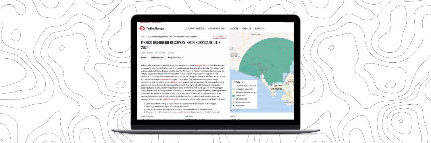
In the weeks following the disaster, drone imagery was obtained over some urban areas of Acapulco, provided by various actors such as Help.NGO and CENAPRED. We guided them to upload these images to OpenAerialMap and integrate them into the Tasking Manager to specifically map the destroyed buildings. Seventeen projects were created for these areas, allowing for mapping a total of 22,537 structures.
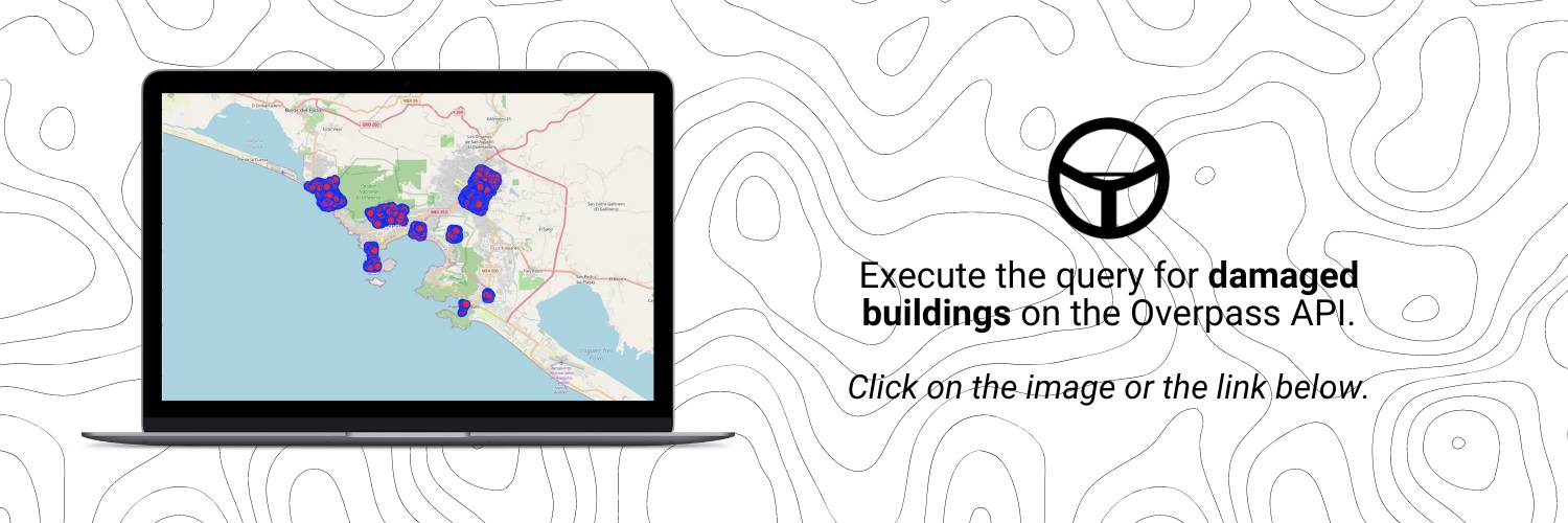 Consult the map of damaged buildings in the Overpass API using this link.
This specific mapping focused on initial recovery actions, enabling the comparison of initial estimated analyses with the exact number of damaged buildings, both residential and infrastructure, for direct attention.
Simultaneously, we established a close collaboration with local actors, universities (UAM, UAEMEX, UACJ, UAGto, UAGRO, and the RENEG Network), and civil society organizations to drive the mapping of key public facilities, such as schools, health centers, and markets. The fundamental participation of youth in these mapping efforts is highlighted in this YouthMappers blog.

Thanks to the collaboration of the global OpenStreetMap community and the proactive leadership of 17 individuals from five Mexican universities, we were able to carry out the mapping of:
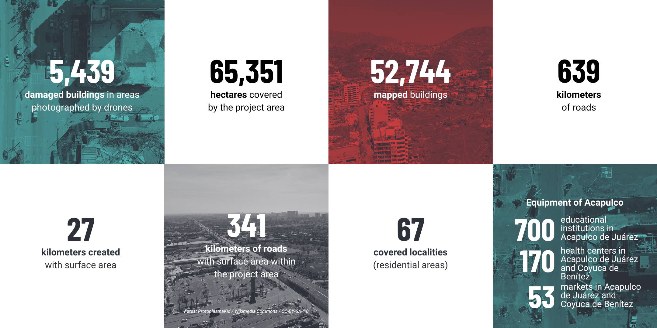
By precisely overlaying these facilities with the damaged structures, we were able to guide the recovery efforts, particularly in public markets and schools, for subsequent support actions to the population.
Challenges and Evolution
The greatest challenge was undoubtedly the disconnection among supporting actors, whether governmental, private sector, or NGOs, leading to a plethora of organizations carrying out partial, uncoordinated actions, and sometimes duplicating efforts or limiting the scope of many initiatives. Over the weeks, coordination efforts began to emerge from civil society, leading to the formation of intersectoral forums alongside the Mexican Center for Philanthropy (CEMEFI) and the United Nations Development Programme (UNDP) for the reconstruction of Acapulco. The Hub continues to participate in these spaces to address the data needs that arise and will continue to emerge continuously during the long-term social, economic, and environmental recovery period in Guerrero.
Regarding access to open data and satellite images after disasters, which are fundamental inputs for effective emergency mapping, the lack of coordination was a significant limitation. The experience in Acapulco, coupled with the Hub’s desire to support a comprehensive digital emergency response, now leads us to seek collaborations with global actors conducting early analysis, such as the Disaster Charter.
In the cartographic response to the emergency, as the reconstruction phase progressed, data needs evolved, and additional challenges arose, such as logistics for debris clearing activities and estimating the affected population. To address these demands, we developed specific forms in Kobo Toolbox and remotely trained Civil Protection personnel for their use. We also conducted various geospatial analyses to assess the disaster’s impact on the population and critical infrastructure. Additionally, we formed a group of volunteer geographers and geoinformaticians from the country to provide support in cartographic organization and mapping of damaged facilities and buildings.
Participants were invited and motivated with daily support to map both facilities and damaged buildings, representing two to three weeks of work. Through this activation, two initiatives emerged: the Humanitarian Mapping Brigade and the Humanitarian Mapping Laboratory.
The Humanitarian Mapping Brigade, composed of 31 expert mappers from 14 countries in Latin America and the Caribbean, will contribute to specific projects and during emergencies. It not only focuses on high-quality mapping tasks but also on validating and providing training. This team will play a key role in strengthening local capacity, promoting an entrenched culture of humanitarian mapping in the region, and establishing a solid foundation for the continuous development of humanitarian and open mapping.
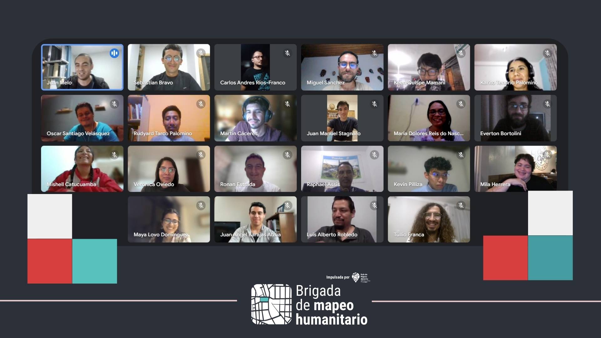
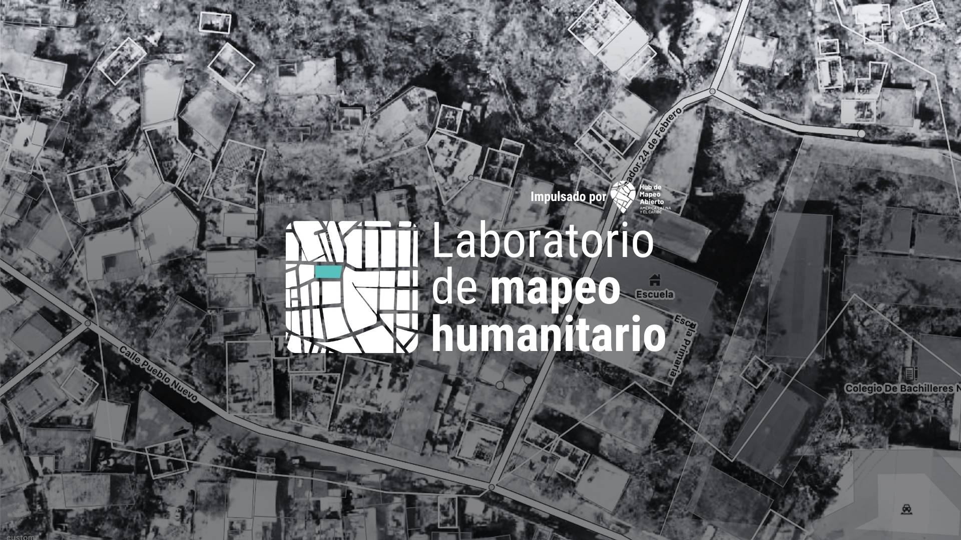
On the other hand, the Humanitarian Mapping Laboratory is a space that fosters collaboration among people from diverse disciplines and basic levels of mapping experience. This laboratory encourages participation and learning at the Open Mapping Hub voluntarily with the aim of consolidating a community for future digital emergency responses. In this regard, we call on university institutions to join in formalizing the Laboratory, promoting collaboration among departments and levels of experience.
Reconstruction of Acapulco
In parallel, we participated in weekly meetings focused on the intersectoral reconstruction group. In these meetings, multiple needs to rebuild Acapulco in a sustainable, participatory manner, considering its exacerbated vulnerabilities, were highlighted. We proposed concrete actions to civil society representatives, officials, and international agencies, such as monitoring vegetation and crops, elements that can trigger fire risks, and reflections on monitoring underwater bay conditions.
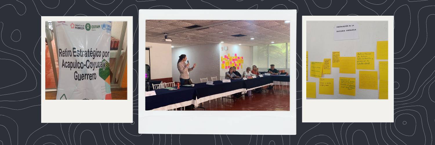
During the Strategic Retreat for Acapulco-Coyuca and Guerrero, where civil society representatives, federal, state, and municipal officials, as well as international agencies, gathered to continue the response to Hurricane Otis and discuss reconstruction, some key points were highlighted:
-
Reconstruction in Acapulco must be approached in a participatory and inclusive manner, especially due to its exacerbated vulnerabilities.
-
The disaster has revealed a wide range of needs in environmental, economic, social, cultural, and political terms.
-
The importance of coordination among various stakeholders to achieve effective reconstruction is emphasized.
-
Issues such as rebuilding social fabric, food security, the role of women, and corporate social responsibility are addressed.
-
The importance of citizen participation and coordination between different levels of government and civil society is emphasized.
The reconstruction process in Acapulco is seen as an opportunity to address structural vulnerabilities and promote community participation in building a more resilient and inclusive future. Humanitarian mapping efforts not only focused on the immediate response to the disaster but also laid the groundwork for future mitigation and preparedness actions. The formation of a network of volunteer geographers and geoinformaticians, along with interinstitutional collaboration, highlights the potential of participatory mapping as a fundamental tool in crisis management and community resilience building.
We thank and acknowledge all participating organizations and institutions in this activation, whose joint effort has been essential for the reconstruction of Acapulco.
Participating Organizations and Institutions
-
Equipment mapping and data analysis: 17 individuals from 5 universities in Mexico (Metropolitan Autonomous University Cuajimalpa, Autonomous University of the State of Mexico, University of Guanajuato, Autonomous University of Ciudad Juárez (UACJ); Autonomous University of Guerrero)
-
Mapping and data analysis: coordination by 3 professors and 1 doctoral student from UACJ, UAEMEX, UAGRO
-
Interinstitutional group for the reconstruction of Acapulco: 45 people: Guerrero Civil Protection; CENAPRED; Disaster Relief-Crisis Ready Harvard; CEMEFI; UNICEF Mexico; Reforestamos México; CONABIO; UAEMEX; UNDP Mexico; HELP-NGO, among others.
Sources
¹ Santos, A. (2023). The official number of victims of Hurricane ‘Otis’ in Acapulco amounts to 50 dead and 30 missing. El País.