Mapping for Climate Ready Cities - Dhaka
Through our Mapping for Climate Ready Cities program, HOT is supporting the development of a thriving ecosystem focused on the creation, interpretation, and use of maps to respond to and reduce climate risks in urban areas across four priority regions. This project page highlights our work in Dhaka, Bangladesh through HOT's Asia Pacific Hub (AP Hub).
Summary
Dhaka is one of the fastest growing megacities in the world. With such rapid urbanization and significant migration from other regions within Bangladesh due to adverse effects of the changing climate, Dhaka confronts unique challenges in population density that places immense strain on urban infrastructure, including, but not limited to: public health and WASH (water, sanitation and hygiene) services, housing, waste management and emergency response capabilities. Moreover, vulnerable communities mainly in slums or informal settlements are threatened by increasingly frequent and intense hazardous issues. The AP Hub’s Open Mapping for Resilience project - known nationally as the Dhaka Thrive project - will address these challenges through the establishment of a comprehensive geospatial database in OpenStreetMap. This will enable humanitarian organizations, local authorities as well as communities to prepare, respond to, adapt, and transform the urban infrastructure in Dhaka.
Background
Growing migration to Dhaka has led to a rapid expansion of slums and informal settlements, resulting in makeshift communities and poor urban planning. These areas have become highly susceptible to climate-related and man-made hazards like waterlogging, fires, disease outbreaks, and urban heat waves. This is further compounded by poor housing and limited access to healthcare, sanitation, and waste management.
These settlements miss out on the benefits of urbanization. With a soaring youth population, it is critical in the coming decades to develop a strong geospatial database to understand these changing population dynamics and needs.
The open-source geospatial database will be a necessary foundation for better and more systematic urban planning. This includes equipping youth with digital skills in mapping and analyzing data for urban planning, healthcare, governance, and education. As the Bangladeshi government pushes for a digital nation with improved digital access and literacy, the HOT Asia Pacific Hub (AP Hub) can be instrumental in supporting these efforts.
Approach
In order to support urban development for sustainable and climate-resilient cities across the Asia-Pacific region, the AP Hub - in close collaboration with World Vision Bangladesh - aims to build community knowledge and data flows by catalyzing open data ecosystems where local government, INGO, NGO, private sector, academia, and community actors come together to map both the most essential and critical features of developing cities in the Asia-Pacific.
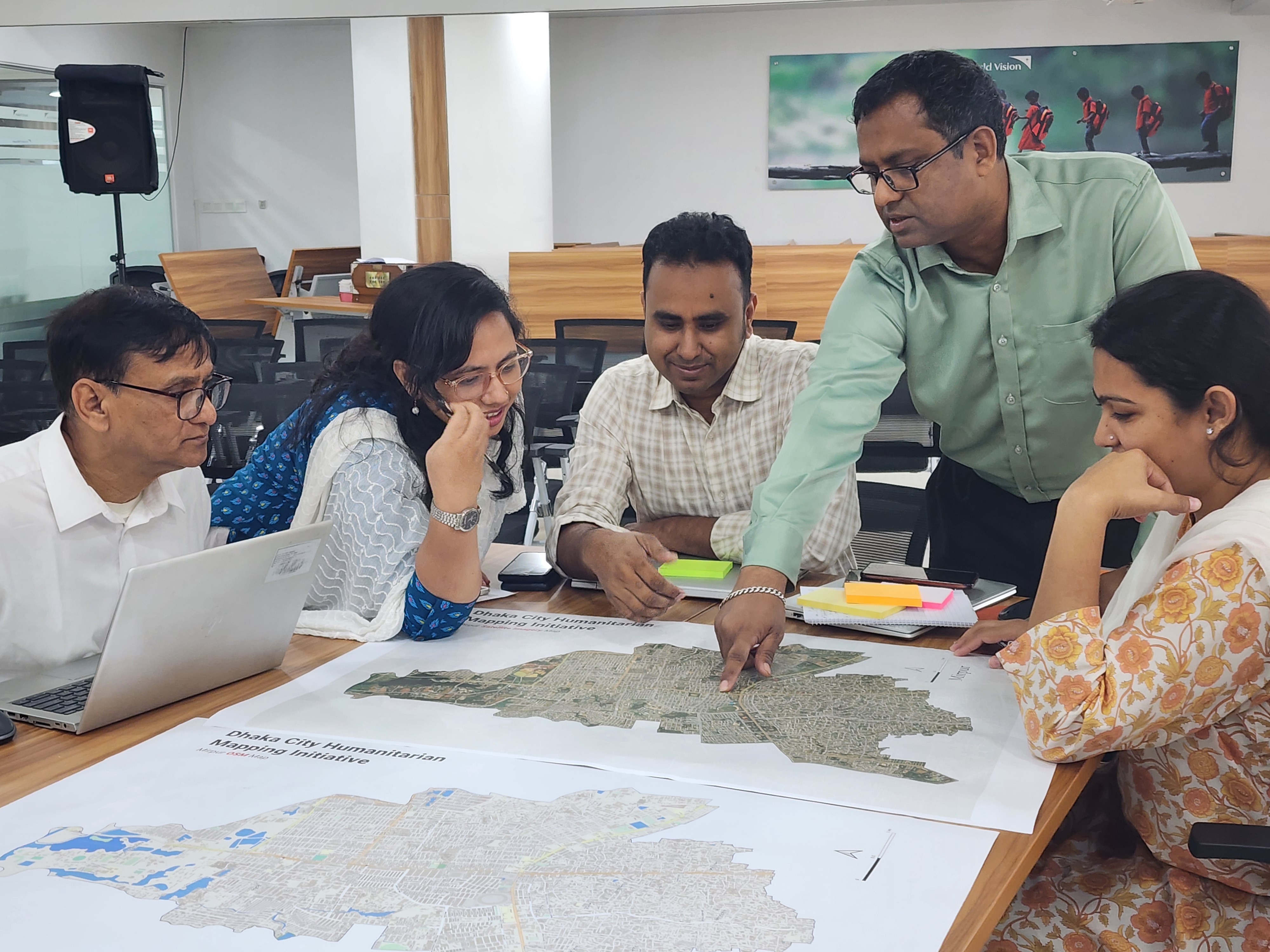
The Mirpur district is where the migrant population coming from north is entering Dhaka. The project seeks to address the unique demands and difficulties encountered by the migrant groups in Mirpur within 2024 and this entails using geographic data to gain a deeper understanding of their migratory path vulnerabilities, access to basic amenities, and patterns of settlement.
Methodology
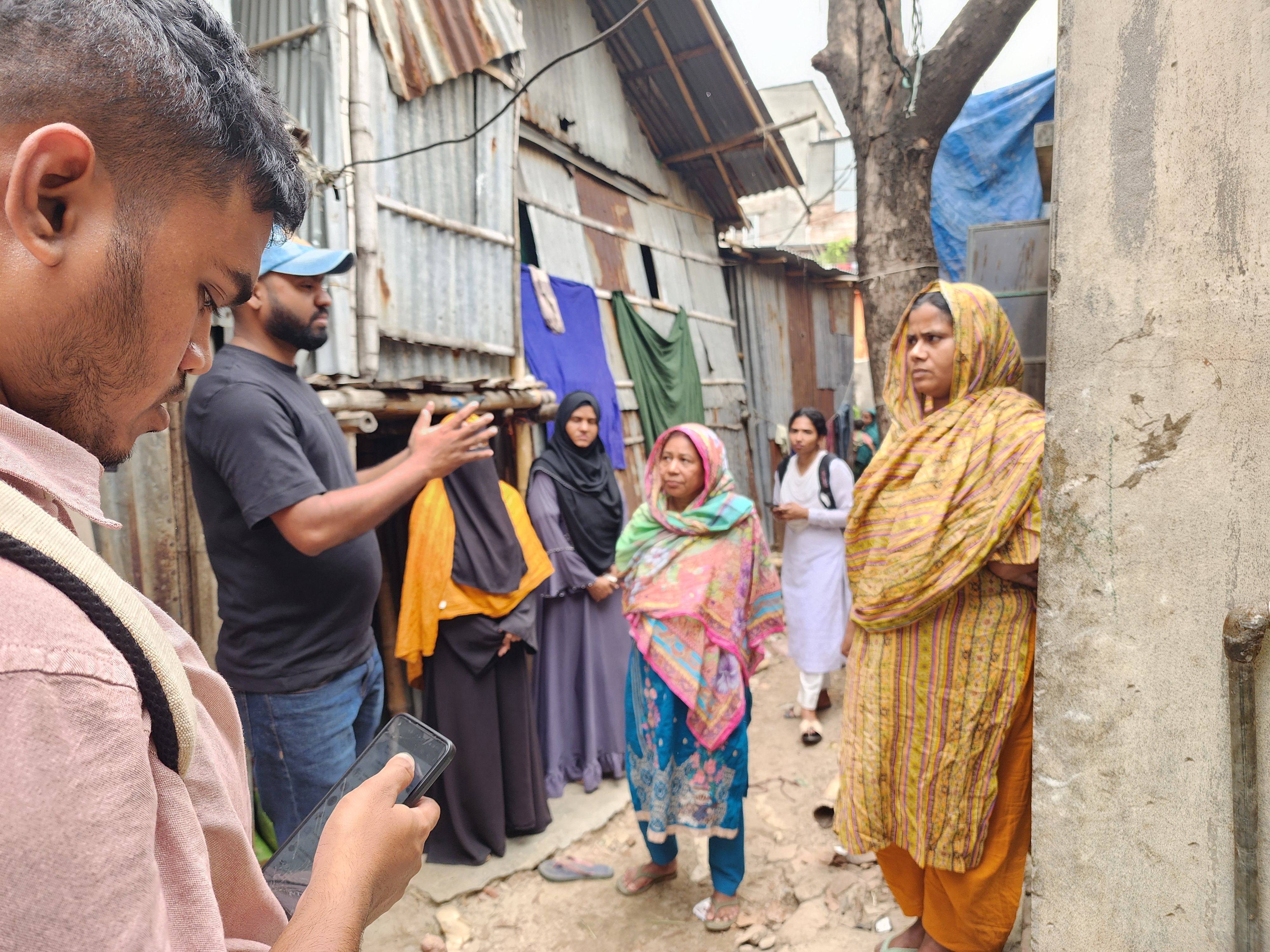
The project will address data gaps with partners, local communities, and stakeholders through remote mapping and validation. This will be followed by field data collection and mapping campaigns focusing on the most vulnerable slums and informal settlements. The initiative will also seek out local data sources that can support OSM data creation, such as drone imagery, public datasets etc.
The data collection and awareness-building efforts will be supported by stakeholder training, workshops, and upskilling efforts focusing on data collection and data use for decision-making.
Datasets Collected
Based on previously held discussions, workshops, and consultations, the overarching themes are focused on utilizing the improved base datasets on OpenStreetMap include (but are not limited with): Climate resilience, waste management, fire hazard risk management, waterlogging and flood risk management, disease management (dengue), heat & green cover, and open & safe spaces.
In this initial phase, AP Hub will work with local partners and stakeholders in developing an accessible and reliable geospatial database, comprising the following prioritized datasets:
- Base data - roads, buildings, water bodies
- Essential services - schools, public toilets, health facilities, places of worship
- Amenities - commercial services (shops)
- WASH facilities
- Street-Level Imagery - Mapillary
Expected Outcome and Impact
By catalyzing a vibrant, sustainable, multi-actor open data ecosystem in the cities, the AP Hub aims to create comprehensive and up-to-date geospatial data on OSM that will empower humanitarian organizations, local authorities, and grassroots communities to better understand, plan for, and respond to various challenges, including the effects of climate change, natural hazards, public health emergencies, and other urban development needs.
Tools Used
- Tasking Manager - To complete the base data (roads, buildings, water bodies) of Dhaka North with the support and contribution of OSM collaborators worldwide.
- OpenAerialMap - To host and serve high resolution drone imagery made available by Dhaka North City Corporation (DNCC)
- Mapillary - To collect high resolution street-level imagery from the slums and informal settlements of Mirpur.
- ODK/FMTM - To collect thematic data at hyper-local level on the field with data collectors and community volunteers
Want more? See this OSM Diary from Brazil Singh for a community member’s perspective on the team’s April 2024 field mapping and data collection trip to Dhaka.