Data-Driven Disaster Risk Management: PhilAWARE

HOT is contributing to the development of PhilAWARE, a custom hazard monitoring and early warning system to improve disaster management and decision making in the Philippines.
Overview of the project:
Following the successful completion of the InAWARE project in Indonesia, HOT continues its collaboration with USAID and the Pacific Disaster Center (PDC) for PhilAWARE – the local installation of the DisasterAWARE system in the Philippines.
Launched in July 2019, the project will equip the Philippines’ National Disaster Risk Reduction and Management Council (NDRRMC) of the Office of Civil Defense (OCD) with a hazard monitoring, early warning, and decision support tool. It consolidates hazard information and alerts from various sources for the agencies’ disaster preparedness and response. This will also ease the sharing of information among the country’s disaster managers from the national, regional, and local levels, with warning and alerts disseminated to the impacted communities.

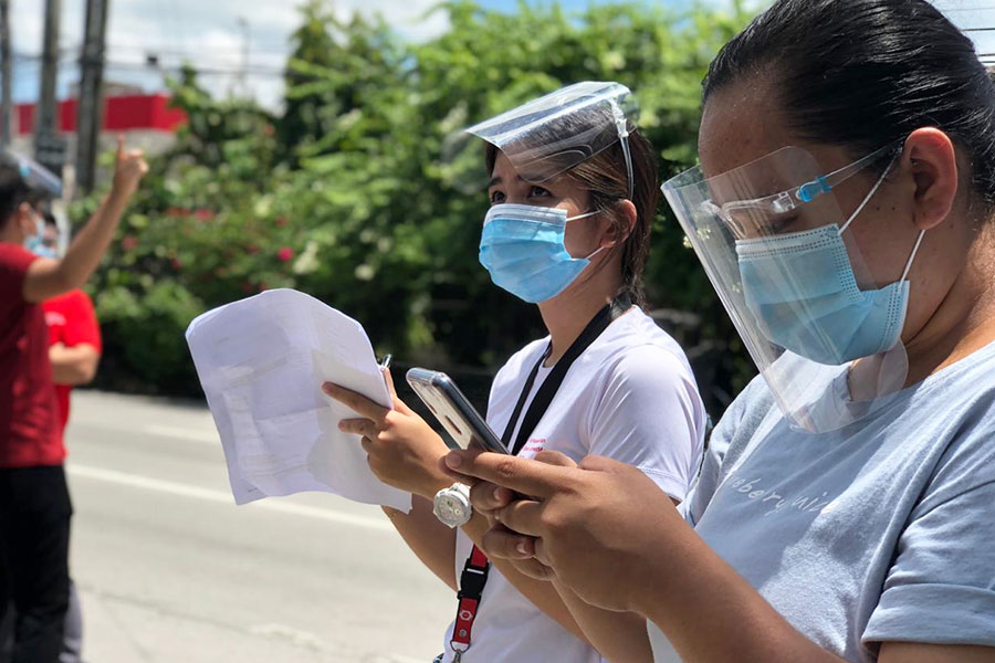
The HOT team in the Philippines is tasked to map the Province of Pampanga and Quezon City in Metro Manila, including its administrative boundaries, road networks, and critical lifeline infrastructures (e.g. evacuation centers, hospitals, schools, etc.).
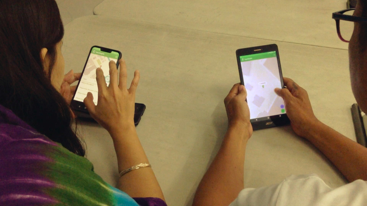
Using the HOT Tasking Manager, HOT together with its global and local network of volunteers, contribute to mapping building footprints and road networks through satellite imagery for the 22 municipalities of Pampanga (area: 2,181 km²) and the whole of Quezon City (area: 166.2 km).² This will lay the groundwork for the field mapping activities. HOT’s mapping team will work alongside representatives in the local community to identify the critical lifeline infrastructures from the ground based on the building footprints. The geospatial data collected will then be validated by a team of data validators to ensure the quality of edits. The community will likewise be trained to use OpenStreetMap, for them to sustainably improve the quality of the map in their locality.
Speaking during the mid-term workshop for the PhilAWARE project in February 2020, Undersecretary Ricardo B. Jalad, Executive Director of NDRRMC and Administrator of OCD emphasized the impact of PhilAWARE in the country: “The need to be always informed, (and) to possess this situational data is a crucial element in effective decision making and planning against all threats.” He also added that such a technological advantage will assist disaster managers across the archipelago in having this important information for disaster response.
Recent news from Data-Driven Disaster Risk Management: PhilAWARE (View all news)
PDC PhilAWARE: Field Mapping Completion, the e-Learning Platform, and Map Presentation to Stakeholders
This month, the HOT Philippines team completed the required field work for the PhilAWARE project and is now presenting output maps to stakeholders. HOT is also working with PDC to prepare an e-Learning platform to remotely support stakeholder mapping initiatives.

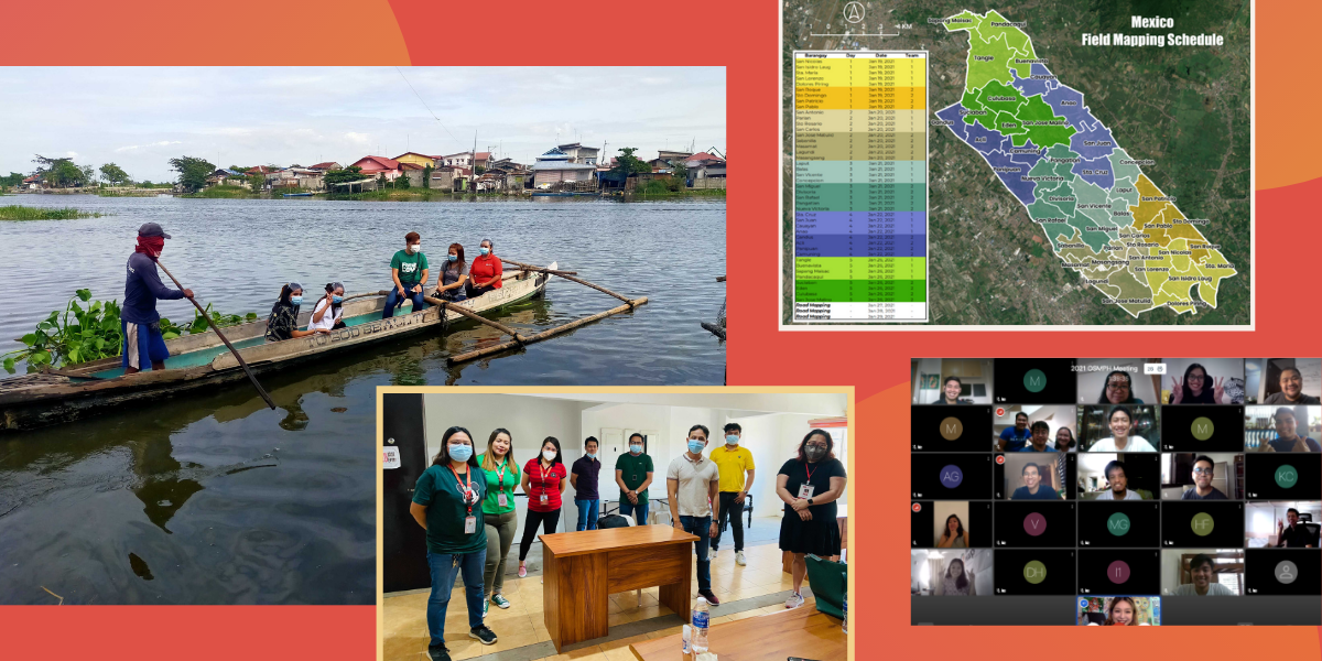
January 2021: New Field Mapping Strategy, Data Validator Selection, OSMPH Meeting — HOT Philippines
In order to speed up the validation process for the PhilAWARE project, the HOT Philippines team is opening a validator selection process for local volunteers. OpenStreetMap Philippines also held our annual planning this month.
The PhilAWARE Project: A Year-End Report
This year, remote mapping for Quezon City and the Province of Pampanga were completed, and a new pilot area, Marikina City, was added. Furthermore, field data collection has progressed well in Pampanga despite the pandemic.

Philippines Celebrates International Day for Disaster Risk Reduction with Field Narratives
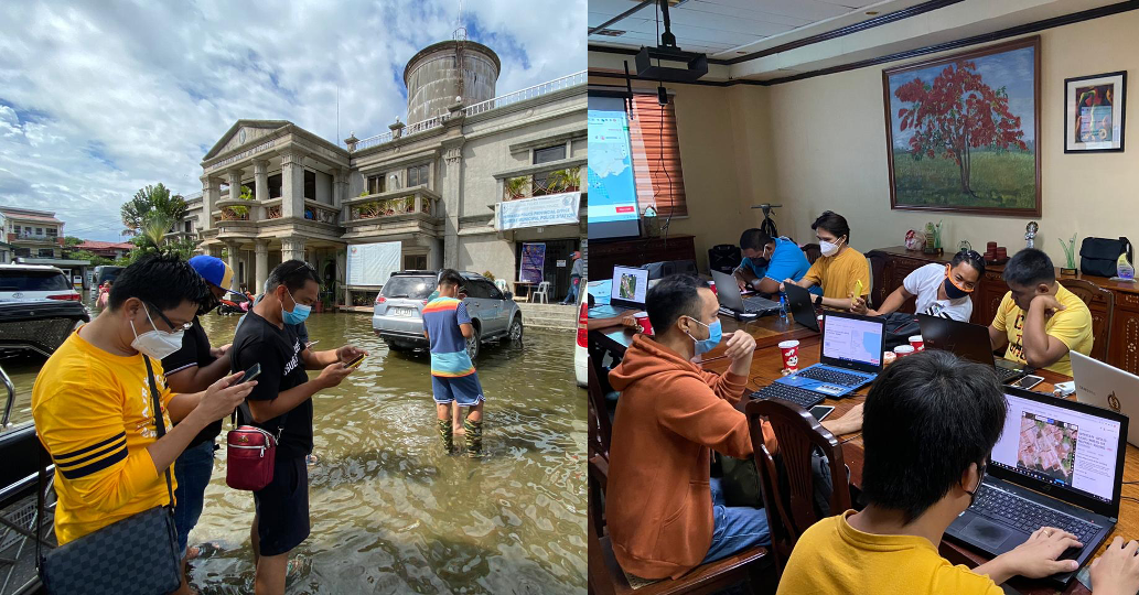
In celebration of IDDRR, HOT Philippines shares more of the fieldwork they are conducting in Pampanga — including coordinating with LGUs, training volunteers, and collecting field data.
Philippines Completes Remote Mapping and Validation for Pampanga
On September 21, 2020, the Philippine mapping team finished remote mapping and validation for the whole of Pampanga.