





Bridging the Data Gap in the Democratic Republic of Congo
Conflict & Displacement • Democratic republic of Congo
In the heart of the Democratic Republic of Congo (DRC), humanitarian efforts face a paradox. While the country is navigating a complex and long-standing crisis, compounded by rapid population shifts, health epidemics, and climate shocks; the data needed to drive effective aid is often locked behind technical barriers. Currently, local and national NGOs frequently find themselves on the periphery of decision-making, not for a lack of will, but for a lack of technical knowledge, accessible digital tools and reliable data.
The proposed solution is a targeted intervention through a collaboration between MapAction and the Humanitarian OpenStreetMap Team (HOT), funded by the H2H Fund, to expand geospatial capacities and improve the available data. By providing localized training, hands-on coaching, a data package and open-source mapping templates, this project aims to create the conditions for local actors to play a more central role in needs assessments, programme design, coordination, and advocacy, in line with localisation commitments and national humanitarian priorities.
HOT will provide technical support for creating the Humanitarian Data Package (HDP), which consists of identifying and mapping existing data sources, collecting and validating datasets, and cleaning and integrating them into a single, unified data package to improve accessibility and usability. This data package will allow local actors to have direct access to relevant data via HDX. HOT collaborated with MapAction for the COVID-19 Vaccine Delivery (GIM Initiative) in 2021 where a similar package was produced.
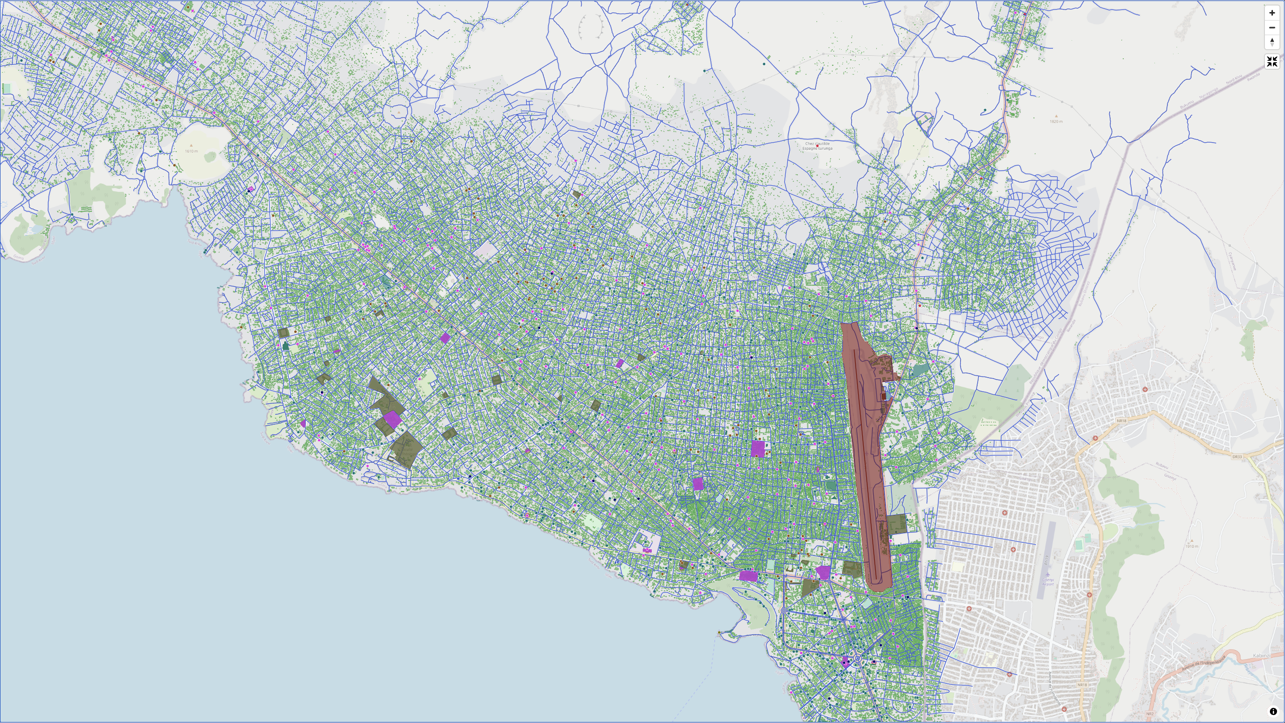
Map on HDX showing the layers on the data package for the H2H DRC project.
A Collaborative Ecosystem: Who is Involved?
- MapAction: Leading the charge with their roster of GIS experts and long-standing history of humanitarian support in the DRC.
- Conseil National des Fora des ONG Humanitaires et de Développement de la RDC (CONAFOHD): Serving as the strategic backbone, this national NGO network ensures that the project remains rooted in local realities and priorities.
- Global Collaborators: Partners like CartONG and Data Friendly Space will offer specialized consultations to ensure the tools we build meet the highest international standards.
The Challenge: How to Support Local Capacity
Data often exists in fragmented silos or non-standard formats, making it nearly impossible for a local NGO in Goma to use it for an emergency assessment without external help. This dependency limits their autonomy and slows down the response.
To fix this, the project focuses on two main pillars: Technical Proficiency and Resource Accessibility.
Pillar 1: Training and Sustained Coaching
Skills are only useful if they can be applied in the heat of a crisis. Between February and July 2026, the project will roll out:
- Localized Training Materials: Developed in French and adapted specifically for the DRC context, covering everything from digital data collection to introductory mapping.
- In-person Intensives: A five-day training in Goma for 20 key members of CONAFOHD.
- The "Coaching Loop": Recognizing that a one-off workshop is rarely enough, MapAction will provide individual coaching sessions (both in-person in Goma and remote in Kinshasa). These sessions will allow staff to work on their organization’s specific data challenges in real-time.
Pillar 2: The "Humanitarian Data Package" and QGIS Templates
Access to software shouldn't be a luxury. The project is betting big on QGIS, a free and open-source Geographic Information System.
- Humanitarian Data Package: We are cleaning and validating fragmented datasets (baseline maps, administrative boundaries, and sectoral data) into one "ready-to-use" package.
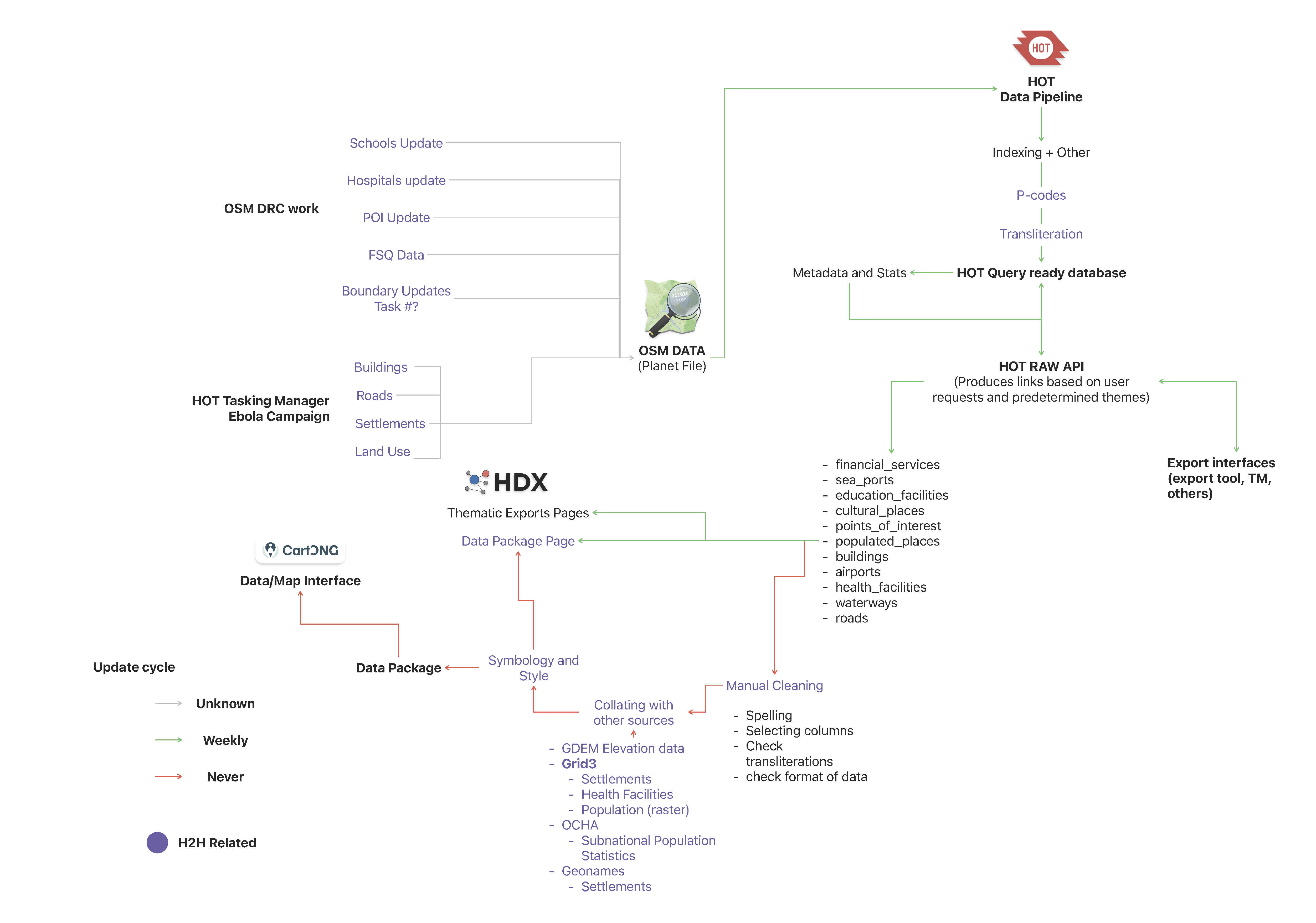
Proposed H2H Humanitarian Data Package workflow diagram.
- Smart Templates: HOT and MapAction are designing mapping templates that act as a "shortcut" for local actors. These allow users to generate professional, standardized maps for Rapid Multi-Sector Assessments (ERM) without needing a master's degree in GIS.
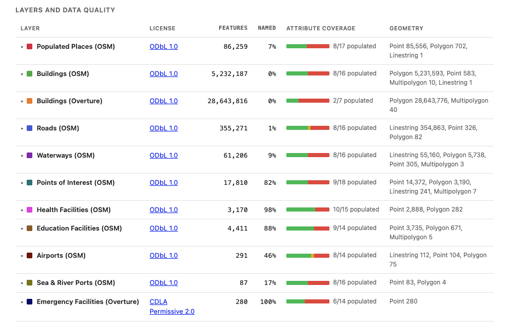
Attribute coverage: how many of the layer's columns carry data. Green is well-populated (50% of rows or more), amber partial, red rare (under 25%). The per-layer report breaks the same measure down column by column.
Looking Forward
The focus remains on technical sustainability and local ownership. This initiative isn't about creating leadership from scratch; the leadership and expertise are already present within the DRC’s humanitarian community. Instead, it is about providing the specific technical support and standardized tools that local teams need to back up their frontline expertise with high-quality data. We are proud to support this shift toward a more technically autonomous and locally-led response.
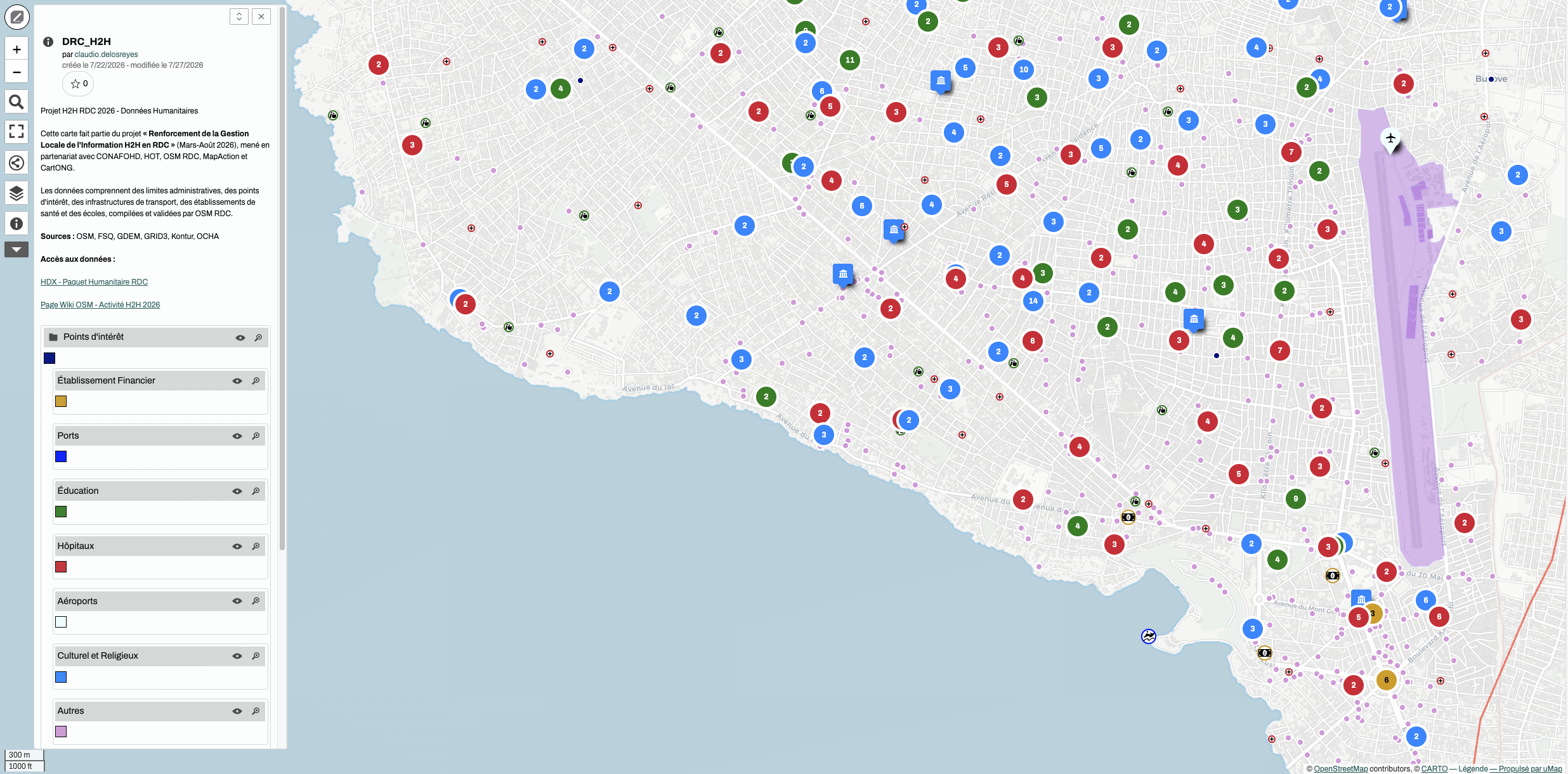
uMap showing the layers on the data package ready to be used for collaborative projects.


