


No One Left Off the Map: Five Years with HOT in West and North Africa
Posted by Ibrahima Cisse • Oct. 26, 2026
From One Ocean to Another
I have spent most of my life looking at the world from the shoreline. As a researcher, consultant, and lecturer at several universities, passionate about the environment, the marine world, and food safety, I led Greenpeace Africa's Oceans campaign for five years. Throughout those years, I shared the daily lives of artisanal fishers and women fish processors whose livelihoods depend on the sea, the mangroves, and the fish that feed West Africa.
Aboard the Esperanza, we sailed the waters of six countries in the subregion, from Cape Verde to Sierra Leone, to listen to communities and alert governments to overfishing. In June 2020, on World Oceans Day, Senegal rejected license applications from 52 foreign industrial fishing vessels. That day, I saw what a collective voice, backed by facts, can achieve.
I have been fortunate to live several lives in one, to commune with the soul of the Russian people, the russkaya dusha, at once deep and generous; to immerse myself in the richness of Spanish and Catalan cultures; to draw on the pragmatism of the English-speaking world. And through it all, to remain anchored in my African roots and my French-speaking culture. These years taught me that there is always more to learn, in the words of our beloved poet-president Léopold Sédar Senghor, “the rendezvous of giving and receiving.” Above all, they taught me a simple lesson: we can only truly protect what we know, and we can only truly know what we have mapped.
So when I joined the Humanitarian OpenStreetMap Team (HOT) in August 2021, I did not feel I was changing course. I had simply picked up a new instrument for the same fight. After five years leading the Open Mapping Hub for West and North Africa, I am leaving HOT. Before turning this page, I want to say thank you, and to share some of the stories that gave meaning to these years of early flights, late-night calls, and dusty roads.
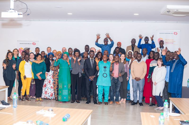
HOT and community members celebrate the launch of the WNA Hub in Dakar, Senegal, in March 2022. Credit: Ibrahima Kébé Diallo, Khalilus Photography.
Twenty-Four Countries, Half a Billion People, One Compass
The Hub was born from a bold promise. Through The Audacious Project, HOT set out to map places home to one billion people living in poverty and at risk of disaster. Before we even had an office, we asked the OpenStreetMap communities of the region a simple question: what do you need?
On March 16, 2022, we officially launched the Hub in Dakar, with a mandate covering 24 countries and half a billion people. A small, highly motivated team had just met its first challenge in record time, after days and nights of work that mobilized the whole organization, our partners, and the communities. Straight away, five projects got underway in the region: access to water, health, urban management, flooding, and community support.
Yet everything was still to be built: registering HOT in Senegal, recruiting, designing programs, re-engaging communities, and convincing partners that open maps could change the way decisions are made.
Gregory Blamo, Secretary General of the Liberia National Red Cross Society, put it better than anyone: “Without accurate data, we either do the wrong thing, or we do nothing.”
We had a compass: the spirit of Ubuntu, I am because we are. It meant working with and through local communities, never in their place. And one rule above all others: no one should be left off the map.
Bringing Communities Back to Life
When we started, the momentum of the region's OpenStreetMap communities had faded. Passionate volunteers were left without resources, reliable connectivity, or support.
We made a bet: before asking communities to map, we would help them stand on their own feet as organizations. With Senghor University in Alexandria, we trained and certified the leaders of about ten OSM associations in civil society management, strategic planning, humanitarian project management, financial management, and resource mobilization. Four pilot countries, Liberia, Niger, Senegal, and Togo, led the way, joined by six others. Each association then received a $10,000 grant over six months to relaunch its activities.
The Mwalai grants, a program designed to boost data production and improve data quality in OpenStreetMap, extended this support to a first cohort of three countries: Côte d'Ivoire, Benin, and Sierra Leone. Each received $10,000 for five months of activities, for a total of $30,000. Trainings were held in four cities in Côte d'Ivoire and Benin, and around a hundred people were trained in data collection and mapping.
Then we opened the doors to research. About ten academic fellowships brought OpenStreetMap into the region's universities. The Open Mapping & Tech Days, a certified training program, brought together 35 participants in Niamey and 35 in Dakar, including 13 women from 11 organizations. In Côte d'Ivoire, 30 participants mapped the town of Ouangolo remotely, adding more than 8,300 buildings. Through the OSMer in Residence program, we placed OSM experts inside partner organizations, starting with Médecins Sans Frontières, so that open data would become a tool for planning their operations.
To keep this movement alive, we launched the Open Mapping Advocacy Network (OMAN). It brings together the champion mappers of the communities supported by HOT to strengthen their expertise and prepare them to respond to partner requests and emergencies.
Today, 22 communities have received grants from HOT, nearly 2,500 people have been trained, 826 women actively contribute to the map, and 12 local data ecosystems have emerged. Behind every number is a person who now trains others.
Tommy Charles's journey is the finest example. He started out as the lead of OSM Sierra Leone; today he is a Project Lead with HOT projects, and his leadership is recognized and valued well beyond his own country.
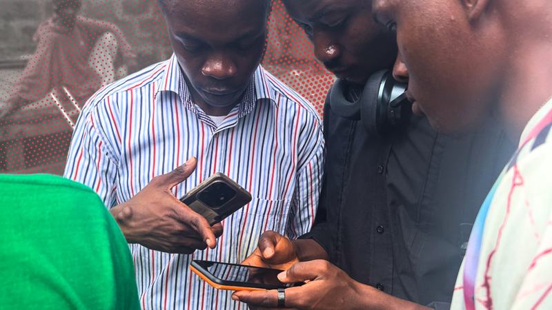
Tommy Charles (left) training residents of an informal settlement in Freetown, Sierra Leone.
Maps That Change Lives
Every project started from a real need, expressed by the communities and the authorities themselves.
Fifteen islands the world had forgotten: In the Saloum Delta, climate change is anything but abstract. Rising waters, increasingly salty mangroves, and dwindling fish stocks weigh first on the women who harvest shellfish and process fish. With REFEPAS, the network of women in artisanal fishing, and OSM Senegal, we did not arrive with a ready-made map. We trained the women to collect and update the data themselves. Fifteen islands, from Mar Lodj to Djirnda, now appear on OpenStreetMap, with more than 14,000 buildings, 565 points of interest, and 19 fish production and processing sites. The women processors can locate their sites, navigate the mangrove channels more safely, and use the maps to sell their products. For someone who came from ocean advocacy, this project closed a circle.
“Learning open mapping will make our lives easier. We will have no trouble navigating and finding our way across the islands from now on. We will no longer lose the locations of the production sites we sometimes only came across by chance.” — Diaba Diop, head of women fish processors in Senegal
Health on the map in Matam: With MSI Senegal and the Ministry of Health, the Sunu Wér Gi Yaram project mapped 29,445 km², home to nearly 820,000 people, directly benefiting more than 412,000 women: 93,286 buildings, 1,803 km of roads and every health service, from 2 hospitals and 104 health posts to 68 health huts and 28 pharmacies. The map revealed a striking reality: most health facilities line the main road, while a large share of the population lives in the interior. MSI adjusted its regional strategy, and the regional health authority now has a dashboard to monitor its facilities. With Tostan, in northeastern Senegal, more than 95% of a municipality's critical infrastructure was mapped, and residents learned to keep it up to date themselves.
Water in the Sahel: In Niger, the Ruwa project brought together OSM Niger, the WASH consortium and the Ministry of Water Resources. 334 young people were trained to map the water points in the Fakara and Ngonga municipalities in the Dosso region, documenting their availability and quality. More than 22,000 buildings were added, and the authorities now have 12 thematic maps to plan access to safe drinking water and identify facilities in need of repair.
Facing floods in Liberia. In Robertsport, with iLab Liberia, OSM Liberia and the Liberia National Red Cross Society, we covered 38 towns home to 30,000 people, trained 75 people and added 18,880 buildings. The maps showed that in fishing neighborhoods most zinc-sheet houses sit directly on the ground, that more than 500 buildings are exposed to coastal flooding, and that the city has only one clinic and one hospital.
“Really, we need data if we want to work with partners to identify types of disasters or the magnitude of disasters. Thank you for the maps and datasets. Those are serious gaps in disaster management.” — Henry O. Williams, Executive Director, Liberia National Disaster Management Agency
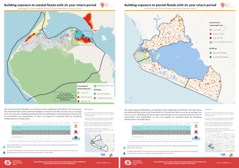
Two maps showing building exposure to coastal floods with a 20-year return period, produced by the project.
A municipality that recognized OSM as a champion: In Togo, the Mia Tou project, carried out with OSM Togo, equipped the municipalities of Lomé and Atakpamé with more than 109,000 buildings, 2,138 km of roads and 32 printed maps. The data made it possible to locate illegal dumpsites and water points. The project won the Togo Digital Awards.
1.8 million buildings made visible in Nigeria. In Bauchi, Borno, Gombe and Yobe states, with support from Microsoft, artificial intelligence helped add more than 1.8 million buildings to the map, in a region weakened by insecurity. This data is now used for vaccination campaigns and child protection; children who were invisible to planners can now be reached.
The Day the Mayor Flew a Drone
In Freetown, more than 360,000 people live in informal settlements that grow faster than any official map. It all began with a modest budget and an idea shared with Mayor Yvonne Aki-Sawyerr, Mr Modupe Williams, and HOT’s tech and regional WNAH teams.
One afternoon in Crab Town, in the Aberdeen area, the Mayor joined our teams in the field and learned to fly a drone. Around her, some twenty young people from informal settlements, the City Council and the Ministry of Lands were learning the same skills. It is a powerful image: a city leader and young residents side by side, seeing their neighborhoods from above for the first time.
Eight informal settlements were surveyed by drone, and their imagery is now openly available on OpenAerialMap. We mapped accessibility for people with disabilities and trained municipal staff in drone piloting and surveying to help Freetown become self-sufficient. In April and May 2025, a crew of 13 residents went further, becoming the first open community drone crew to map an entire capital city.
Our partnership with JICA in Waterloo and the Know Your City program with Slum Dwellers International carried this momentum forward. Two new projects followed with our local partners: community heat resilience in Freetown, which aims to reduce urban heat by 60% by 2030, and scaling open drone crews between Sierra Leone and Senegal.
Healthier, Better-Prepared Cities
Breathing cleaner air: In Nigeria’s industrial cities, air pollution kills silently, for lack of local data to measure it. Through the Eco-Smart Cities project, our local partner, the local youth-mapping organization Humanitarian enhanced Platform for Development (HePD) trained university students to map neighborhoods in OpenStreetMap. Together, they installed low-cost air quality sensors, calibrated with the University of Lagos, around six industrial sites in Lagos, Ogun, and Kaduna. The results are sobering. Near the Kaduna refinery, over 30,000 households live within one kilometer of the pollution sources, and PM2.5 levels were unhealthy on 791 of the 1,332 days studied. In October 2024, six solar-powered sensors were handed over to state authorities and partner universities to ensure continued monitoring.
In Ghana, alongside Marsh, JBA and PDHS, we are producing exposure data to model flood, drought and pest risks in four cities, the Volta Delta and the country's agricultural north. And in Senegal, UNICEF entrusted us with mapping schools as part of the GIGA initiative, which aims to connect every school to the internet.
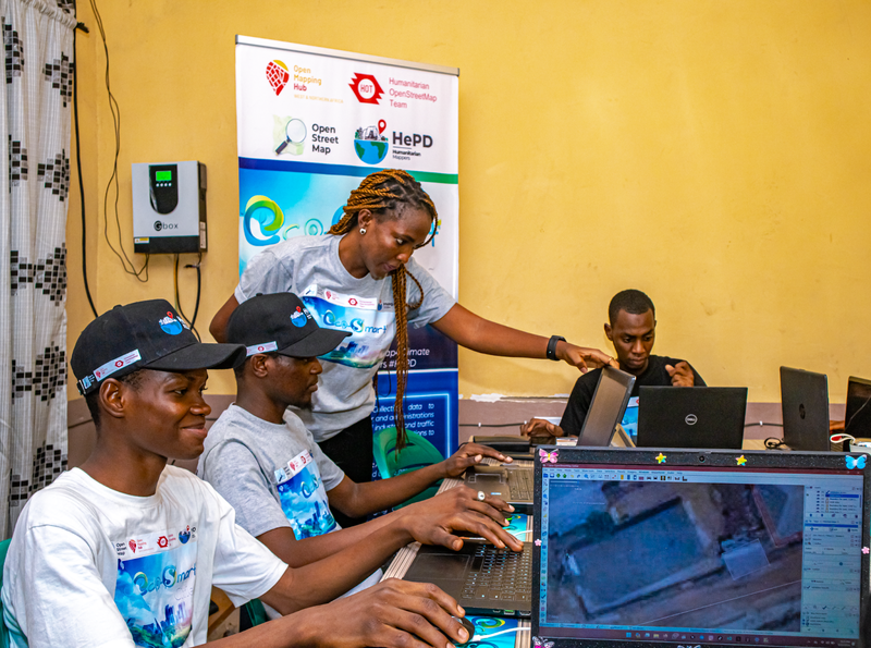
Mapping activity with the HePD team (HePD, 2024).
When the Earth Shook
On the night of September 8, 2023, at 11:11 pm, a powerful earthquake struck Morocco's High Atlas, southwest of Marrakech. Within hours, the first satellite images confirmed our fears: many of the hardest-hit villages had almost no data on the map. Rescuers could not plan routes to places that did not officially exist.
By the next morning, HOT's global team, our Hub, and OSM Morocco had jointly launched an emergency activation, focused on the priority areas identified by the local community. Within 48 hours, 310 contributors had already mapped 32,450 buildings and 530 km of roads. Two days after the earthquake, devastating floods struck Derna, in Libya, and we stood alongside OSM Libya.
What followed was solidarity on a scale I had never seen before. More than 5,500 volunteers from around the world made over one million edits, mapping nearly 670,000 buildings and nearly 12,000 km of roads. Experienced mappers analyzed post-disaster imagery to flag blocked roads and damaged infrastructure, so rescuers could coordinate access for survivors.
This ordeal convinced us that we had to act before disaster strikes. We documented disasters that occurred between 2014 and 2023 across our 24 countries and identified more than 160 response actors, including Red Cross societies, national disaster management agencies, local governments, and development partners. Our main recommendation is to build a regional coalition of these actors that can carry out multi-country, multi-year programs rather than isolated interventions. We also stepped up training in North Africa, focused on flood-zone mapping and support for health campaigns.
Women on the Front Line
Across Africa, disasters hit women and girls hardest, yet they are rarely involved in decisions. With the Red Cross societies of Cameroon and Sierra Leone, the Strengthening Gender Resilience Against Disaster project built the capacity of 40 women's organizations through a training-of-trainers approach, then funded four of them: Smart Girls Squad and Data Girls in Yaoundé, Transformative Women's Initiative in Bo, and Strong Girls Evolution in Freetown. In total, 280 women learned to map risk areas and prepare for disaster response.
The results can be seen in the villages. In some, mapping helped identify flood-prone areas and the places where women and children are most at risk, leading to better evacuation planning and safer temporary shelters. Women now sit on disaster preparedness committees. And a young woman trained in Bo told us that on the day heavy rains made the river overflow, she knew exactly what to do: she got her family to safety.
“I believe that through open mapping, the skills and response capabilities of women across Sierra Leone will drastically improve during disasters.” — Agnes M. Farma, Head of the Gender Unit, National Disaster Management Agency, Sierra Leone
The people behind the data
Numbers never tell the whole story, but they show how far a small team can carry a big idea when it walks alongside communities. For example, the Eco-Smart Cities project alone mapped more than 4 million buildings between November 2023 and September 2024.
None of this would have been possible without our funders: The Audacious Project and its philanthropists, including the Skoll Foundation, ELMA Philanthropies, Rippleworks and Pivotal Ventures, as well as Microsoft, USAID, the Judith Neilson Foundation, the Howden Foundation, UNICEF and many others. Nor without our field partners, including MSI, Tostan, REFEPAS, the Red Cross societies of Liberia, Sierra Leone and Cameroon, CODOHSAPA, SDI and GIZ, and the community of mappers who give their time so generously.
We also learned to make the region's voice heard, all the way to the World Urban Forum in Baku, and to account for our work.
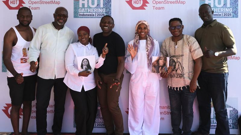
The WNA hub team poses together during our Indonesia mapping activities in June 2026.
Thank You
To my WNA Hub team, you have been my greatest pride. You weathered the storms, including a 2025 that shook the very model of humanitarian action, and you kept finding new ways to serve communities. I will never forget your courage.
To HOT's leadership and colleagues around the world, thank you for your trust.
To the communities, the mappers, the women of the Saloum Islands, the young surveyors of Dosso, the women of Yaoundé and Bo, and the drone pilots of Freetown, thank you for reminding me every day that the best map is the one drawn by those who live on the land.
I am leaving HOT, but not the movement. Open data will always be, for me, an essential common good for Africa. I will continue to follow, with pride, everything you achieve.
Ubuntu.
Dr. Ibrahima Cissé
Regional Director, Open Mapping Hub – West and North Africa (2021–2026)
Share