



Access to Open Imagery: Innovation and OpenAerialMap
Posted by Tyler Radford • Dec. 9, 2015
The Humanitarian Innovation Fund recently published HOT's latest OpenAerialMap blog post written by Cristiano Giovando:
http://www.elrha.org/hif-blog/openaerialmap-final-blog/
Below a preview of the article:
"In 2014 the Humanitarian OpenStreetMap Team (HOT) was awarded a development grant by HIF and after 10 months of intense design and coding, OpenAerialMap (OAM) is finally here! Anyone can now go to www.openaerialmap.org and find openly licensed Earth imagery that can be publicly used for any purpose, and in particular, to support humanitarian mapping with OpenStreetMap. A single place to find open imagery had not existed before OAM was created. Those wanting to share image data and mappers looking for imagery can now easily meet, thanks to this innovative system.
The idea behind OpenAerialMap
The idea of creating OpenAerialMap dates back to 2007 when satellite imagery providers started making their data freely available for disaster response mapping. It was suddenly clear that the humanitarian mapping community was not able to easily ingest and organize all this wealth of information. It took several years of brainstorming and prototyping to come to the design that HOT proposed to HIF. This included creating an open source set of tools that would provide functions for hosting, uploading, sharing, searching, filtering, displaying, downloading and using imagery data. All these features have now been implemented and the software source code is available in Github. OAM is currently hosted in HOT’s computing infrastructure, but its code is available for anyone wanting to replicate the same system in local contexts or through cloud service platforms.
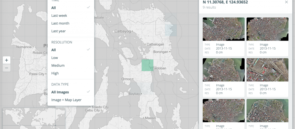
HOT launched a call for developers in February and among excellent applications, the Development Seed team led by Nate Smith was selected. Their experience in designing mapping user interfaces and developing open source tools was invaluable to building an attractive and effective OAM Catalog application. This consists of an interactive, easy-to-use map browser presented with a dynamically shaded grid that symbolizes density and availability of images across the world. Users can navigate the map and click on any cell to display footprints, overviews and details for each image. As illustrated in figure 1, additional filtering tools provide more control on what data is displayed on the map. For example, following a specific event is possible to show only imagery that was collected in the last 7 days over a specific location. All metadata and map service information is available to the users both visually and through an application programming interface (API). This provides computer based open and interoperable access to the entire OAM Catalog, allowing any developer to easily make use of the imagery and build applications that automatically retrieve its data.
The challenges and goals
One issue identified in early development was about costs of hosting and distributing imagery data, which usually consisting of very large multi-gigabyte files. It was clear that no single organization could afford these costs, therefore a solution was created called Open Imagery Network (OIN). As shown in figure 2 (view in full here), OIN is a federated network of highly available (always accessible and offering large bandwidth) imagery “buckets”. These may include public storage endpoints on cloud services like Amazon S3 or Microsoft Azure. All these repositories of individual files are paid for by OIN members, including original satellite image providers and foundations supporting humanitarian mapping, thus spreading the costs. OAM then provides API and browser access to the entire collection of images through a common OIN index file."
Share




